Mild temperatures have been the theme for much of this week in the Alps – as several weather fronts have crossed the region, accompanied by southerly winds. The result has been a mixed bag of sunshine, rain, snow, and strong winds.
Parts of Austria and south-eastern Switzerland in particular saw heavy snow on Tuesday, above 2000m (below that level it was often raining) – especially in the Silvretta, which had up to half a metre of the white stuff at altitude. Meanwhile the Arlberg (home to St Anton and Lech-Zurs), the Kitzbuhler Alps, and the Engadin Valley in Switzerland (home of St Moritz) had 20-40cm.
Meanwhile, in the western Alps, accumulations were generally lighter. In the Chamonix Valley, for example, there was 5-10cm of snow on Tuesday at 1800m, and similar amounts at the same elevations in the Three Valleys and Val d’Isere-Tignes. Higher up, the new snow is a little deeper.
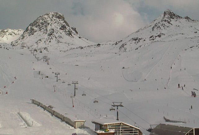
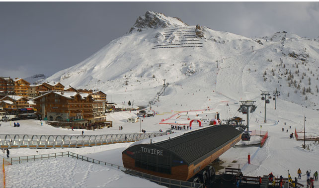
Here’s how it was looking in Tignes earlier this afternoon.
Meanwhile, in the lower resorts of France, a combination of rain, southerly winds and mild sunshine has pushed the snowline back uphill on south-facing slopes. Away from the pistes, many of these slopes are now grassy again.
Right across the region, the skiing on the lower slopes has been rather sloppy and wet as a result of the thaw. Meanwhile, thanks to the wind and humidity, the avalanche risk has increased at altitude. In many areas, it’s now back up to 3/5.
The outlook, however, is promising
In the western Alps, today is the last day of really mild weather, with the daytime freezing level down to 1900m tomorrow, and 1700m on Saturday. Four more weather fronts are expected to sweep quickly across the region as well, bringing significant accumulations of snow at altitude, and rain lower down. By Saturday, the white stuff will be settling at around 1200m.
Meanwhile in the east, it’ll stay milder for a little bit longer, before temperatures drop sharply at the beginning of next week. The snow is expected to be generally lighter here. However, one of the features of the coming storms will be that – at last – snow will fall in the resorts of Dolomites. They’ve been heavily reliant on their snow cannons for cover since the start of winter.
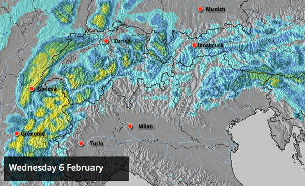
Here’s tomorrow’s snow forecast. Note those splodges of yellow over the Italian Alps and the Swiss border. 30-50cm of snow will be very welcome in the likes of Passo Tonale and Madonna di Campiglio.

And this is the snow map for Monday
In other words, from about 1500m upwards, and especially above 2000m, there’ll be some superb skiing once the next spell of (very) unsettled weather has passed, especially in France. However, off-pisters will however have to deal with a significant avalanche risk for several days to come.
Meanwhile, in North America…
Across the resorts of the North American west it’s been an unusually quiet few days – especially when compared with what went on last month.

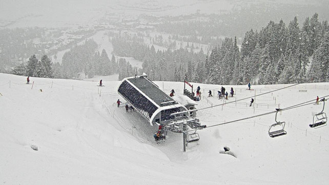
However, a busier spell of weather is now on the cards. A band of snow has already developed in Wyoming, which has brought 15cm of new snow to Jackson Hole today (see above). Snow is also expected in California between now and Saturday, as a low pressure system pushes in from the Pacific. It could bring 30-60cm of the white stuff to the resorts of Lake Tahoe. We’ll also see snow in the northern Rockies and the Pacific Northwest as a result of this storm – which will be good news for Whistler.


If you have done Ali Ross advanced but have not exercised for 4 weeks due to injury will you still be able to ski ?
I don’t see any reason why you wouldn’t be able to ski, but it depends on what the injury was…