Mother Nature has hit the pause button. After all the wild weather of early November – which dumped heavy snow at high altitudes – the weather has turned mostly dry and very mild in the Alps.
There’ll be increasing amounts of fog in the valleys. But up high, in the sunshine, we can expect the freezing point to be well above the 3000m mark. That means the snowline will continue to retreat uphill for a while. In some places, it’s still unusually deep above the 2500m mark. But increasingly the mid-mountain slopes are grassy again.
Fortunately, there are signs that the high pressure currently settling over the region will drift north at the weekend. By Monday 19 November cooler air should be flooding into the region from the east. Hopefully, it will be accompanied by some natural snowfall: but even if it isn’t, the drop in temperatures will allow the ski resorts to run their snow cannons at mid-mountain level. As the end of November approaches, this is an important prelude to the start of the ski season.
We shouldn’t be surprised by this hiccup. In the Alps, winter’s arrival is always a stop-start process. But it’s worth remembering that this has been a very mild year. France has just recorded the warmest-ever January 1 – September 30 period. So if you’re planning an early-season ski trip the best advice for now is to aim high.
That said, there is already good skiing to be found in the glacier ski areas – thanks to the heavy snow at the start of the month. The best conditions are probably above Cervinia and Zermatt, which were both walloped in the recent storms. But the snow is also deep on the glaciers at Hintertux (110cm), in the Stubaital (80cm), Solden (172cm) and Tignes (90cm).
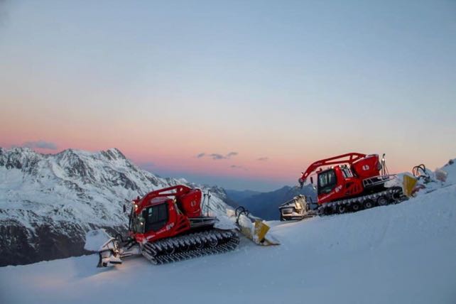
What’s more, high-altitude Obergurgl is due to open on Thursday, with up to 40cm of cover up top. Here’s how the higher slopes looked on Saturday morning, with the pistenbullies at work.
After that, the next big date in the diary is November 24-25, when Val d’Isere runs its First Tracks weekend, Val Thorens its Grande Premiere party, and Ischgl its opening concert. Val Thorens may even open a few pistes this weekend, starting November 17, if conditions allow. In Val d’Isere in particular there’s already lots of snow in the top half of the ski area. But all the same, all three resorts will be very pleased to see if the drop in temperatures materialises next week.
Meanwhile in North America…
https://www.youtube.com/watch?v=F_8rHo1Tp04
In Colorado, Breckenridge got off to a fabulous start at the weekend – thanks to 60cm of fresh snow in the run-up to the opening. The snow is up to 75cm deep on the trails.
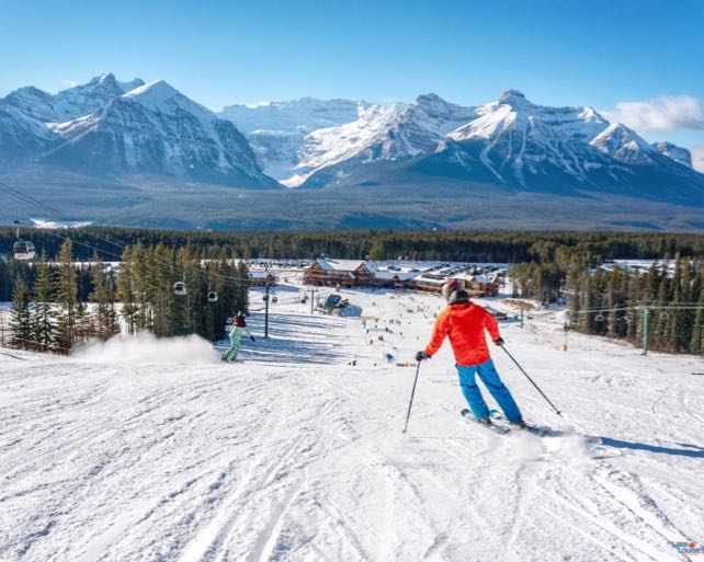
In Banff National Park, Lake Louise, Sunshine and Mount Norquay are also open for the start of the season. Here’s how it looked in Lake Louise on Saturday. There was light snowfall here on opening day, but on the lower half of the mountain the snow cannons have done much of the work. However, there should be more natural snowfall here on Wednesday.


Add Comment