


In the Alps, October 2017 is continuing its theme of occasional bouts of snow – followed by sharp thaws.
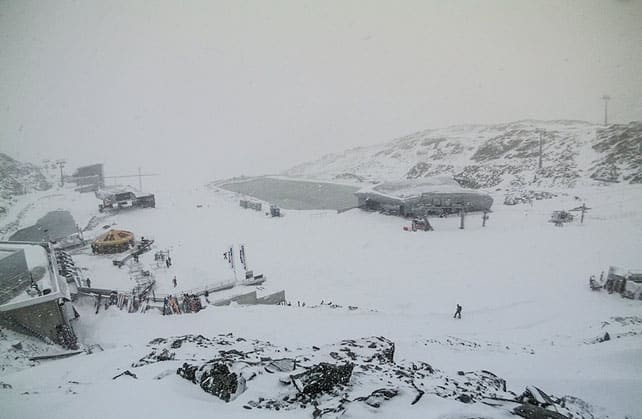
The latest storm, which began on Saturday night, has been meatier than most this month. It started in the west, but like all of the snowy episodes we’ve had so far this winter, it’s dropped its heaviest load on the eastern Alps. On the Hintertux glacier, for example, they reckoned on 35cm of snow by mid-afternoon today, and it’s still snowing there as I write. There could be nearly half a metre of new cover up there by the time the skies clear.
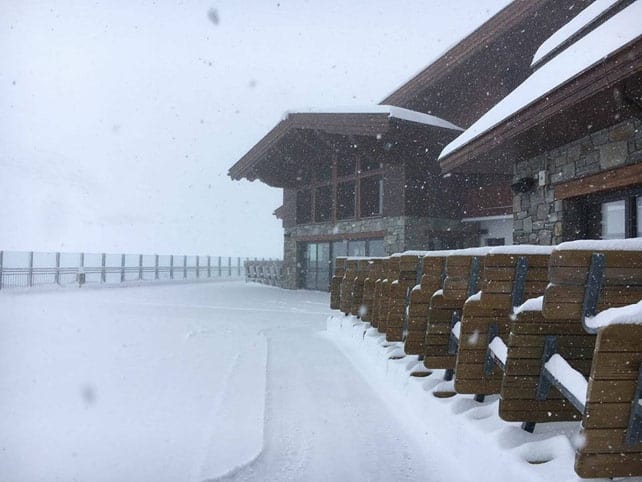
Here’s how it looked at 3000m above Tignes on Sunday morning.
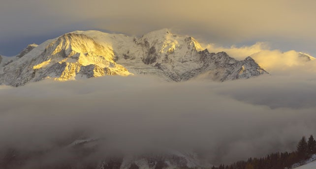
In the western Alps, the skies are now clearing, as you’ll see from this rather lovely shot of the Mont Blanc massif this evening, seen from the Prarion above Les Houches.
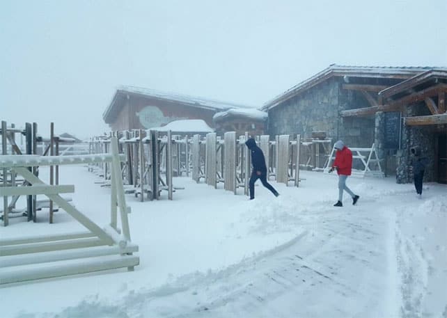
Meanwhile, this was the scene just beneath the Pitztal glacier in the Tirol this afternoon.
Tomorrow morning, skiers in the region’s high-altitude glacier ski areas will be having a high old time on freshly-groomed slopes – with those in Austria enjoying the deepest cover and the largest areas of pistes.
However, I doubt there will have been enough snow to allow much off-piste skiing. When I was on the Hintertux a couple of weeks ago, the crevasses on the glacier hadn’t yet been filled in, away from the groomed runs. This storm won’t have been enough to rectify the situation.
What’s more, a thaw is now on the cards…
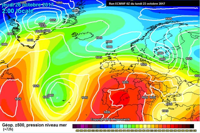
Check out the latest weather chart for Thursday, courtesy of the ECMWF (above). As you can see, it’s going to warm up sharply, and in Austria the daytime freezing point will jump from 1600m today to 3600m on Wednesday and Thursday. So the snow on the lower slopes will rapidly melt, and even on the glacier it’ll loose its chalky, winter softness. Still, temperatures are forecast to drop back again, just in time for the start of the World Cup racing season on Solden’s Rettenbach glacier on Saturday and Sunday.
Let’s hope they get a hard racing surface, and bright sunshine, on both days.
Currently, you can ski on the Hintertux, the Stubai, Pitztal, Kaunertal, Rettenbach, Motttal, Kitzsteinhorn and (in Italy) Schnalstal glaciers, as well as those above Saas-Fee, Zermatt, and Les Diablerets in Switzerland, and Tignes in France. Cervinia is now also opening for weekends. If you’re planning a cheeky early-season trip, before Christmas, bear the recent hot-cold, hot-cold weather pattern in mind and make sure you book somewhere with plenty of skiing around the 3000m mark.
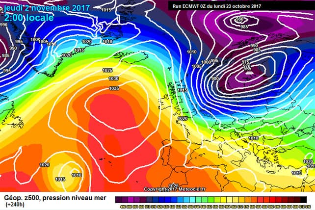
Oh yes, and talk a look at the current ECMWF prediction for November 2. At the moment, this is just a possibility. The weather could evolve in a very different direction over the next ten days. But all the same, it doesn’t hurt to dream a little, does it?


Add Comment