


Regular followers of our Snow Report will know that September’s seen several snowstorms in the Alps, with the white stuff occasionally settling down to 2000m. This spell of cool, changeable weather looks set to end on Wednesday, but before it does, there’ll be one last blizzard, and it’ll be the best of the bunch.
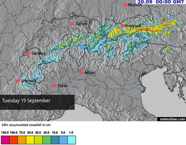
As you can see from our latest snow forecast for the Alps, Austria in particular will see heavy snow. Parts of the Tirol could see more than 50cm, and along the central Alpine ridge in the Salzburgerland 75cm should fall in 24 hours. The Grossglockner, Austria’s highest mountain, is set for a pasting.
This is more good news for Austria’s glacier ski areas, where conditions are steadily improving after the hot summer.
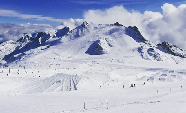
Pictured below, for example, was how the Hintertux looked this morning. Austria’s ski-racing star Anna Veith was training in Hintertux over the weekend, and many more skiers will be flocking to its slopes once the new snow has settled.
Skiing is also on offer on the Stubai, Pitztal, Rettenbach and (in Italy) Schnalstal glaciers, and they’re all looking forward to the coming dump. It should do wonders for the skiing surface, and will hopefully bring more pistes into service.
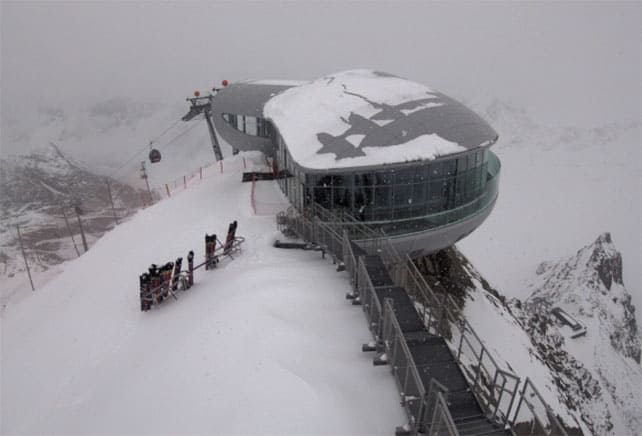
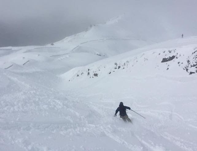
Here’s how it looked above the Pitztal this afternoon as the weather closed in.
The weather is set to change midweek, with a return to sunny weather, and rising temperatures. However, we’re not looking at a heatwave just yet. In Austria, for example, the daytime freezing point won’t get above 2700m before the end of the week, which is “normal” for early autumn. That means the snow on the glacier pistes should stay soft and grippy for several days to come.
It looks as though it will stay mild next week as well. However, current forecasts suggest the Alps will miss the worst of the coming warmth.
Meanwhile, in the southern hemisphere…
The South Island resorts of New Zealand are continuing to enjoy a snowy spring. Mount Hutt is – as ever – the snowiest of the resorts, with 40cm of new snow in the last 24 hours, and settled cover that’s 285-380cm deep. The resort was closed today because of the blizzard conditions.
The Queenstown and Wanaka resorts have had snow too. Pictured below was Treble Cone earlier today. The resort reported 15cm of fresh this morning, and a settled base of 116cm.
There’s been less of the white stuff about lately in the Snowy Mountains of Australia. The forecast is for snow showers tomorrow, followed by a powerful thaw. Resorts such as Thredbo and Perisher aren’t complaining though. Three big storms, dubbed the Blizzards of Oz, have created some of the best August and September conditions for years.
Here’s last week’s typically ecstatic (and inspiring) video recap from Thredbo.
ARVE Error: For the maxwidth (maxw) option you need to have normal or lazyload mode enabled, either for all videos in the plugins options or through shortcode e.g. [youtube id=123456 mode=normal maxw=999 ].
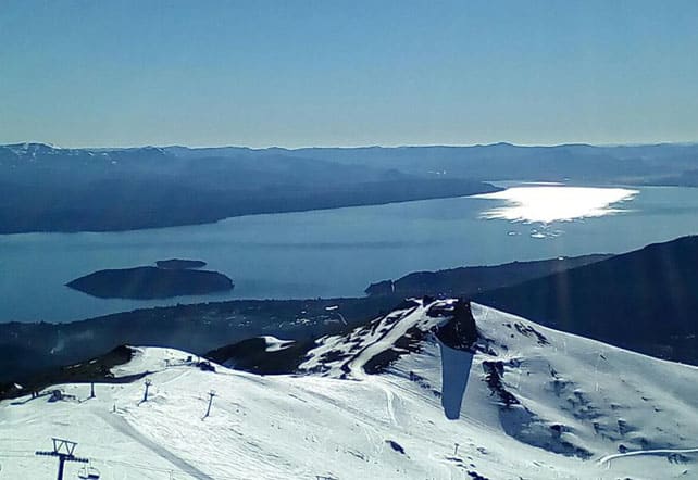
In the Andes, spring conditions have taken hold of the slopes in resorts near Santiago, Chile, and Portillo has already closed for the season.
The weather’s been spectacular further south as well. Here’s the view from the top of Catedral Alta Patagonia this morning.


Add Comment