What’s this, Snowfiends? A sustained period of cold weather in the Alps? After all the mild weather we’ve seen, it’s hard to believe: but for the next five or six days at least it looks as though conditions will – at last – be properly wintry across the northern half of the region
Two areas of high pressure are the cause. One sits over Scandinavia and northern Russia, and the other over the Atlantic, and together they’re going to funnel a series of cold fronts across Europe. We’re not looking at a deep freeze to rival that in the Alps in January and early February 2012, when temperatures on the slopes dropped to -20C at times. But the change in the weather will bring the freezing point down from its persistently spring-like position – and add soft, new snow in the process. The cold weather will also allow resorts to run their snow cannons at full pelt, where necessary. Which means that in the lower resorts conditions are going to improve considerably.
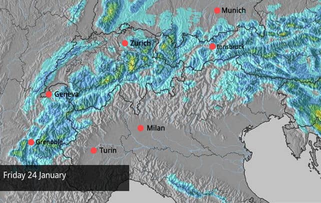
Pictured, above, is how our snow forecast for the Alps is looking for tomorrow. In most places, only 5-10cm of snow is expected, although a few spots south of Zurich could get 30cm. There will be snow again on Sunday and Monday, and at the moment this looks like a heavier dump. France, Switzerland and the Arlberg in western Austria (home to Lech and St Anton) will get the lion’s share, although the resorts north of Innsbruck might have received 30cm by Tuesday. Let’s hope so. They need it.
You’ll note from the forecasting maps that very little of this expected snow is going to leak across the central ridge of the Alps, into Italy. That’s fine though, because it’s the Italian resorts that have seen most of the weather this winter, and have plenty of snow.
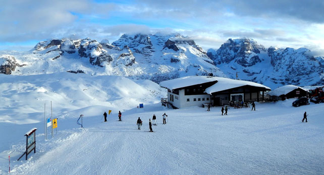
Pictured below is Madonna di Campiglio in the Brenta Dolomites, which has had a cracking winter so far. Currently, it has a whopping 180cm of snow at 1500m, and 240cm higher up.
But for a real eyeful of how deep the snow has been in the southern half of the Alps, check out the video posted here by Nick Hayter: shot in Auron in France at the weekend.
One thing to note about the coming change in the weather: the colder, drier air, as well as the new snow, is going to increase the instability of the snowpack, off-piste. So hire a guide and make sure you’re properly-equipped before you venture off-piste – and read the local avalanche bulletins carefully, too.
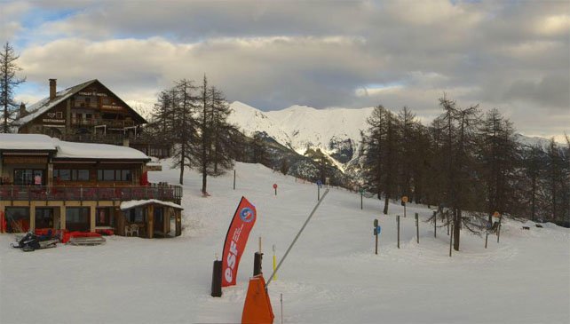
Here’s a quick sample of today’s webcams. Starting with Serre-Chevalier, another resort that’s done well out of the Snow Gods’ southern bias this winter. Here, the snow is 85-200cm deep, depending on altitude.
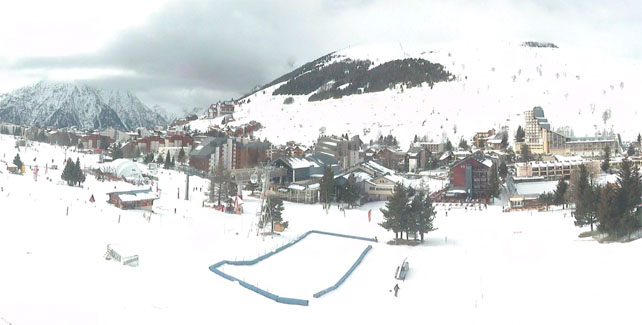
Below is the centre of Les Deux Alpes, which – like Serre Chevalier – had fresh snow at the beginning of the week. Here, it’s 30-160cm deep.
Here’s today’s snow report video from from up high in Val Thorens.
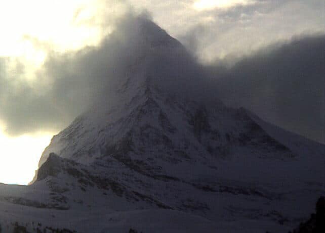
Meanwhile, pictured below is the Matterhorn this afternoon, above Zermatt. Zermatt reports 60-250cm on its slopes, thanks to a top-up at the beginning of the week.
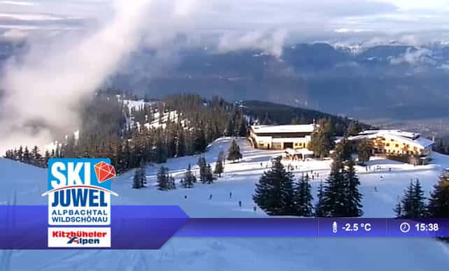
Finally, these are the slopes above Auffach in the Ski Juwel in Austria. The snow at the top is up to 70cm deep in places, and has been refreshed by light snow this week. But it’s very thin on the lower pistes, and they’ll be looking forward to the change in the weather which is due to set in tomorrow.
The sun’s out in the western resorts of the US and Canada
In the east of the US, it’s bitterly cold – something the New York Times is describing as the new normal,. But out west, in the Rockies and coastal mountain ranges, it’s not quite so frigid. In Vail, Colorado, for example there’s a high today of -6C and sunshine. In common with many resorts in Colorado, Vail had a great start to 2014, and reports a settled mid-mountain snowpack of 112cm.
| France: Two of our editors have been skiing in Tignes and Val d’Isere over the last couple of days, and report that “piste conditions are near perfect at present”. They should be even better once the colder weather settles in and there’s fresh snow. Lower resorts will feel the benefit too. Generally speaking the deepest snow is to be found in the southern French Alps, and at altitude further north. | |
| Switzerland: As in France, you should aim high and stick to the south for the best snow, in the short term at least. However, we should see conditions in the more northern resorts, and at lower altitudes, improve over the next four days. In the west, Verbier currently reports cover 35-115cm deep. In St Moritz in the east, it’s a very healthy 194-228cm deep. | |
| Austria There’s plenty of snow close to the Italian border in resorts such as Obergurl, and moderate amounts in the west, where (St Anton) reports 25-90cm. But in the north they’re still waiting for the switch to a more northerly airstream, expected tomorrow. Ski areas such as the Skiwelt have had light snow up high to refresh the pistes: but they still need a proper dump, borne on a cold wild, to rescue conditions on the valley runs. | |
| Italy: The early weeks of 2014 have been marked by moderate to heavy accumulations of snow across the Italian Alps, and it’s here you’ll find the deepest cover. However, there’ll be less snow than in the north over the coming days, as the weather fronts stall on the central Alpine ridge. Above the Aosta Valley, Cervinia currently has 130-285cm of snow on its slopes. In the Dolomites, Canazei reports 50-195cm. | |
| Andorra: The change in the weather will affect the Pyrenees too – although tomorrow’s snow probably won’t be as heavy as first thought. Already, the snowpack is good: Soldeu and Pas de la Casa in Grandvalira report 90-180cm of settled snow, and nearby Vallnord has even more at Arcalis. | |
| Western USA: It’s still sunny in the Rockies: time to enjoy some superb piste conditions after last week’s snow. Currently, Breckenridge has 147cm packed down, mid-mountain, Snowbird has 150cm, and Jackson Hole 122cm. | |
| Western Canada: Whistler is having a dry winter by its normal high standards. There’s been no fresh snow for a week. Currently there’s a mid-mountain snowpack of 134cm. Elsewhere, Lake Louise in Banff National Park reports a dusting of fresh snow, and has a mid-mountain snowpack of 141cm (it’s unusual that it has snow even marginally deeper than Whistler, by the way). Further south, Fernie has had 6cm in the last two days, and reports a total snow depth of 177cm, mid-mountain. |


At last! Here comes a proper dose of winter to the northern Alps. https://t.co/W49wfa3SzX