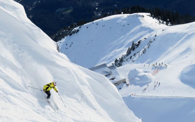
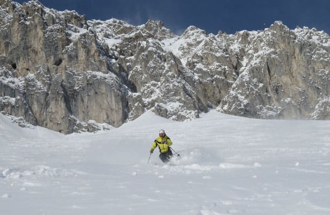
This was ski patroller Sebastian Larcher earlier today on the Nordkette. It’s the mountain immediately north of Innsbruck in the Austrian Tirol, and if it looks steep – well, that’s because it is. Two of the chutes down to the mid-station are blasted to protect them against avalanches, and when the snow’s good, they’re a joy to ski.
And this morning, in the midst of this annoying, stop-start winter, the snow was very good indeed. Whenever there’s a Nordstau in these parts (a Nordstau is the local name for one of those storms that hits Austria from the north) the southern face of this 2334m peak gets more than its fair share of snow, and at the top there was a good 30cm of the lightest, softest powder. Lower down the new snow was maybe 20cm deep, with a crust underneath, but even so, pretty much every slope was sensational, with only the occasional crrrrghhhhhhhh as your skis found the icy underlayer.
On a Monday morning, there was hardly anyone there, either. Talk about being at the right place at the right time.
Here’s Sebastian again.
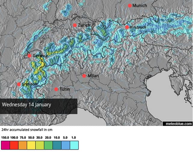
The fresh snow came yesterday and overnight, as part of a storm that was supposed to bring 20-50cm of snow to many parts of the Alps. Sadly, it didn’t quite live up to its billing. In France, Val d’Isere and the resorts of the Three Valleys (such as Val Thorens and Meribel) had 5-15cm, depending on altitude. Switzerland had 5-15cm in the west, and 20-25cm in the west. In Austria, St Anton reported 20-25cm this morning, and the Skiwelt claimed 10cm. Obviously in a few, lucky spots – such as the Nordkette – there was more. But generally, there’s a feeling of disappointment today in the Alps, because a big dump was sorely needed in the wake of some ridiculously mild weather on Friday and Saturday. It was also raining in many places – well above 2000m – and the lower slopes got hammered. In the western Alps (and in Italy) this has been a very tough season for the lower resorts; so far, at least.
The new snow was also accompanied by high winds, which are still blowing. Off piste, there’s a mix of wind-scoured, melt-freeze crust and unstable wind-packed slabs of windblown snow, as well as powder, and finding the good stuff amidst the hazards requires the services of an experienced guide. As the Tirol’s avalanche service reported this morning, “The snowpack has been enormously impacted by rain, snow and storm winds.” Reading the conditions is not easy.
Much of the responsibility for the long run of disappointing weather lies with the high pressure that’s been squatting over the Alps, or sitting just to the south-west of the region, ever since November. Small variations in its position can have a big impact on the weather fronts coming down from the north or north-west. Sometimes it retreats a little, and a meaty storm gets through – as it did on December 27. But often it proves more stubborn, and the fronts lose their power before they hit the mountains.
Now, however, it looks as though we might get some relief from this exasperating weather pattern. There will be sunshine this afternoon and tomorrow, but on Wednesday snow is expected again as the high pressure finally takes a more decisive step backwards; and it looks as though more will come over the following five days. Let’s all say a prayer to the Snow Gods that it comes to pass: but target resorts with plenty of skiing above 2000m, just to be on the safe side.
Light to moderate snowfall in the Rockies
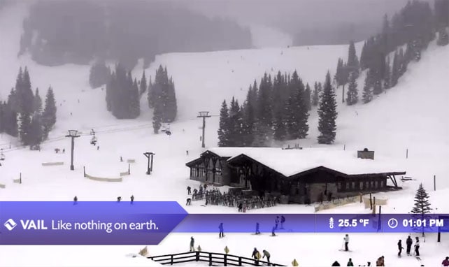
Last week saw an unwelcome mild spell in the American Rockies (and the Pacific Northwest). But in most places that’s been blown away by cooler air, and some light snowfall. Pictured below was Vail, Colorado, yesterday afternoon, when it was getting 13cm of fresh, and many locals were more concerned about the fate of the Denver Broncos than the quality of the skiing. Mid-mountain, the cover in Vail is 104cm deep, testament to the pounding the resort got over Christmas.
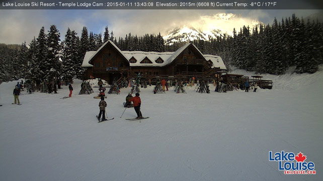
Today is cooler still, and in southern Colorado and Utah, it’s being marked by heavier snow, too. Both Wolf Creek in Colorado, and Snowbird in Utah could get 30cm by the time the skies clear. Elsewhere, 10-15cm is more likely. Further north, the Canadian Rockies, it’s colder still with top temperature in Lake Louise likely to be -11C. There’s the chance of a little more snow here at the end of the week.
| France: the mild weather on Friday and Saturday last week made the cover wet and heavy in many resorts, and it refroze yesterday when the storm blew in. At altitude, the new snow has helped to freshen up the pistes no end, but lower down it won’t be long before the passing traffic scrapes the cover back to reveal the ice and pebbles underneath. Off piste, there’s a freeze-melt crust just beneath the surface all the way up to 2500m.
Yes, there could well be lots of new snow at the back end of this week, if the weather forecast holds good. But it wouldn’t hurt to book a high-altitude resort just in case the warm air makes a comeback. Currently in high-altitude Tignes there’s 36-90cm of cover, on-piste: quite hard in places lower down, and much softer on the Grande Motte Glacier. Meanwhile, in Meribel reports 10-70cm of snow on-piste, and Serre Chevalier has 20-100cm of cover, on-piste, although even on the higher pistes, the skiing surface is rather hard in the mornings. |
|
| Switzerland: in western Switzerland, the situation is very similar to France. The wicked thaw of Friday and Saturday was followed by a drop in temperature and some disappointingly light snowfall. It’s enough to freshen up the pistes at altitude, but not enough fill in the off-piste, or properly cover the ice and pebbles lower down. In the north-east the snow is generally thicker, but again not brilliant on the lower slopes. Currently Verbier, in the west, has 7-90cm of cover, and reports 7-15cm of fresh, while Laax in the east has has 35-210cm of cover. In the south, there was only a dusting of snow at the weekend. St Moritz, reports snow 5-99cm deep, on piste. | |
| Austria: generally, Austria has has the best of the winter so far – enjoying longer spells of snow as well as cooler temperatures. But the weather has been anything but uniform and there is a big variation in cover. Among the winners so far have been the Arlberg in the west of the country, where Lech reports cover 40-90cm deep. Meanwhile, in the east, the Kitzsteinhorn glacier above Zell am See is claiming 50cm of new snow from the latest storm, and cover that’s 65-260cm deep, on-piste. Nearby, Saalbach has 7-20cm of new snow, and cover that’s 35-65cm deep. In the Skiwelt the cover thinned during the thaw, and is currently 30-40cm deep. | |
| Italy: the Italian Alps have missed out on almost all the snow that’s fallen since Christmas. Cover is very thin on the lower slopes, and most resorts are relying on their snow cannons to keep the pistes in reasonable shape. Currently above Cervinia the snow is 70cm deep, mid-mountain. Meanwhile, in the Dolomites, Canazei has up to 60cm of cover on its higher pistes. | |
| Andorra: in Andorra, the Grandvalira ski area reports a respectable 50-100cm of cover on its pistes, although it too has been suffering from mild temperatures lately. | |
| Western USA: see our main report. After a mild spell last week, the weather is turning a little more wintry again in the American Rockies. Currently, Vail in Colorado has 104cm of snow packed down, mid-mountain, in the wake of yesterday’s top-up, Jackson Hole in Wyoming has 160cm, and Snowbird in Utah 157cm. | |
| Western Canada: Whistler reports just 11cm of snow on the upper slopes in the last seven days, and a settled snowpack of 124cm. The temperature is yo-yoing about all over the place, too: Wednesday will see another thaw before light snowfall on Thursday. More consistent winter weather can be found inland, in Banff National Park, where Lake Louise is expecting a top temperature today of -8C. The resort reports 18cm of snow in the last week. |




Add Comment