


It’s snowing across the Alps today, and there’s lots more to come, as a series of weather fronts cross the region.
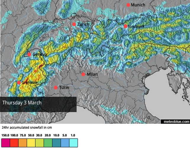
The first came in yesterday, and is being closely followed by another today. Overall, the northern half of the Alps, and France and western Switzerland in particular, should see the heaviest snow. But there’s already been a decent dump in the Italian Dolomites, with up to 45cm of snow falling in places. It’s been snowing in Austria too.
Temperatures are currently low – in France and Austria the freezing point will be around 900m today, so the snow will be settling at village level even in the lowest resorts. It’ll warm up slightly tomorrow, and cool down again at the weekend.
Here’s today’s weather map.
And here’s Saturday’s snow forecast, which looks like it could be another big day for the southern Alps, as well as France.
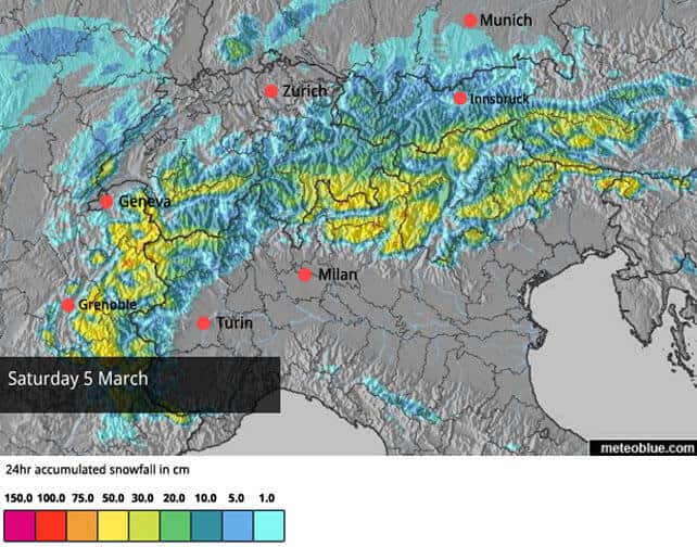
It’s worth pointing out that there’s some disagreement about exactly when the snow will fall. Some French forecasts are predicting that Friday will see heavier falls tomorrow than today. But either way we’re looking at a significant dump.
The new snow comes on top of light to moderate snowfall across the northern Alps last week – as well as moderate to heavy snow in the Italian Alps on Sunday and Monday. Some of this Italian snow leaked over the border into the southern Austria and Switzerland, and resorts such as Val d’Isere in France.
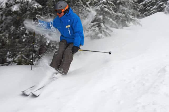
Whenever it’s snowing, it’ll be tough going on the slopes, with wind and low-visibility a problem. Whenever skies clear – hallelujah.
Off-pisters will need to equip themselves with a guide, though. The avalanche risk is already considerable, at 3/5, and may well creep up to 4/5 in places over the next couple of days.
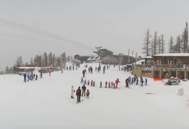
Here’s a quick squizz at the webcams, starting with Courchevel, where there’s 15-20cm of fresh snow this morning, and 145-202cm of settled cover.
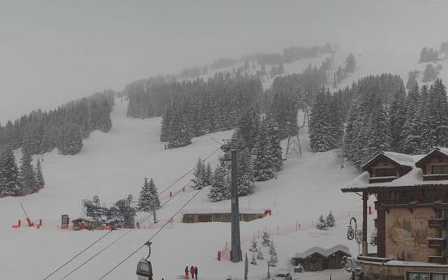
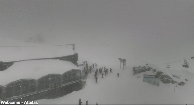
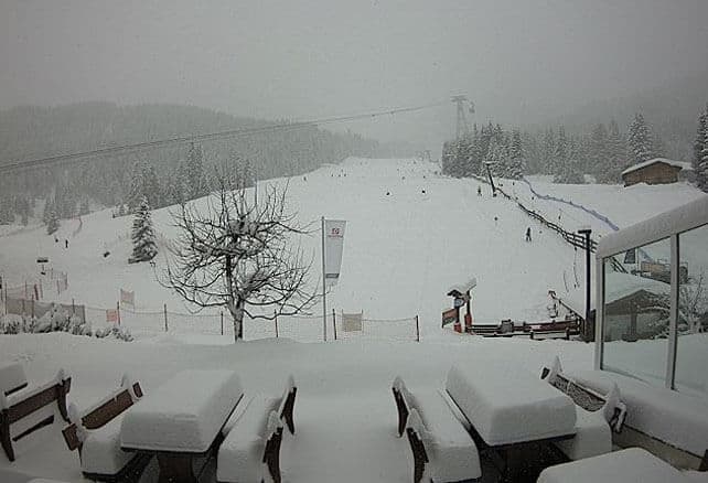
Pictured below is Val d’Isere, which has had snow from every direction in the last week, and now has 165-300cm on its slopes. This is taken up on the Bellevarde, and gives you an idea of the lack of visibility today.
Pictured below is Serre Chevalier, which has 10cm of fresh snow this morning and settled cover 20-143cm deep, depending on the altitude.
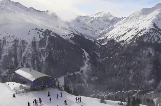
Below is Verbier, which has 15-20cm of fresh snow this morning and settled covered 40-255cm deep.
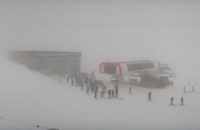
Below is how it’s looking in St Anton in the Austrian Tirol, where there’s been a break in the snowfall. The resort reports 5-20cm of fresh snow today and cover 75-300cm deep on the slopes.
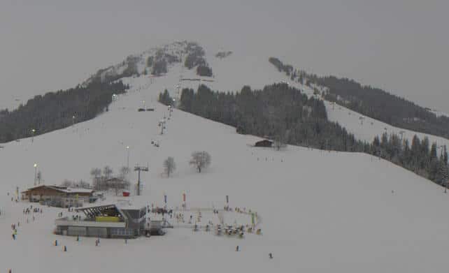
Pictured below is Soll in the Skiwelt, where there’s 50-60cm of settled snow on the slopes.
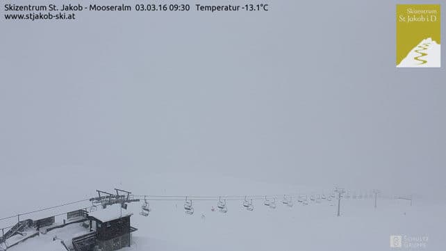
And this is St Jakob in the East Tirol, which reports 10-15cm of snow snow this morning, and settled cover 90-110cm deep.
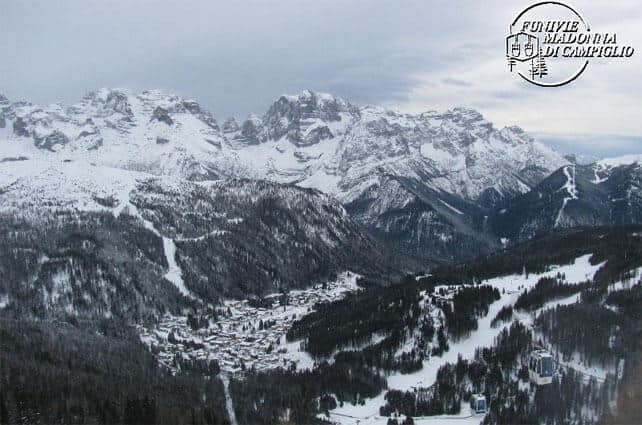
It’s been snowing in the Italian Dolomites, too. This is Madonna di Campiglio, which had 50-70cm of fresh snow on Sunday and Monday, and more overnight. Settled cover here is 90-150cm deep.
These are the slopes above Selva in the Val Gardena, which had 40cm of snow overnight…
California is bracing itself for exceptional snowfall
For the most part, it’s been a sunny and mild week across the resorts of the American west. In fact, much of February has been like that, with one of two interruptions.
But things are about to loosen up significantly. The first in a series of snowstorms is due to hit California, with 30-45cm of snow expected on Saturday night in the Lake Tahoe area, followed by another 30-45cm on Sunday/Monday. More snow is expected on Tuesday/Wednesday and there may be three more storms after that.
Even level-headed snow forecasters are talking about the possibility of ten feet of snow in ten days…
The storms will be pushing inland too, but they’ll be weakening as they go. California is where the big dumps will be. In Utah and Colorado they’re talking about lots of top-ups and the odd 30cm day as well.
In western Canada there’s been rather more snow of late. Yesterday, Whistler report 31cm of fresh snow, mid-mountain and 66cm in seven days. There’s more to come today and Friday. Here’s how it was looking on Monday.
Inland, Sun Peaks reported 11cm of fresh yesterday morning, and 41cm in seven days. In Banff National Park, Lake Louise had 5cm of new snow on Wedneday morning.
| France:France is in the middle of splendidly wintry spell, characterised by heavy snow and cool temperatures. The mercury will bobble about a bit tomorrow – and that will mean a bit of rain on the lowest slopes. But up high conditions will be superb on-piste, whenever there’s a break in the clouds and the new snow is groomed. Off-pisters need to ski with caution though – as the avalanche risk is already considerable. Chamonix reports 227-350cm of settled snow on the Grands Montets, and Val Thorens 180-290cm. | |
| Switzerland: conditions across the northern and western resorts of Switzerland are quite similar to the northern resorts of France: it’s snowy, cool and the visibility is poor above the treeline. Spring is on hold for the time being… Currently, Engelberg reports 30-350cm of settled cover on its pistes. In the south-east, St Moritz has 55-101cm. | |
| Austria: Austria’s resorts saw light to moderate snowfall overnight (which was heaviest along the Italian border and in the East Tirol), and are expecting more late today. Conditions are currently good and wintry everywhere. In the Ski Juwel Alpbach reports 55-145cm of settled snow, on-piste, while Lech in the Arlberg has 130-250cm. | |
| Italy: Italy’s had a good week for snow. The western end of its Alps saw heavy snow on Sunday and Monday, and there light to moderate falls elsewhere. Overnight the Dolomites had a decent fall to add to this too – and there’s more to come at the weekend. Currently, high-altitude Cervinia reports 50-2550cm of settled snow. In Canazei in the Dolomites it’s 50-140cm deep. | |
| Andorra: the Pyrenees had a good dump of snow at the weekend, to remedy the effect of the late-February thaw. More is falling there today. In Andorra, Pas de la Casa has up to 100cm of cover packed down, on-piste. | |
| Western USA: see our main report. All eyes are on California, as the storm-sequence of the season lines itself up. Currently, in Colorado, Breckenridge reports 144cm of mid-mountain snow, in Utah Snowbird has 210cm, and in California Heavenly has 216cm. | |
| Western Canada: in Whistler the mid-mountain snowpack is 282cm deep, and more snow is expected. In Banff National Park, Lake Louise reports a mid-mountain snowpack of 112cm. It’s expecting a mild day by its generally chilly standards, with a high of +2C. |


Add Comment