


Skies are clearing over the Alps today after the latest weather front dropped nearly half a metre of snow in the eastern Alps.
Overnight, the Hintertux Glacier in the Austrian Tirol reports 35cm of new snow, and Val Gardena in the Italian Dolomites 45cm. In the west, the French resort of Tignes reports 15cm of new snow on its glacier.
The new snow comes on top of earlier falls this week: and whilst skies are clearing sooner than we’d hoped, the outlook is still very positive for the early season. The cover has improved dramatically in the glacier ski areas, and the first non-glacier areas – Verbier and Cortina d’Ampezzo – are both opening small areas this weekend to help stoke the excitement.
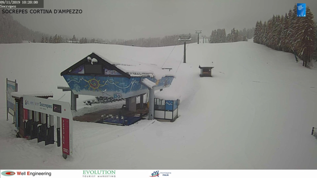
Here’s how it was looking in Cortina d’Ampezzo this morning. One lift is opening here tomorrow, on the Col Gallina.
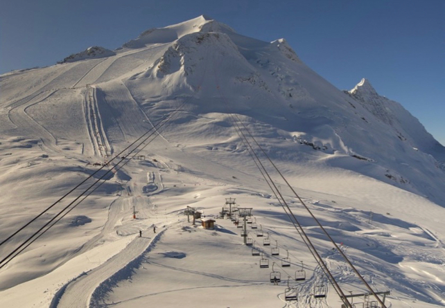
Of course, there’s already plenty of skiing on offer on the glaciers. The Hintertux for example, currently has 37km of pistes open. Between them, Zermatt and Cervinia have even more, with 50km of skiable pistes today. Here’s how it’s looking above Zermatt this morning.
What’s more, with 45-95cm of snow on its slopes already Obergurgl in Austria is in great shape for its season opening next Thursday, on November 14. It’s the first big non-glacier resort opening of the season, and it’s still snowing there as I write.
There’s now going to be a break in the snowfall. But temperatures will stay low, and resorts with openings on the horizon will be working their snow cannons hard.
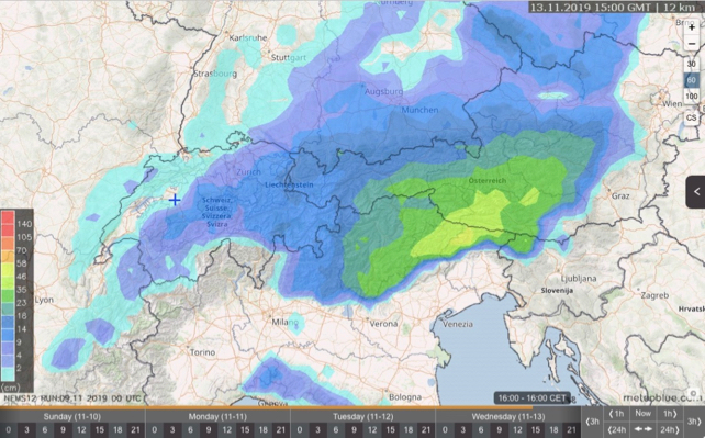
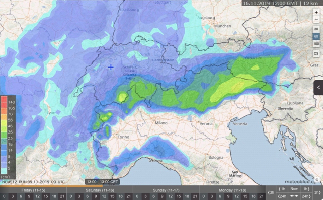
Then, according Meteoblue’s snow forecast, another front will hit the central and eastern Alps on Tuesday night, with a particular focus on the Dolomities, and parts of Austria, notably the Osttirol and Carinthia. Here’s the 24hr snow forecast to 3pm on Wednesday.
Chances are, we’re likely to see more pistes open up in the Dolomiti Superski area next weekend – when another heavy fall of snow is expected, which looks as though it will favour the Italian Alps.
Of course, the mid-range outlook is key. How the second half of November works out will have a big impact on the launch of the mainstream ski season at the end of the month and the beginning of December.
Remember, for example, how heavy snow in early November 2016 was followed by a mild, wet and tempestuous spell which washed away most of the snow below 2000m? There’s no sign of one of those in the mid-range forecasts, but it’s too early to say either way, and the mid-range forecasts are ambiguous. So we mustn’t take anything for granted.
So if all this early-season snow is tempting you to consider a pre-Christmas trip, make sure you target a high-altitude resort, to be on the safe side. Keep an eye on the snow forecasts and weather reports over the next couple of weeks too – to see if this pro-Italy/Southern Austria trend in the weather beds in.


Add Comment