At last, the powerful Easter thaw is over in the Alps. Temperatures have dropped back significantly: and there’s fresh snow falling in Austria, parts of the Dolomites and Switzerland.
Later today there’ll be some snow in the French Alps too, but according to the current forecast, it’ll only be a dusting.
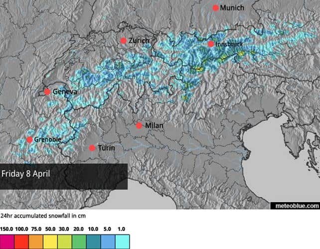
Here’s today’s snow forecast.
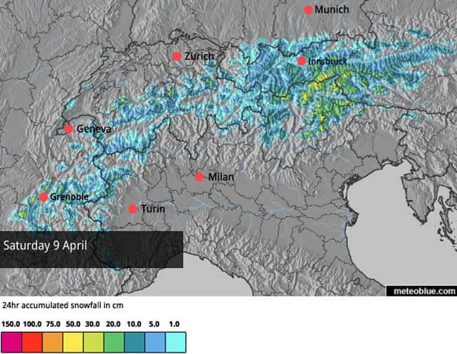
And this is the forecast for tomorrow.
In Austria, the daytime freezing point will be down to 1800m. In France, it’ll be around 1400m.
As you’ll see the heaviest snow is likely to be in the Tirol, in Austria, and in the Italian Dolomites. In the Dolomities, many resorts are closed already, or will be shutting at the weekend: but the snow will make a big difference to high-altitude ski areas in Austria such as Obergurgl, Hintertux and the Stubai glacier, where they’ll be skiing into May (and on the Hintertux, the season should run right through the summer).
The outlook, by the way, is for milder weather to return next week. Though the thaw won’t be as sharp as the one we’ve just seen.
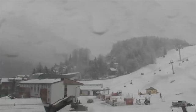
Just to give you an idea of how much colder it is today, here’s how it’s looking at village level in St Anton this morning, at 1300m. It’s been a while since we’ve seen snow falling to this kind of altitude in the Alps.
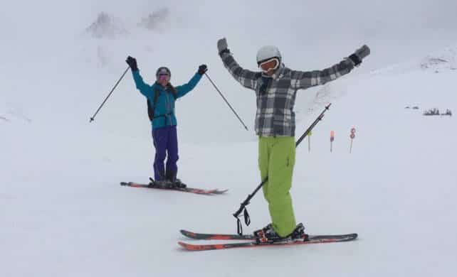
Meanwhile, one of our editors, Peter Hardy is skiing on the other side of the Arlberg ski area today, in Lech. “The good news is there’s tons of snow and the lifts remain open until April 24th,” he says. “The bad news is the complete lack of visibility.” He also points out that lower down in the ski area, the snow is falling as rain.
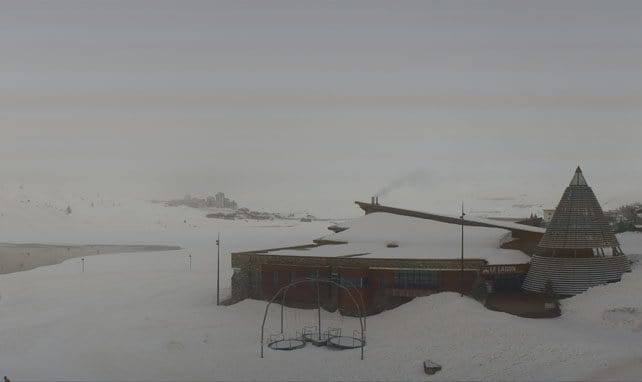
Below is how it’s looking in Tignes, in France. As you can see, there’s only been the lightest dusting of new snow here (although the existing cover is still quite deep). In common with many resorts in the French Alps, it’s foggy, too.
The change in the weather has been a relief for Snowfiends right across the Alps, who have endured one of the sharpest spring thaws in recent years. But conditions are still demanding, thanks to the low visibility: to which you can add rather icy conditions in the western Alps where there’s been an overnight refreeze, but little in the way of fresh snow. I’m in the French resort of Valmorel this week, courtesy of Club Med: and I’m about to head off into what looks like a world of white. But I’d better work hard: the almost limitless array of cakes and puddings on offer here each evening is starting to show on my waistline…
Meanwhile, in North America…
In the American Rockies, the snowy excitement of late March has been replaced by spring warmth. There’s precipitation in the forecast for the weekend, but it’s going to fall as rain on the lower slopes, before temperatures drop in a week’s time. In California, a mix of rain and snow is expected this weekend, though it will be generally a little cooler.
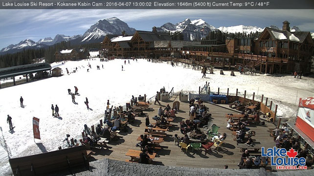
It’s mild in Canada, too. Pictured below was the sun-deck scene yesterday at Lake Louise in Banff National Park. The mercury hit +11C later in the day.
| France: there was the heavy rain in many French resorts on Tuesday night and Wednesday morning – the final insult of a spring thaw that gripped the region until yesterday. Still, the cold snap has now steadied the ship, and with a little fresh snow in the forecast, skiiing conditions on the higher pistes will be much improved when the sun comes out. Next week, the weather will warm up again, but the thaw won’t be as strong as the one we’ve just had. Currently, Chamonix reports up to 168-255cm of settled snow on the Grands Montets, and Val d’Isere 87-167cm. | |
| Switzerland: conditions across Switzerland are similar to those in France. The weather is foggy and much colder, and the pistes this morning are hard-packed. Further east, snow is falling and up high there should be a noticeable improvement in skiing conditions, especially when skies clear. Currently, Zermatt reports 210cm of settled cover at 2900m. In the south-east, Verbier has 25-215cm. | |
| Austria: parts of Austria had fresh snow yesterday and there’s more falling there today. By the time this storm blows itself out, the high-altitude resorts here will have the best conditions in the Alps. Currently, Obergurgl reports 21-144cm of cover, on piste, and the Hintertux glacier 90-285cm. | |
| Italy: many resorts have closed or are about to close in Italy, but if you can get out to the Dolomites this weekend before the lifts shut in the likes of the Latemar ski area, or Cortina d’Ampezzo, you should find a decent, grippy layer of wintry snow under your skis. Looking further into spring, high-altitude Cervinia should be your target, where the snow is 30-215cm deep. | |
| Andorra: in Andorra, the shutters are coming down on the ski season, and on Sunday the Grandvalira ski area, home of Pas de la Casa and Soldeu will be closing. | |
| Western USA: thanks to all the snow at the back end of March, some Rocky-Mountain resorts have extended their seasons. Vail for example will be open till April 17. However, it is warm there at the moment. At the top of Beaver Creek it was +10C yesterday. There, the mid-mountain snowpack is 160cm deep. Meanwhile, in Utah Snowbird has 256cm, and in California Heavenly has 213cm. | |
| Western Canada: spring has well and truly sprung in Whistler: it was +23C at village level yesterday, and even above the treeline the mercury hit +14C. Whistler Mountain closes on April 17: but on Blackcomb they’re hoping to keep skiing till May 30. Meanwhile, in Banff National Park, Lake Louise saw a high of +11C yesterday. It will close on May 8, and reports a mid-mountain snowpack of 110cm. |




Thanks the info. Any information on Wengen?