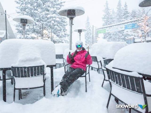
Sorry, Snowfiends. There still is no sign of a significant shift in weather patterns in the Alps. The past few days have seen heavy snow: but it’s been falling in the resorts of the American west – such as Snowbird in Utah, pictured above.
In the Alps, a little of the the white stuff fell at altitude yesterday. But the rain/snow level was high – around 2000m across the northern Alps, so things were pretty soggy at village level in most resorts. Only the highest resorts and glacier ski areas have really benefitted – and we’re not talking about significant accumulations. In France, Tignes claimed only 5cm of fresh cover. Val Thorens reckoned it had had 2cm. Further east, in Austria, a few spots notched up more than 10cm – but the areas that really need the white stuff (the Italian Alps as well as lower resorts almost everywhere) missed out altogether, or got their precipitation as rain.
Today, the sun’s out, and it’s mild. What’s more, there’s no sign of anything more than a dusting of snow in the forecast for the foreseeable future. Monday is the most likely day for a (brief) return of more unsettled weather, but once again the snow won’t be heavy enough to change the overall situation.
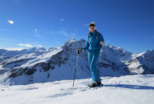
So it looks as though the resorts will have to make do with what they’ve got in the run-up to Christmas: plus what they can make with their snow cannons at night. Across the northern French resorts and at altitude in Switzerland, the scene is still a white one, thanks to the storms at the end of November. There’s widespread snow still in the Arlberg in Austria too. I’ve been skiing there today, in little Warth am Arlberg, which has the highest snowfall average in the Alps. It’s now connected to Lech, and as you’ll see from this photograph (below) of Martina Brenner of the Hotel Lechtalerhof, there’s still a decent coating of snow. However conditions are spring-like, with soft, wet snow on slopes that get the sun, and a firm skiing surface in the shade and higher up. It’s a good idea to get your edges sharpened before you go out.

Meanwhile, in the lower resorts of central and eastern Austria, and across Italy, the pistes are often ribbons of white against the grass.
Still, at least the sun will be out…
Keep sacrificing the chickens (if you’ve got any left), and remember, it’s been an extraordinarily warm summer, autumn and early winter in the Alps, and for now the trend looks like it will continue. If you’re planning to ski in the near future make sure you target a high-altitude resort.
Meanwhile in North America…
If I had a limitless budget, then I’d be heading out west right now, because December is turning into a month of plenty in the western resorts of the USA and Canada.
Following on from heavy snow at the end of last week in California, the latest beneficiaries have been the resorts of the American Rockies. In Utah, a storm that lasted from Sunday to Tuesday brought 76cm of fresh snow to Snowbird and Park City around 40cm.
This was Snowbird on Tuesday.
In Colorado there’s been more snow too. Breckenridge reported 27cm of fresh snow yesterday from the latest storm, and nearly 60cm in the last week. Here’s the latest video from the resort, filmed on Tuesday.
Further north, Steamboat reported 57cm of fresh snow in two days, and nearly a metre in the past week. What’s more, local snow guru Joel Gratz reckons that from Saturday to Christmas Eve there will be multiple snowstorms in the state, thanks to “a strong jet stream that is ripping straight across the Pacific Ocean and into the western US”. This will bring significant amounts of fresh snow to resorts in California and Utah, too.
Two of our editors, Peter and Felice Hardy, are in Jackson Hole, Wyoming at the moment. There’s not been been as much new snow there this week as in Colorado, but all the same the mid-mountain snowpack is 86cm deep, and thanks to low tempeatures (-10C), the cover is in great condition. “The lenses of my goggles froze over this afternoon,” reported Felice yesterday. “That’s never happened to me before.”

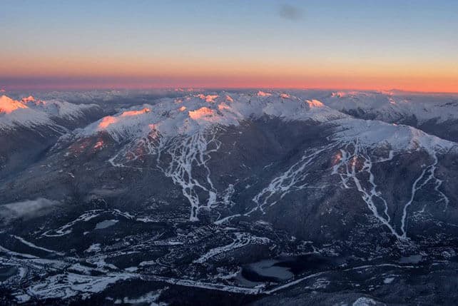
Meanwhile, north of the border, Whistler has just had a short break from the white stuff, after a very busy week of weather. More is now expected, with as much as 30cm set to fall by Saturday night. Temperatures will stay wintry too, so there’ll be none of the rain which fell last week. The snow will also push inland, but is unlikely to fall in the same quantities.
Here’s Whistler, taken from the air, on December 14.
| France: Moderate to heavy snow at the end of November has been followed by a prolonged spell of sunshine across the Alps, with very mild temperatures two weeks ago. There have been a couple of episodes of light snowfall since then: but nothing to significantly improve the depth or quality of the snowpack. The latest snow fell on Tuesday night and Wednesday this week, but was little more than a dusting, and fell as rain on lower slopes. It’s going to be followed now by another spell of mild, dry weather and today the freezing point is likely to hit 3000m for a time.
Across northern resorts the mountains still look white and wintry above 2000m, and above 2500m there’s a little fresh snow around. However, most pistes are heavily reliant on man-made snow and will be hard-packed in the morning and afternoon, softening when the sun hits them during the day. Off-piste skiing is very limited. Further south, and in lower resorts, the snow cover is much patchier, and the pistes are ribbons of white against the grass. Currently, in Tignes, there’s 32-70cm of settled cover, on-piste and in Val d’Isere 32-65cm. Val Thorens has 50-90cm of cover on piste. |
|
| Switzerland: conditions across the northern and western resorts of Switzerland are quite similar to the northern resorts of France: the higher resorts look nice and wintry, although the cover off-piste is generally too thin to be skiable and the pistes are firm. In the south-east the cover is thinner, although there are a few pistes open in St Moritz. The best snow will be up on the glaciers, in resorts such as Saas Fee and Zermatt. Currently, Zermatt reports 125cm of cover at 2900m. | |
| Austria: the best snow in Austria is to be found on the glaciers at the moment, although the Arlberg in the west is in reasonable shape too, thanks to heavy snow a fortnight ago. Aim high for the best conditions right now – either in high-altitude Obergurgl or in one of the many glacier ski areas: Hintertux, the Molltal, the Pitztal, the Kaunertal, the Stubai, the Rettenbach, above Solden, the Kitzsteinhorn and the Dachstein. | |
| Italy: most Italian resorts are still waiting for the their first significant snowstorm. However, brilliant work by the snow-making and grooming teams have ensured that pistes have opened with little help from Mother Nature. As is the case everywhere at the moment, the best skiing will be at altitude, in the likes of Cervinia, and on the Presena glacier above Passo Tonale. | |
| Andorra: in common with much of the Pyrenees, Andorra’s ski resorts were walloped by snow a fortnight ago. But as is the case in the Alps, the march towards winter has stalled. In the Grandvalira ski area, Pas de la Casa has up to 50cm of snow packed down, on-piste. 158km of pistes are open across the ski area, which is a remarkable achievement given the unhelpful weather so far this month. | |
| Western USA: see our main report. The resorts of California, Utah and Colorado are in great shape at the moment, and are expecting significant amounts of snow over the next week. Currently, in Colorado, Breckenridge reports 89cm of mid-mountain snow, in Utah Snowbird has 120cm, and Heavenly 93cm. | |
| Western Canada: Whistler’s season is looking up, thanks to heavy snow over the last week. Meanwhile, in Banff National Park, Lake Louise reports 82cm of cover on its pistes, mid-mountain. |


Add Comment