


This is more like it, Snowfiends. On top of last week’s 40-80cm of snow in eastern Switzerland and Austria, there was a 5-30cm top-up across the north-eastern Alps yesterday. In the Tirol, the Skiwelt reported 20cm of new snow, as did the Stubai Glacier and the Nordkette, near Innsbruck. Meanwhile in the Salzburgerland, Saalbach had 30cm.
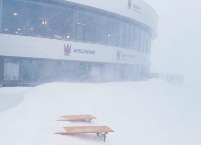
Here’s how it was looking on Stubai glacier yesterday morning.
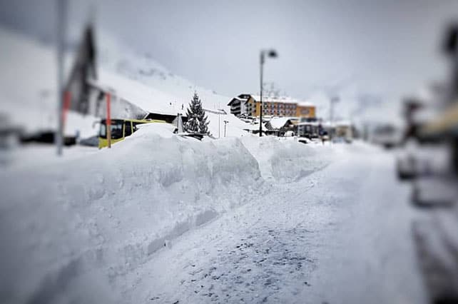
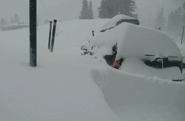
This was Kuhtai yesterday…
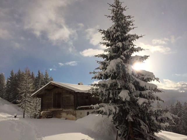
And here’s how it looked in Kitzbuhel.
Further west, the snowfall was lighter – in the Arlberg, Lech reckoned on 10cm of new snow yesterday (although we shouldn’t forget that the snow was heavy here on Wednesday and Thursday last week).
In eastern Switzerland, most resorts were lucky if they got 5cm yesterday, to add to the 40-odd centimetres that fell on January 4-5.
The new snow brought to a close a fabulous week, which – in the short term as least – has turned the season around in the eastern Alps. It’s brought its own troubles of course, notably sudden jump in the avalanche risk, which is 3/5 in many areas. There have already been fatalities. But all the same, it’s quite a transformation.
This video from the avalanche-protected slopes of the Nordkette on Friday sums up the situation nicely.
Now, all eyes are on the snow forecast for the week ahead, because it’s looking promising for the north-western Alps.
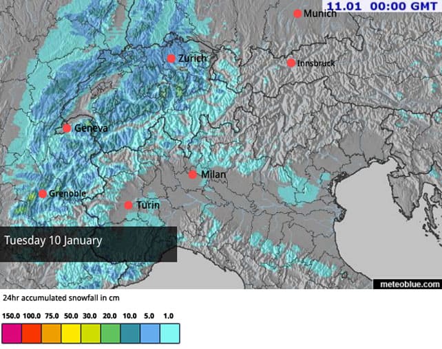
It starts tomorrow with what’s expected to be a 5-20cm dusting, as you can see from Welove2ski’s latest snow map.
But it’s the forecast at the end of the week which is really encouraging. It’s too soon to be absolutely certain of it, but according to most predictions Friday, Saturday and Sunday should see three successive weather fronts hit the region, bringing much-needed relief to the lower resorts of France – notably in the Portes du Soleil. The European Centre for Mid-Range Weather Forecasts reckons the cold snowy spell may last till January 17. At that point the action may shift south into Italy. I certainly hope so: I’m due to ski in Canazei on January 19!
Here’s our snow forecast for Friday, which should be the first day of the really active and snowy spell.

So – to sum up, Austria has by far the best conditions at the moment: but the north-western Alps should start to catch up next weekend. Overall, it looks as though the French Alps and western Switzerland will get more snow than Austria – although it will be snowing in the eastern Alps too; adding to the snow that fell between January 4 and January 8.
That’s worth bearing in mind if you’re in the market for decent, rock-covering base off-piste. As a result, the Arlberg resorts of St Anton and Lech-Zurs look like a good bet if you want to venture off the groomed trails, although the avalanche risk will be high.
Provided they do well from next weekend’s weather, Val d’Isere and Tignes are also worth considering for an off-piste trip. Val d’Isere in particular still has a deep (if hard-packed) base on its upper slopes in the wake of its late-November dump. By next Tuesday it should have a topcoat of powder, too.
Heavy, HEAVY snow in America
The ski resorts of California are having an extraordinary fortnight of weather. Yesterday, it was pouring with rain up to 3,000m, and most resorts were closed. But this was a mild interlude in what is turning out to be a memorably snowy spell. Last week, Squaw Valley on the western side of Lake Tahoe had 2m of snow, as did Heavenly in the south, and now that temperatures are dropping again plenty more of the white stuff is expected.
In fact, local snow guru Bryan Allegretto reckons the western side of the lake will get at least 165cm more this week.
Clearly, there’ll be a lot more digging out to be done before the weather calms down. This was Kirkwood last Thursday.
Yesterday afternoon, the mild weather moved into Utah, and brought rain to the lower slopes in many resorts. However, temperatures are dropping back today and there’ll be 30-60cm of snow fresh there by tomorrow morning, with further dumps expected on Wednesday and Thursday. They’re expecting snow in Colorado, too: 30-60cm in the northern mountains, and 60-90cm in the southern resorts.
As you can imagine, there’s been some mouthwatering video shot across the region in the last seven days. This footage was shot at Powder Mountain in Utah on January 5.
ARVE Error: For the maxwidth (maxw) option you need to have normal or lazyload mode enabled, either for all videos in the plugins options or through shortcode e.g. [youtube id=123456 mode=normal maxw=999 ].
This was Snowbird…
And this was Vail, Colorado.
Oh yes, and this was Squaw on January 3…
Further north there’s been much less snow, and it’s been much colder. Whistler in Canada is expecting snow today, but it’s likely to be 10-15cm. Then the skies will clear, and temperatures will drop back again. A daytime high of -13C is expected on Thursday. Inland, at Lake Louise in Banff National Park, it’ll be closer to -20C.


Add Comment