It’s been snowing hard in the south-western Alps – and won’t let up until tomorrow afternoon. Some resorts could see more than half a metre of the white stuff by the time the skies clear.
In the northern Alps it’s been dry and cool – although not cold enough to stop the snow softening on south-facing slopes each afternoon. However it may get colder and snowier in the north at the weekend.
In the Rockies, the mild spring conditions continue, although there has been some snow in the Pacific Northwest.
Resorts across the south-western Alps are having another of their private snow parties.
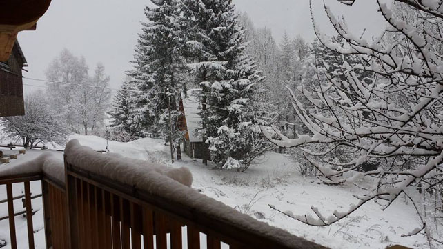
We saw a few of these in February – when weather systems steamed in from the Med, and lodged against the mountains. Sometimes, storms like this roll quickly eastwards: but not always, and this is one that seems to have got stuck. The snow arrived yesterday and it will keep falling – on and off – until Tuesday. Accumulations should be significant. After all, you only have to look at this shot from mountain guide Stefano Percino in the Monterosa ski area, above Italy’s Aosta Valley, for a sense of how snowy it is today.
Meanwhile, here’s how it’s looking Bardonecchia, in the Milky Way, where 20cm of snow fell yesterday. Currently the snow here is 60-140cm deep.
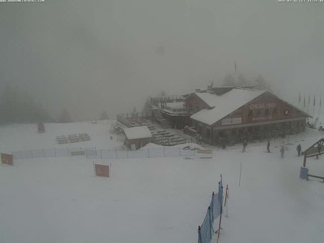
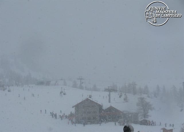
Meanwhile, pictured below is how it’s looking in Madonna di Campiglio, much further east.
In, fact, although the eye of the storm is in the western Italian resorts, there’s light snow falling in the core of the Dolomites too. It’s also falling in French, Swiss and Austria resorts that are close to the Italian border. Parts of Val d’Isere, for example, have had 20cm of snow from the storm so far, and here how it’s looking on the Pisaillas glacier at the eastern end of the ski area (which is where it snows most heavily when the weather’s like this).
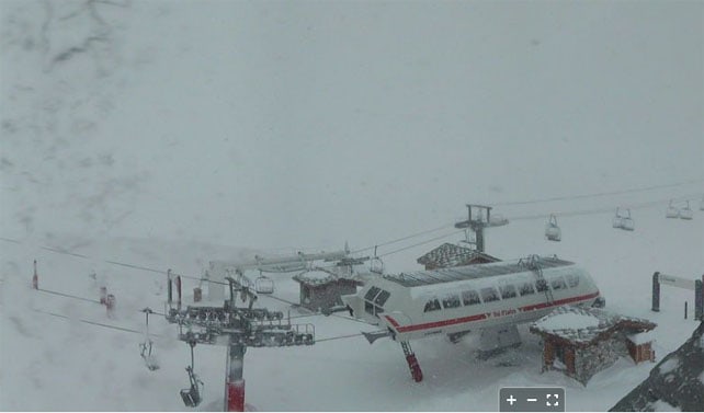
Other non-italian resorts getting snow include Montgenevre, Saas-Fee, Zermatt and – to a lesser extent – Obergurgl.
Here’s today’s snow forecast for the Alps to give you an idea of the storm’s reach.
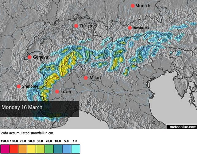
Expect conditions to be vastly improved once the clouds lift – although there will be a significant avalanche risk – not only because of strong winds, but also as a result of poor bonding between the new snow and the existing cover, which was hard and crusty on south-facing slopes.
You should also bear in mind that, on piste, the time to ski the snow is as soon as possible. We’re now in mid-March and the sun is regaining its power. It’s likely to affect the quality of the new cover very quickly once it’s out.
In most northern resorts, it’s been cool(ish) and dry
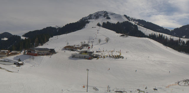
Further north, it’s been cool-ish and dry, although whenever the sun comes out temperatures have risen. On the Hohe Salve, at the top of the Skiwelt ski area in Austria, for example, the mercury has hit 2.5C this afternoon.
As a result, conditions are mixed at the moment. North-facing slopes are hard, except in the high-altitude resorts, where the cover wasn’t subject to a daily melt-freeze cycle that characterised early March. Up there the snow is still wintry and soft. Lower down, and on south-facing slopes, the snow’s getting wet and heavy during the day. Ski from top to bottom in resort such as Courchevel, and you’ll probably find every conceivable type of cover, on-piste, in a single run – except of course for freshly-fallen powder.
The outlook is for proper spring-like weather on Wednesday and Thursday, once the Italian storm has blown itself out. However, there are signs that, come the weekend, a lump of cold, wintry weather will drop down from the north-east, bringing light to moderate snowfall, and favouring Austria in particular.
In the Rockies, the spring weather continues
It’s staying warm in the Rockies for the time being. In Breckenridge – where I had some memorable skiing nine days ago – the temperature at the base of Peak 9 could hit +14C in the sunshine this afternoon. In Jackson Hole, the mercury’s likely to hit +13C at the base of the lifts. Colorado snow guru Joel Gratz reckons there could be snow showers on Wednesday and Thursday, but they won’t break the grip spring has on the region. The best chance of significant change is on March 25.
Meanwhile, up in the Pacific Northwes,t there has been a little fresh snow. It’s much-needed. Here’s how it was looking in Whistler yesterday, which reported 10cm of fresh on its upper slopes.
| France: overall, the period from late January until the end of February was a snowy one in France, and the cover is still pretty good in most resorts as a result. That said, there have been several mild spells since then, and the quality of the skiing surface has been affected. If you’d rather be skiing consistently soft, wintry snow, this is the time to head uphill, and focus on the highest ski areas.
Today, it’s mostly dry and windy away from the resorts that line the Italian frontier – which are seeing light to moderate snowfall. In the dry areas, expect to find hard-packed pistes on north-facing slopes, and spring conditions wherever the sun is shining. Currently, Val d’Isere has some of the best snow: thanks to a 20cm top up which has blown over from Italy. On-piste cover there is 105-160cm deep. To the south, Serre Chevalier has 20-130cm of cover, and in the Three Valleys, Val Thorens reports 120-205cm of settled snow on its pistes. |
|
| Switzerland: conditions in Switzerland are very similar to those in France. It’s mostly dry today, but resorts near the Italian border are seeing fresh snow. Currently Verbier reports 15-205cm of cover on its pistes, Laax in the east reports snow depths of 25-310cm, and St Moritz in the south has 50-140cm. | |
| Austria: there was a little snow in central and eastern Austria last week, but the cover on valley runs in the lower resorts is thinning quickly in the spring sunshine. Hopefully, the snow that’s forecast for the weekend will come and top them up. In the Arlberg, Lech currently has 85-205cm of cover, on piste, and in high-altitude Obergurgl it’s 30-165cm deep. Meanwhile, further the east, Schladming reports 80-150cm of on-piste cover. | |
| Italy: the western resorts will get a significant top-up of snow as a result of the current storm. In the Aosta valley, Gressoney in the Monterosa ski area currently has cover 90-230cm deep, on-piste. Meanwhile, in the east Canazei in the Dolomites reports 40-130cm of settled snow on its slopes. | |
| Andorra: the Pyrenees saw heavy snow at the end of February, some rain, then a cold snap and then – as in the Alps – mild sunshine. However, the last three days have been more wintry, and in the Grandvalira ski area, there’s 7cm of fresh snow today. Snow depths range from 140-210cm, on-piste, and top temperature in a href=”https://welove2ski.com/grandvalira-soldeu” target=”_blank”>Soldeu will be -3C. | |
| Western USA: spring has a strong grip on the Rocky-Mountain weather at the moment, and there’s no immediate end in sight. Currently, in Vail, the mid-mountain cover is 135cm deep. In Utah, the Snowbird reports 190cm of settled snow, mid-mountain, and in Wyoming Jackson Hole reckons on 172cm of snow, mid-mountain. | |
| Western Canada: at last, Whistler has had a top-up of snow, although it’s short of the 20cm expected. Inland, in Banff National Park, Lake Louise has had a 9cm top-up, and is expecting a high today of +4C. |




Add Comment