At last! The Alps are about to see their first really meaty September snowfall.
The snow will start this afternoon in France and Switzerland and spread east overnight – and we’re expecting significant accumulations in Austria and eastern Switzerland before the storm blows itself out. Here’s Wednesday’s map from Welove2ski’s snow forecast.
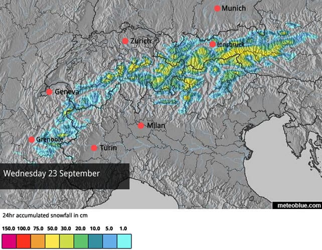
As you can see, up to half a metre could fall in the high Austrian Alps – and glacier ski areas such as the Hintertux, Pitztal, Stubai and Kitzsteinhorn should do well. However, 20-30cm is more likely in most places, with 5-20cm in the western Alps.
It’ll be a huge relief for all the high-altitude ski areas, which were hammered over the summer by high temperatures, and had a dousing of rain last Wednesday. Some – such as the Kaunertal in Austria, and the Val Senales glacier in Italy – have had to delay their openings as a result.
This week, they’re looking a little more wintry: but all of them could do with more snow.
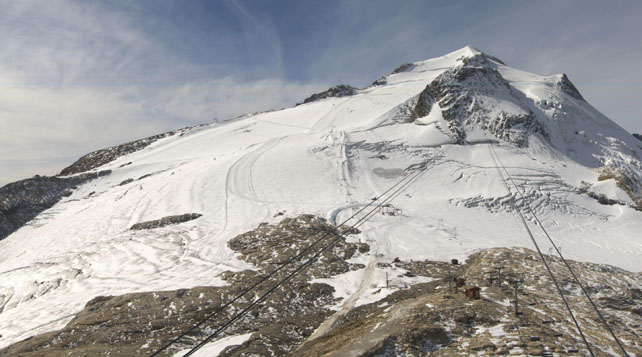
Pictured above is the Grande Motte glacier, above Tignes in France earlier today. It’s due to open on October 3. At least it’s white now, but as you can see the covering of snow is still thin.
Meanwhile, pictured below is the scene yesterday on the Hintertux glacier, at the far end of the Zillertal, which is open all year. Here too they will welcome the top up.
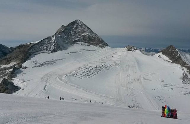
However, excitement about the coming storm has been tempered by the mid-range forecast, which is predicting an extended spell of mild and sunny weather from Thursday.
In fact, by Friday the daytime freezing level will be up to 3200m in both France and Austria, which means all but the highest slopes will be affected by the thaw. I have seen one forecast which suggests the high pressure will eventually slip west, allowing a bolt of unstable and frigid air to power down from the Arctic to the Alps, on October 4. But it’s much too early to be sure: and other mid-range forecasts are showing less exciting outcomes.
Meanwhile in North America…
As you will have seen in the September 15 snow report, the Canadian Rockies had an early-autumn dump last Monday night/Tuesday morning. This video was shot at Mt Norquay, above Banff, on September 15.
The colder air then hustled south, bringing snow to US, too. Pictured below was Aspen, Colorado, on Thursday.
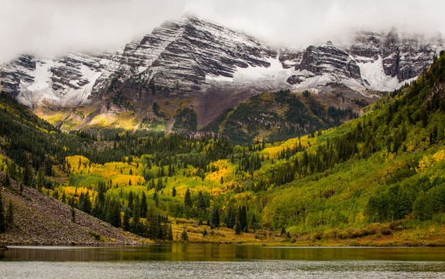
And here’s how it looked in the Grand Teton National Park, near Jackson Hole, Wyoming at the weekend.
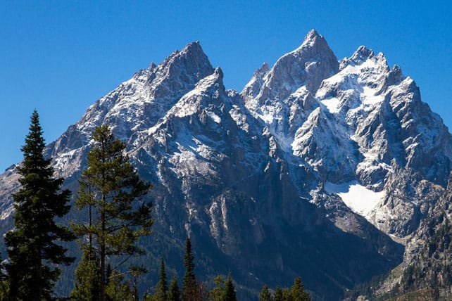
With a powerful El Niño now well-established in the Pacific, everyone is expecting the usual weather patterns to be disrupted, and it’s likely that many areas will be milder than usual. Aside from last week’s cool interlude, it’s certainly been that way for most of September in the Colorado Rockies, and even at high-altitude Arapahoe Basin, where the base lodge is at an eye-watering 3,285m, the week will be mainly sunny and warm. Daytime highs will regularly nudge +16C. As a result, there’s no immediate sign that it will be turning on its snow cannons in the annual race with Loveland to be the first to open for autumn skiing.
In the southern hemisphere, the season is about to wind down
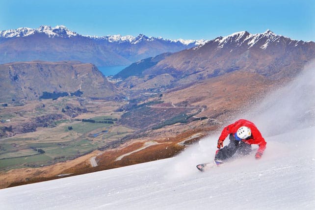
Next Sunday sees one of the first significant closing days in New Zealand, when the resort of The Remarkables shuts its lifts to skiers. Many more ski areas will follow suit on October 4, as they will in Australia and the Andes.
In New Zealand, there can be few complaints. It’s been an a cracking winter, especially in its early and middle sections, when the weather stayed consistently cold and snowy for weeks. Many would ascribe this to the impact of El Niño, which often generates more southerly winds across the country than normal; although no sensible forecaster would have said this was a certainty back in June. Even when El Niño is powerful, as it is this year, its impact can be unpredictable. In the Andes, for example, skiers were expecting bountiful snowfall this season, but it started with an unusually long and dry spell around Santiago; which put the start date for some resorts back by a month, compared with 2014. Yes, there were a couple of big dumps later on, but it hasn’t lived up to expectations.
It’ll be very interesting to see what El Niño serves up in North America in the coming winter…
| France: all of the French glacier ski areas are currently closed. However, the Grande Motte above Tignes will be open again from October 3. | |
| Switzerland: currently Zermatt claims 145cm of snow at 2900m. Here, 15 lifts are currently open, serving 14 pistes. You can also ski on the glacier above Saas-Fee. | |
| Austria: three glaciers are currently open in Austria for skiing – the Hintertux, the Molltal and the Pitztal. The Hintertux has the most terrain on offer, with 18km of pistes. Austria’s other glacier ski areas will be hoping tomorrow’s dump lives up to expectations so they too can get going. | |
| Italy: Italy’s glacier resorts are currently closed. The glacier above Val Senales is hoping to open on September 25. Cervinia will be opening again on October 17. | |
| Andorra: Andorra’s ski resorts are closed. | |
| Western USA: Timberline Lodge on Mount Hood in Oregon had to close its lifts on August 2 after a low snowfall and a hot summer (thanks to Martin Bell for the update!). Hopefully, the Colorado resorts of Loveland and Arapahoe Basin will shortly be starting their race to open, but it’s still too warm to get the snow cannons going. | |
| Western Canada: all eyes are now on the resorts of Banff-Lake Louise, thanks to their snowfall last week. There’s talk of Mount Norquay opening in less than six weeks’ time. |




I note that you say that a powerful El Nino effect is now well established in the Pacific but is that in fact the case? Although mainstream media in the U.S. are claiming certainty on this any respectable forecaster knows the effect is very far from certain this far out! Perhaps a little premature on your part to be jumping on this particular bandwagon?
Hi David – I like your scepticism! It’s not just the American media that have been getting excited about El Niño: we’ve just had a rash of UK news stories predicting the Mother of All Winters because of it. The UK ones in particular seem to be based on quite flimsy evidence.
These stories are all speculating on the likely effect of the current El Niño. However, few would argue with the fact that El Niño is now established in the Pacific, and that it is unusually strong.
America’s Climate Prediction Centre is regarded as one of the authorities on the subject and you can see its latest monthly update here: https://www.cpc.ncep.noaa.gov/products/analysis_monitoring/enso_advisory/ensodisc.pdf.
It states that the current “atmospheric and oceanic anomalies reflect a strong El Niño”. What’s more, the prognosis is that, “There is an approximately 95% chance that El Niño will continue through Northern Hemisphere winter 2015-16”.
What’s much less certain is the impact. Historic snowfall stats support the view that there are “typical” El Niño effects on winter weather in America and Canada, when the event is a strong one like this. But they don’t always come to pass. So you shouldn’t bet your holiday on skiing waist-deep powder in, say, California, because of it – as I’ve explained in this feature, published in August.
What’s more, some climatologists are warning that new phenomena, such as the disappearance of the Arctic sea ice, are adding extra unpreditability to the outcome.
For example, when David Phillips, Senior Climatologist at Environment Canada, looked back at historic El Niño snowfall stats in eastern British Columbia for Welove2ski, he said that “the dice are loaded to give you milder temperatures, and less snow and less rain”.
However, changes in the world’s climate are making him uncertain about the impact of El Niño this time round. “Climatologists like to think that the past is a guide to the future,” he told me. “In this case there is no past. Another wrinkle is the disappearance of the Arctic ice. This is uncharted ground. These are very exciting times for guys like myself but I wouldn’t bet more than a loonie (CAN $) on any forecast coming up.”
In other words, it’s not just excitable journalists who say we’ve got an El Niño on our hands. But when you read a report that says a region “will get heavy snow this winter” because of it, you’re right to be doubtful. There may be increased likelihood of snow: but that’s all.
Sean I’m sticking with the sceptics! Not least because I am booked in for my 2 week honeymoon to Big White at the start of January in my first every ski trip to Canada. So the thought of the snow being less than champagne powder fills me with dread! You can understand why I’m with Bobby Martrich from EPAWA on this one!