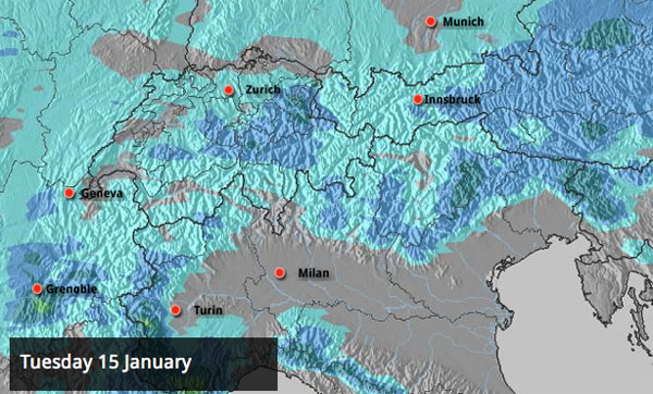
Here’s a map to gladden the hearts of Snow Report readers. It’s the Welove2ski snow forecast for Tuesday, January 15: and whilst it’s not predicting epic quantities of the white stuff, it is suggesting snow is going to fall at very low levels.
You know, like it’s supposed to in the middle of winter.
Gone at last is the two-week thaw which has had everyone quietly shaking their heads in the Alps. Warm spells at this time of the year are course not unheard of. There was a very sharp thaw only two years ago in early January – when the only decent skiing was on the glaciers. But it’s unusual to get one which lasts so long. The heavy rain it’s brought from time to time has blunted the spectacular start to the season we enjoyed in early December, and combined with spring-like temperatures it’s thoroughly spoilt the snow on lower slopes. Thank goodness it’s being chased away by properly frigid weather.
This week, I’ve been skiing in Kitzbuhel and we’re already feeling the benefit of the changing weather. Yesterday, colder, less humid air was drying out the snow above about 1500m, and provided some lovely skiing both on piste, and off. Since then, there’s been a little fresh snowfall. I imagine the guys at the Kitzbuhel Ski Club will be able to resume work on the famous Streif: the Hahnenkamm race course which is due to host the most famous Kitzbuhel Downhill race on January 26.
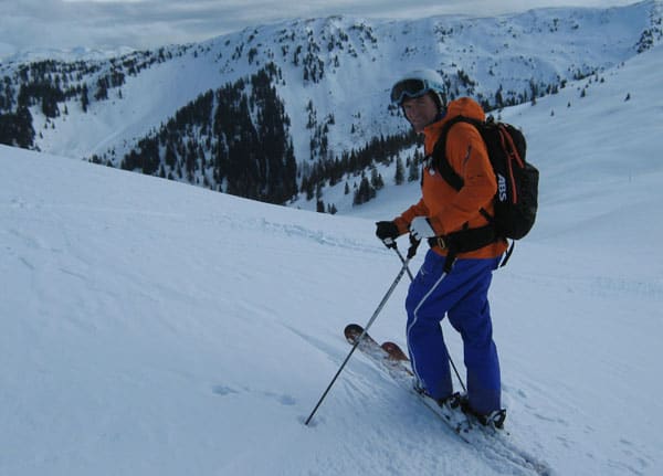
Meanwhile, over in Meribel, Alf Alderson reports hard-packed powder on piste “with the occasional icy patch where traffic is heavy. Off-piste, conditions are mixed. There’s lots of chopped-up, crusty stuff, but powder can still be found on north-facing slopes.” He also reported heavy snow was starting to fall last night.
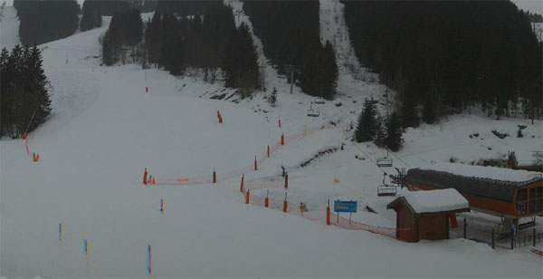
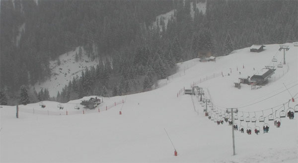
More of the white stuff is expected today. Our snow forecast suggests as much as much as half a metre in a few parts of Switzerland – although 30cm is more likely in most places, including France and the Arlberg resorts of Austria. (Mid-morning update: Chamonix reports 30-40cm of snow this morning in the town, so clearly a lot has fallen overnight in the western Alps.)
It looks as though the snow is going to be heavy enough in the west to bring relief to both pistes and off-piste – at least on slopes which aren’t blasted by the wind. Which is better than we’d originally hoped for! Further east, it may only be the pistes that are refreshed by today’s snow. There may not be enough to cover the crusty surface, off-piste, on the lower slopes. But let’s wait and see…
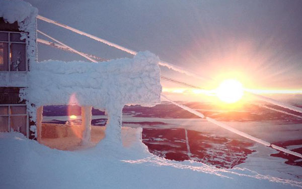
Up in Scandinavia, the winter has been much more…wintry. There was a brief thaw earlier in the week, but now temperatures are frigid again – with highs of -11C expected in Are, Sweden over the weekend. Here’s how sunrise looked on Monday…
Across the pond, 35cm of powder brought big smiles in Whistler on Wednesday, and the resort celebrated with a rather spiffing little video.
The Californian resorts have had fresh snow too: Heavenly reported 15cm yesterday morning and Kirkwood 33cm. Here’s yesterday’s video snow report from Kirkwood.
| France: See our main report. After an extended thaw, fresh snow is now falling across the French Alps, and temperatures are set to drop precipitously. As a result, the skiing surface on piste should improve in all resorts, especially on the lower slopes. Up top, snow depths are still impressive. Above Tignes, the snow is currently up to 245cm deep; above Val Thorens it’s up to 210cm deep, and above Flaine it’s up to 244cm deep. | |
| Switzerland: Switzerland should see the best of today’s snow, with up to 50cm expected to fall in places. Andermatt and Engelberg are among those resorts like to get a decent dump. Expect a dramatic change in temperatures over the next five days, and much improved skiing on the lower slopes once the snow has fallen. Currently, Verbier has up to 220cm at the top of its ski area, Andermatt has up to 360cm, and Davos up to 112cm. | |
| Austria: Austria won’t see as much snow as Switzerland and France today, but there should be enough to refresh the pistes. All eyes are now on the mercury over the next few days: the lower resorts would dearly like to see temperatures drop to more normal levels. Currently, the Arlberg resort of St Anton reports up to 170cm of snow on its highest slopes, and Lech 200cm. Above Obergurgl there’s up to 181cm of snow. Lower down, in the Skiwelt, there’s 125cm of snow up top and 20cm on the lowest valley runs. | |
| Italy: Generally, there’s been less snow in the Italian Alps than the north this winter, but cover is still pretty deep on the higher slopes. It looks as though most resorts should see at least a dusting of fresh snow at the weekend, but it will only be enough to refresh the piste a little. Don’t expect much in the way of off-piste skiing. Above the Aosta valley, Cervinia has some of the deepest cover, and reports settled depths of up to 220cm, mid-mountain. Further east, in the Dolomites, Canazei has up to 125cm of snow on its pistes. | |
| Andorra: The Pyrenees have had more than their fair share of the mild weather since mid-December. However, cover is still reasonable, on piste – 30-70cm deep according to altitude and aspect in the Grand Valira. Temperatures will drop sharply here over the next two days and there should be a dusting of snow. | |
| Western USA: California has some of the deepest cover in the west at the moment – 254cm of settled snow is reported at Kirkwood, for example. In Utah, Snowbird the snow report talks of 147cm, mid-mountain; in Jackson Hole in Wyoming that figure is 116cm, and in Vail, Colorado 51cm. Colorado has had a dry week – and snow depths there are not great for the time of year. | |
| Western Canada: As you’ll have seen from the main report, Wednesday was a powder day in Whistler. The resort reports 82cm of fresh snow in the last week, and a settled snowpack of 211cm, mid-mountain. Inland, Fernie’s excellent season continues – with 78cm of fresh snow in the last week and a settled mid-mountain snowpack of 243cm. |


Winter gets its mojo back. https://t.co/iHu8RJtz And about time, too…
RT @welove2ski: Winter gets its mojo back. https://t.co/iHu8RJtz And about time, too…
RT @welove2ski: Winter gets its mojo back. https://t.co/iHu8RJtz And about time, too…
Snow report update – 30-40cm of new snow in Chamonix this morning. Seems like we’ve turned a corner! https://t.co/iHu8RJtz
RT @welove2ski: Snow report update – 30-40cm of new snow in Chamonix this morning. Seems like we’ve turned a corner! https://t.co/Bt8UGJWr