Watch out Snowfiends: winter is about to make a big comeback in the Alps.
On Wednesday, temperatures will start to drop in the west, as a cold front edges its way south into the region. Then, on Thursday, it looks as though this chilly air will collide with a second low-pressure system moving up from the Mediterranean.
The likely result is a lot of snow along the Italian border with France, Switzerland and Austria.
It’s not yet certain who will get the lion’s share. At the moment it looks as though the central and eastern resorts in Italy will see some of the heaviest falls, before the eye of the storm moves north: the Tirol and Carinthia in Austria should also get a proper dump. I’d keep an eye on the likes of Val d’Isere, Cervinia, Zermatt, Saas Fee, Livigno, Passo Tonale, St Moritz, Obergurgl, Solden, the Stubai and Hintertux glaciers, and the Dolomites. Someone along that central spine of the Alps is likely to be walloped.
Even so, the snow will be widespread, and accompanied by wintry air. In France, for example they expect the daytime freezing point to drop to 1000m, and for snow to settle as low as 400m for a time on Thursday morning.
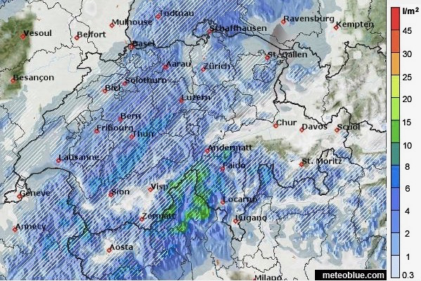
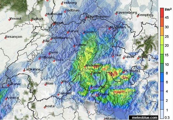
At the top, I’ve shown Meteoblue’s weather map for the period on Wednesday when the snow is most widespread. But the map below, for the three hours after 11pm, shows how the storm is likely to intensify.

Skies will clear in the west on Friday morning, and in the east on Friday night, and there could be a little more snow at the weekend.
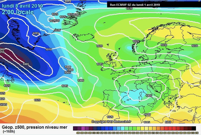
Below-average temperatures are likely to persist into next week, as you’ll see from the latest ECMWF weather chart for April 8.

So you can expect a couple of white-out days in some areas, and for the avalanche risk to jump in the most heavily-affected regions. Great caution will be needed until the snowpack settles.
But at the very least there’s going to be some lovely piste-skiing on offer once the skies clear. Meanwhile, anyone who hires a guide, respects the avalanche warnings and heads off piste onto north-facing slopes will enjoy a spring harvest of powder.
Despite the low temperatures, I’d still aim for a high-altitude resort with lots of north-facing slopes: because the new snow will stay soft, dry and wintry there for longer. But in the short term at least, the week commencing April 6 or 7 should be a lot of fun…


Add Comment