


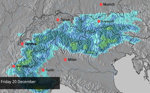
Right then, Snowfiends. Let’s get straight onto the good news, courtesy of the Welove2ski snow forecast for the Alps on Friday.

That’s right – snow! After nearly three weeks of almost unbroken sunshine and mild temperatures in the western Alps (and nearly two weeks of similar conditions in Austria), the white stuff will be making a welcome return. It looks as though it’ll arrive in the west on Thursday and spread right across the range on Friday. It’s too soon to sure exactly how much will fall, or where, but at the moment 10-20cm looks likely, with France, Switzerland and Italy getting the lion’s share. That may change: so keep an eye on the snow forecast over the next couple of days.
Of course 10-20cm isn’t what you’d call a dump: it’ll refresh the pistes, but it won’t do much for the off-piste terrain in most resorts, which needs two or three proper snowstorms before the rocks are covered. What’s more, the sunshine is set to return at the weekend.
However, there are now signs that, come the week of Christmas, there will be a more prolonged breakdown in the weather. This isn’t absolutely certain yet – the high pressure could yet settle in again. But several of the mid-range weather models are suggesting there’ll be significant snowfall in the middle of the week. Keep your fingers crossed if you’re heading out there Saturday and Sunday. By next Friday, you could be skiing powder.
As for right now, it’s still a good idea to get your edges sharpened before you hit the slopes – as I discovered last week in Verbier. Generally speaking, the higher you go, the better the snow is. But even in Auffach, in Austria’s Ski Juwel area – which tops out 1903m – there was decent piste-skiing yesterday. Actually, the area benefited from dusting of snow on December 14, from a storm which grazed the northern edge of the Alps – and anyone who was out had the mountain pretty much to themselves.
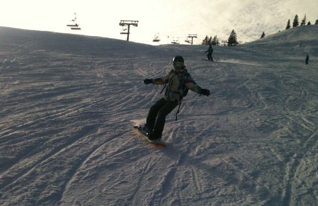
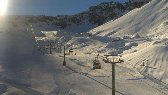
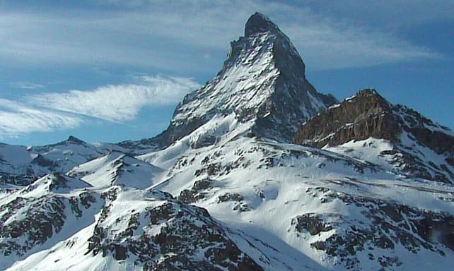
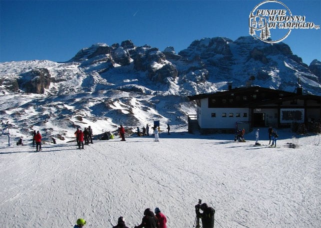
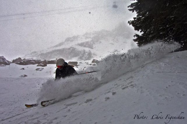
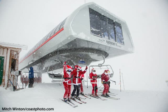
Here’s a quick survey of today’s cams and photos. Yes, the mountain looks magnificent. But all eyes are on the forecast right now. More snow is needed to set the resorts up for the Christmas and New Year rush.
In Breckenridge, the sun shone for the Dew Tour
The last four days have seen world-class freestyle skiing and boarding in Breckenridge, Colorado – thanks to Ion Mountain Championships – the only winter stop on the Dew Tour this season. It’s always a big event. But this year the approach of the 2014 Winter Olympics gave it an extra edge. It also featured Britain’s very own James “Woodsy” Woods in the slopestyle – who will be a genuine medal contender at the Sochi games. This time, he finished sixth – a disappointment for him, but a result which still underlines his stature in the sport.
Here’s video of the winning Slopestyle run from America’s Nick Goepper.
And here’s David Wise’s winning run from Saturday’s superpipe final. Check out the elevation he gets on those early tricks…
As you’ll see from the Goepper video, the weather was sunny for much of the weekend, and will stay that way until Thursday. After that, local snow guru Joel Gratz and his Utah compadre, Evan Thayer are both predicting a change in the weather, although it looks as though there won’t be as much fresh snow as first thought. Both are now talking about light to moderate accumulations in the run-up to Christmas.
Further north, in Montana and Wyoming there should be more snow, which will nicely add to Jackson Hole’s decent start to the season.
Western Canada gets a top-up
There was light snow in Whistler over the weekend – but less than originally forecast. Another 11cm is expected on the upper slopes by Wednesday. The mid-mountain snowpack there is 84cm. That’s okay given we haven’t reached Christmas yet. But it’s nothing special by Whistler’s early-season standards. This time last winter the cover there was twice as deep.
Meanwhile, inland, parts of British Columbia are having a great start to the season. Revelstoke, for example, reports 351cm so far this winter (more than double Whistler’s tally), and 60cm in the last week. It expects about 20cm more over the next couple of days.
Better late than never, here’s Revelstoke’s opening day video, which gives a flavour of the season so far.
| France: see our main report. At altitude, the cover on-piste is respectable for the time of year. But lower down the sunshine and mild temperatures have thinned the cover considerably, and the pistes are icy first thing and at the end of the day. The snow which is forecast for the end of the week is badly needed to freshen things up. Most big-name resorts in the country are now open, including Val d’Isere, where the settled cover is 40-75cm deep, Val Thorens (60-100cm), Meribel (25-78cm), Les Deux Alpes (15-170cm) and Alpe d’Huez (20-150cm). However, Serre Chevalier has postponed its opening day until December 21 in order to preserve the cover for Christmas. | |
| Switzerland: Conditions in Switzerland are similar to those in France. More snow is needed to fresh up the pistes, and fill in the off-piste terrain. Hopefully, it’s coming – just in the nick of time. In Laax the settled cover is 10-70cm deep, in Verbier it’s 18-90cm deep and in St Moritz it’s 20-23cm deep. | |
| Austria: Austria saw moderate snowfall on December 6 and 7 and there was a dusting on Saturday in places, but the mild weather has thinned the cover in most places, and off-piste the snowpack is below average for the time of year. Given the conditions, high-altitude Obergurgl is a good bet right now, as are the glacier skiing areas such as the Hintertux, and the Kitzsteinhorn. | |
| Italy: The weather has been sunny across much of the Italian Alps for some time now, and the snow is thinning on the lower slopes. In Cervinia, the last snow fell on November 21, and the mid-mountain cover is now reported to be only 20cm deep. In Madonna di Campiglio in the Brenta Dolomites, the cover is 10-50cm deep, and above Canazei in the main Dolomiti Superski area it’s 10-70cm. | |
| Andorra: Thanks to heavy snow in November, the Pyrenees got off to a cracking start to the season, and in Andorra both the Grandvalira and Vallnord ski areas are open. As in the Alpes, there’s been a long period of sunshine too, and the cover is thinning on the lower slopes. Grandvalira reports 90-160cm of settled snow, on-piste. Temperatures today are expected to reach +7C. | |
| Western USA: The weather’s been mostly sunny and dry in the American west since December 8. But snow depths are still good for the time year. Breckenridge has 84cm packed down, mid-mountain, Snowbird 84cm, and Jackson Hole about the same. There should be more snow towards the end of this week. | |
| Western Canada: In Banff National Park, Lake Louise reports 21cm of snow in the last week, and a mid-mountain snow depth of 51cm. It’s balmy there by recent standards: -6C. Further west, Whistler is expecting a high today on the upper slopes of -4C, and around 11cm of fresh snow by Wednesday. |


Going skiing over the holidays? There’s good news in today’s Snow Report… https://t.co/m7JHpUQYAq
@welove2ski we are very much liking your snowy map https://t.co/ntregh647T
Snow is on it’s way #verbier https://t.co/anTXD35IBo. Just in time for #Christmas!
I heard a whisper… snow on thursday… #meribel #skiblanc https://t.co/b8VHsellqx