


Don’t forget your sunscreen. That’s the watchword in the Alps at the moment, as the sun beats down from a clear blue sky. With a few cloudy interludes it looks set to stay that way until at least the middle of next week.
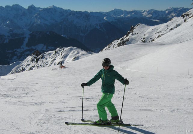
Don’t forget to sharpen your edges too. Temperatures are balmy for mid-December and the snow is going through a daily thaw-refreeze cycle, softening in the sun during the day and then hardening up overnight. The process isn’t nearly as extreme as you’d find in the spring: but all the same you should ski highest slopes for the best conditions. Thanks to the airline SWISS, the new W Verbier and Ski Verbier, I’ve been in Verbier these last couple of days, and up above about Les Ruinettes at 2200m the pistes are firm and fast. Conditions are perfect for bombing about and waking up your leg muscles. But once you get down down below 2000m it is pretty slick in the morning – and at the end of the day when the sun begins to set.
There are slim pickings off-piste, too. The snow has settled and thinned since the big dumps of November, and the consensus is that unless you want to give the bottoms of your skis a good scrape, you’re best sticking to the groomers.
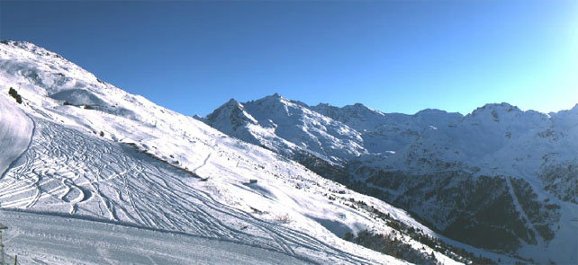
This is a fair representation of conditions across the western Alps. The snow’s a little deeper off-piste in France – but it’s been ten days since the last (light) snow, and more than two weeks since the last proper dump. It’s been warm too: according to French forecaster Meteo Chamonix, the freezing point today is going to be up to 3000m. For the best conditions, ski as high as you can.
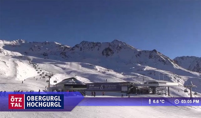
Further east, in Austria, the snow’s a little fresher, thanks to moderate snowfall on Friday and Saturday. However, it’s warm here too, with the freezing point at around 2500m, so again you need to aim high for good skiing. As in the west, you’ll probably have to stick to the pistes: according to the Tirol’s excellent avalanche service, “Snow depths in most outlying terrain are somewhat below average”.
Needless to say, with Christmas and New Year on the horizon, everyone’s hoping for storm to freshen everything up. And that’s not yet a certainty. The latest piece of “weather wisdom” I’ve heard out here is that “it’s been snowing in New York, and we always get snow in the Alps ten days later, so we’ll be fine”. But at the moment all that we can be sure of is that it’ll get a little cloudy at the weekend – and then clear up again (see our Alpine forecast for more on that).
Beyond that, some but not all of the mid-range weather charts are suggesting the high pressure will break down around December 19. But we’ll have to sit tight for a few more days yet to see if the possible turns into the probable.
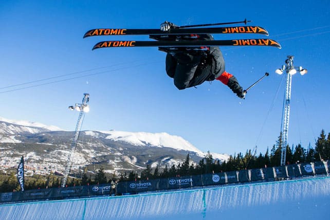
Across the Atlantic, there’s been sunshine too
Regular followers of our Snow Report will know that last week was an exciting one for Snowfiends in the American Rockies, thanks to the first really intense winter storm of the season. Resorts such as the Canyons in Utah, Jackson Hole in Wyoming and Heavenly in California all clocked up more that 60cm of snow, and most of the big resorts in Colorado got at least 30cm. Temperatures then fell through the floor, with highs around -14C and windchill to make things even colder.
This week, it’s sunny – and it’s getting a lot milder too. There’s the chance of a few flurries in Colorado and Utah over the weekend, but Colorado snow guru Joel Gratz thinks December 19 and 20 will see the next big storm. Evan Thayer in Utah has his eyes on those dates too.
In Canada it’s been frigid too. Last Friday in Lake Louise, the temperature didn’t get much above -24C! There wasn’t nearly so much fresh snow as there was further south: but the forecast is looking more promising. Whistler is, for example, expecting 10-20cm over the weekend.
| France:See main report. On piste the cover is respectable for the time of year, but it’s a shame the French Alps won’t see any new snow for at least a week. The mild temperatures expected this week will be a pain too – affecting snow cover on sunny pistes right to the top of many resorts. Beware of thinning snow on the lower pistes, too. Most of the big-name resorts in the country are now open, including Val d’Isere, where the settled cover is 40-75cm deep, Val Thorens (65-105cm), Meribel (25-80cm), Les Deux Alpes (15-170cm) and Alpe d’Huez (20-150cm). | |
| Switzerland: The eastern end of Switzerland had a light-to-moderate top-up of snow on Friday and Saturday. Elsewhere it was dry – and will remain that way for the forseeable future. In Laax the settled cover is 10-70cm deep, in Verbier it’s 20-90cm deep and in St Moritz it’s 20-25cm deep. | |
| Austria: Austria had fresh snow at the weekend, but the general warming trend has settled in here as well as in the west. Ski as high as possible to be sure of good conditions. Obergurgl is a good bet right now, as are the glacier skiing areas such as the Hintertux, and the Kitzsteinhorn. | |
| Italy: The weather has been sunny across much of the Italian Alps for some time now, and the snow is thinning on the lower slopes. In Cervinia, the last snow fell on November 21, but the mid-mountain cover is still reported to be 145cm deep. In Madonna di Campiglio in the Brenta Dolomites, the cover is 15-60cm deep, and above Canazei in the main Dolomiti Superski area it’s 10-70cm. | |
| Andorra: Thanks to heavy snow in November, the Pyrenees got off to a cracking start to the season, and in Andorra both the Grandvalira and Vallnord ski areas are open. As in the Alpes, there’s been a long period of sunshine too, and the cover is thinning on the lower slopes. Grandvalira reports 90-160cm of settled snow, on-piste. Temperatures today are expected to reach a balmy +10C. | |
| Western USA: The weather has warmed up following last week’s winter storm. But snow depths are still good for the time year. Breckenridge has 86cm packed down, mid-mountain, Snowbird 96cm, and Jackson Hole 81cm. | |
| Western Canada: the resorts of the Canadian Rockies missed out on the snow further south – though it was even colder than in the US. Now, it’s a little milder. In Banff National Park, for example, Lake Louise reports 3cm of snow in the last 24hrs and is expecting a high today of -14C. Further west, Whistler is expecting a high today on the upper slopes of -4C, and around 6cm of fresh snow. |


Dazzling weather in the Alps today, again. But when’s the next snowstorm coming? Our latest Snow Report looks ahead. https://t.co/Tjgb4Nt78d
Sean Newsom you’re very welcome https://t.co/kk9DzmgoAd @welove2ski
@CamelSnow1 makes an appearance today on @welove2ski… Looks like a bluebird day! https://t.co/BC08da0IiB