


If you’re hurting for the snow, you’d better look away right now.
The skies have cleared – briefly – and across the southern half of the Alps the effect of an extraordinary sequence of snowstorms is all too apparent this morning.
Pictured below is Madonna di Campiglio in the Brenta Dolomites. It’s had 657cm of snow so far this season, 38cm of which fell on Tuesday. The settled snow depths on piste vary between 200cm and 255cm, depending on altitude.

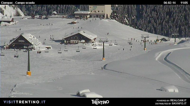
Pictured below is the Ciampac/Buffaure sector of Canazei’s slopes, further east. In this part of the Dolomites, the snow is 80-280cm deep.
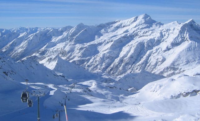
Below, is the scene in the Monterosa – in the Aosta Valley – where the settled cover is 150-300cm deep.
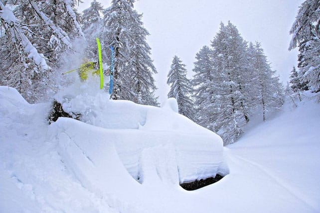
And here’s a close-up, taken on Tuesday.
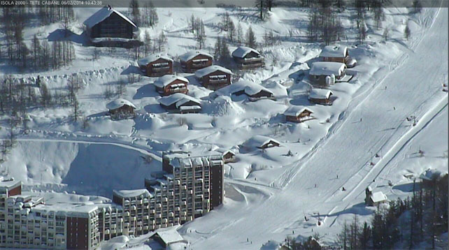
Pictured, below, is Isola 2000, just north of Nice, where the snow is 210-300cm deep.
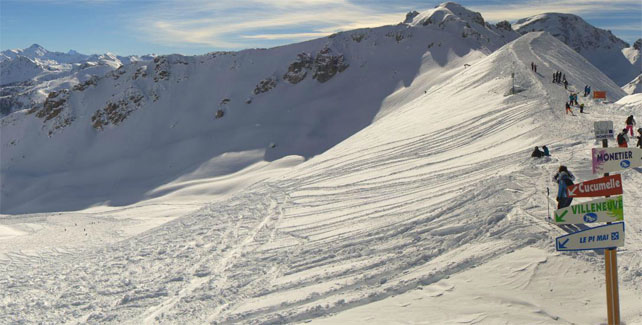
Below, is Serre Chevalier, south of Grenoble, where the snow is 110-225cm deep.
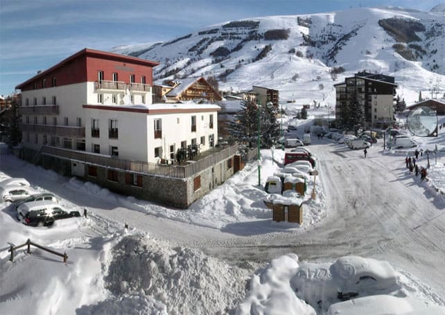
And this is Les Deux Alpes, nearby, where the snow is, supposedly 30-175cm, although I think they’ve stopped updating the figures…Clearly, there’s more than 30cm in at village level now.
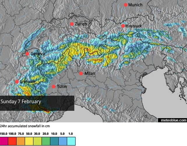
This is not to say that there isn’t snow in the northern half of the Alps. In fact there were light-to-moderate falls across many resorts yesterday: Flaine in France had 13-22cm of fresh snow, Verbier in Switzerland reports a 5cm top-up and Laax, also in Switzerland, 7-10cm. But there’s been nothing like the sequence of meaty dumps seen further south.
Unfortunately, it also looks as though the resorts north of Innsbruck in Austria are missing out on the snowstorms again – repeating a pattern we saw in December and January. Conditions on the higher pistes are still good, but the contrast between resorts here and those lining the Italian border is sharp. In the north, the Skiwelt reports 45-75cm of cover. In the south, Obergurgl has 80-190cm, and Nassfeld a whopping 190-410cm.
Here’s how it was looking in Nassfeld this morning.
And guess what? More snow is on the way. This time, the whole of the western Alps will benefit – as well as parts of eastern Switzerland and the Italian Dolomites. Two separate weather fronts are expected; the first on Friday, and the second on Sunday/Monday. Then, it’s likely a third storm will bubble up from the south on Tuesday, although it’s too early to be certain of that yet.
Although sun-worshippers will despair, this is good news as temperatures have risen sharply today. Any slope below 2000m that sees much sun will be getting wet and heavy as a result.
Great skiing in the Pyrenees
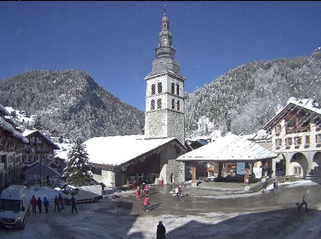
There’s some cracking skiing to be had in the Pyrenees, as well. Two of our editors are out in Baqueira-Beret today, and have just posted the picture below. “Baqueira is cheap and empty. Why don’t more people come here?” they ask.
The snow’s in good nick too. Conditions are “excellent”, and according to the snow report there’s 215-285cm of settled cover on the pistes. So I’m not jealous at all, then…

In the western US, heavy snow is expected
There’s been light-to-moderate snowfall across the American Rockies over the last couple of days. Steamboat in northern Colorado did well from this weather, picking up 20cm of fresh powder. Here’s the mouthwatering video the resort shot yesterday to celebrate…
However, it’s the forecast for the next four days which has really got everyone buzzing. A big lump of warm, humid air is due in from the tropics, hitting California first and then spreading into a broad swathe of the Rockies. It’ll be mild – which means rain in the valleys. But there will be big dumps at altitude. “Several feet of snow possible on the mountain tops,” says Bryan Allegretto, Open Snow’s Tahoe reporter. “Snow will be measured in FEET,” predicts Evan Thayer in Utah. In Colorado, Joel Gratz is calling for “20+ inches of snow” in the most favoured resorts.
Meanwhile, in Rosa Khutor…
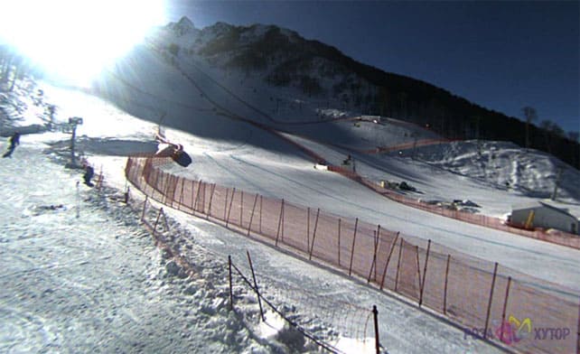
The weather is behaving itself at Rosa Khutor, which is hosting all the Alpine Skiing disciplines at the Winter Olympics. Currently the snow is 60-263cm deep. It looks as though there could be more snow there on Tuesday.
| France: there’s excellent skiing across the French Alps today beneath clear skies – although rapidly-rising temperatures are making the snow heavy on slopes that receive a lot of sunshine. Conditions are best in the resorts south of Grenoble. Currently, Val d’Isere reports 87-168cm of settled snow on its pistes, Val Thorens 90-175 and Montgenevre 130-180cm. | |
| Switzerland: the deepest snow is in the southern and central resorts. For example, St Moritz reports 110-186cm of settled cover on its pistes, and little Andermatt 98-400cm. Meanwhile, in the west, Verbier reports cover 45-137cm deep, and in the north Laax has snow 40-160cm deep. Most resorts in the Swiss Alps should see more snow over the next four days. | |
| Austria: the pattern of the first half of winter has reasserted itself, with the resorts lining the Italian border seeing most of the fresh snow, and those in the north missing out. Check out the contrast between snow depths in Skiwelt and Nassfeld, mentioned in the main report, for an indication of that. Elsewhere, snow depths are okay but not brilliant. For example St Anton currently has 40-110cm packed down on its pistes. In Saalbach-hinterglemm, there’s 25-60cm of settled snow. | |
| Italy: see our main report. The winter still belongs to Italy. Little Madesimo reports 250-400cm of settled cover on its pistes. Cervinia has 130-310cm of snow on its slopes. San Cassiano reports 160-270cm. | |
| Andorra: there was fresh snow in Andorra earlier in the week, which refreshed the pistes nicely. Currently, Soldeu and Pas de la Casa in Grandvalira report 110-210cm of settled snow on their pistes. It is rather mild today, however: +5C on the lower slopes. Across the border in Baqueira in Spain, the cover is 215-285cm deep. | |
| Western USA: see our main report. It’s going to be an interesting four or five days, with heavy snow expected in California and the Rockies. Currently, Breckenridge in Colorado has 193cm packed down, mid-mountain, Snowbird in Utah has 180cm, and Jackson Hole in Wyoming 160cm. | |
| Western Canada: No doubt about it, it’s been a weird winter. Madonna di Campiglio in Italy has had more than double Whistler’s snowfall so far this season. Currently, the mid-mountain snowpack in the Canadian resort is 126cm deep, and there’s been only a dusting of fresh in the last seven days. However, there are signs that the weather may change next week. Inland, Sun Peaks reports 10cm of snow in the last week, and 142cm of snow packed down on its higher runs. Lake Louise in Banff National Park reports no fresh snow in the last week. Top temperature today will be -19C! Brrrrrr… |


A gorgeous gorgeous gorgeous gorgeous day in the Alps. And there’s more snow to come…
https://t.co/BRNlHKzf0n
White snowed #Trentino RT“@welove2ski: A gorgeous, gorgeous day in the Alps. And there’s more snow to come…
https://t.co/FJkM1tWmg0”