


Has winter in the Alps finally settled down? You can’t help but wonder this week, which has seen – for the most part – low temperatures and some more scattered snowfall to add to last weekend’s storm.
As a result of the change in the weather, conditions in Alpine ski resorts have improved significantly. The biggest transformation has been in southern Switzerland and parts of Italy, which were walloped by heavy snow at the weekend, after a dry and mild start to the year. Madonna di Campiglio, for example, had 50cm on Friday and Saturday, with a 15cm top-up yesterday, Madesimo has had over a metre of snow since last Friday.
Low-lying resorts everywhere are heaving a sigh of relief, too. In France, Les Gets had 40-odd cm between Saturday and Tuesday morning and published this reassuring video on Tuesday.
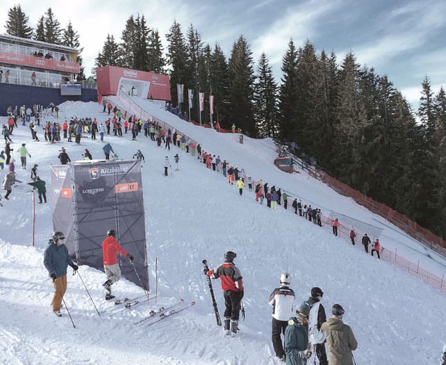
In Austria, too, the fresh snow over the weekend has also pepped up the pistes nicely in the lower resorts. Generally, conditions have been better here than in the west so far this season – although less snow has fallen here in the last six days than in Italy, France and parts of Switzerland. One of our editors, Felice Hardy, is skiing in Kitzbuhel this week, and says that overall the pistes are in great shape. There are icy patches on the valley runs, but an excellent, grippy mix of natural and snow-cannon snow on the higher pistes.
By the way, training is now underway in Kitz for the biggest date in the World Cup skiing calendar: the Hahnenkamm race weekend, which kicks off tomorrow with the Super-G at 11.30am. Weather permitting, the Downhill is on Saturday morning.
Of course, in the high-altitude resorts the skiing’s even better now – because they already had deeper cover, and weren’t nearly so thaw-affected. I was skiing on the Stubai Glacier in Austria last week, and had nothing less than superb snow from 3200 down to 2300m.
Away from the groomed pistes, conditions remain unpredictable and treacherous. This is a challenging year for off-piste skiers, with the thin snowpack, yo-yoing temperatures, poorly-bonded layers, and wind-drifted slabs all adding to the risk. The last fortnight has seen a grim sequence of fatal accidents: so please, if you’re tempted, hire a guide and make sure you’re properly equipped.
The immediate forecast looks promising, but…
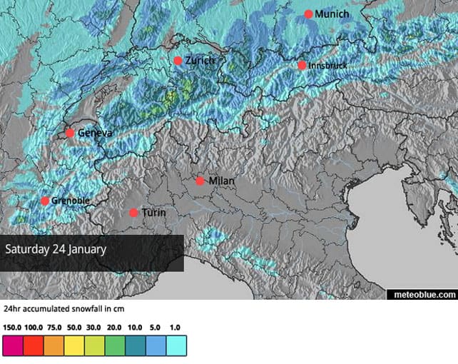
What’s next? Well, today there’s a southerly wind blowing, but it hasn’t pushed temperatures too high. In France, the freezing point will be at 1000m, and in Austria about 1200m. Tomorrow, temperatures will start to drop, and the weekend will be pretty chilly. There should be more snowfall too, although the weather front due into the Alps on Saturday will be weakened by high pressure creeping in from the west. According to our Snow Forecast for the Alps central Switzerland will do best, with maybe 30cm of snow falling on Engelberg, and lighter accumulations of 5-15cm elsewhere in the northern Alps. However, very slight changes in the way the high pressure behaves are likely to affect how much of the white stuff falls. So we could be pleasantly surprised by the final snowfalls totals…or disappointed.
Looking into next week, there’s the chance of a really juicy winter storm developing around Friday January 30, but it’s too soon to be sure of it. We’ll have to keep our fingers crossed, and sacrifice a few more chickens…
We also have to bear in mind that this has been an exceptionally mild winter so far. Saturday 10th was the warmest January day on record in parts of the Alps, and there’s still a lot of warm air hanging around in the mid-Atlantic. It could easily make drift east and spoil the party. Remember, too, that snow depths on the lower pistes in most resorts are still much thinner than they should be in mid-winter. So, despite the improvement in conditions, it’s best target a high-altitude resort if you’re looking at some of the tasty late-booking holiday discounts currently available.
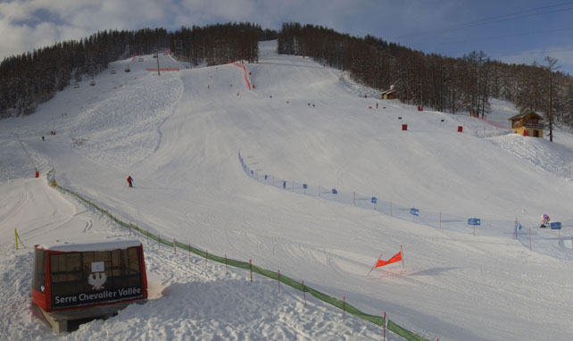
Here’s a quick sample of today’s webcams, starting in Serre-Chevalier, which benefited from a spell of light-to-moderate snowfall yesterday in the southern French Alps and the western and central parts of the Italian Alps. 15cm fell there at altitude, and at 2100m the snowpack is now 123cm deep.
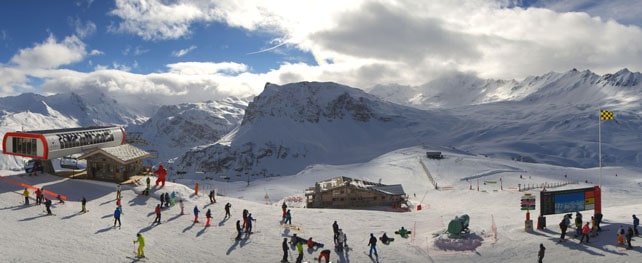
Meanwhile, here’s how it’s looking in Val d’Isere, where the snow is 46-100cm today. Note the avalanche warning flag: the risk today is 3/5.
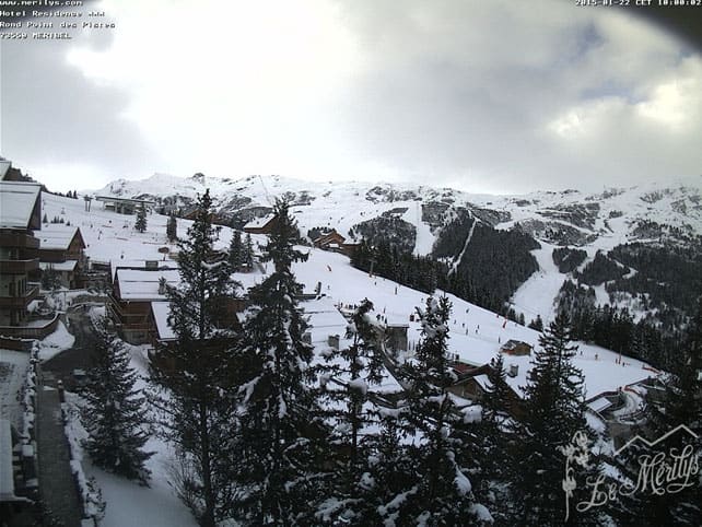
Pictured below is Meribel today, where there’s 40-85cm of snow, on-piste.
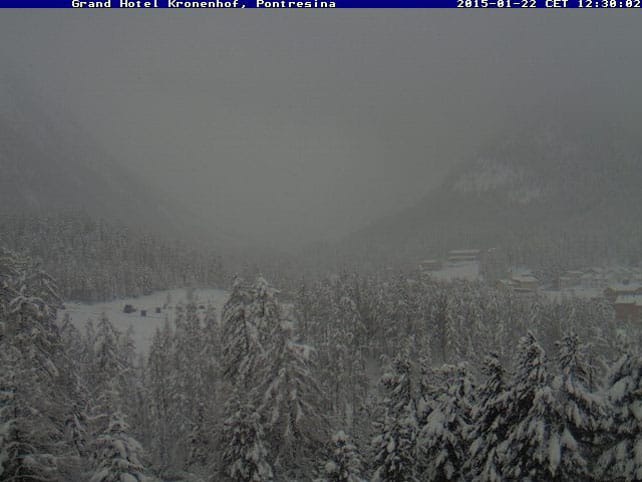
Meanwhile, this is how it’s looking at Pontresina near St Moritz today, which is one of the resorts that did well from the weekend storms. The cover here is 35-145cm deep – and clearly, there’s more snow falling today.
Below was the scene this morning in Champoluc in Italy, where the skiing has been improved no end by the weekend storm and subsequent top-ups. In fact, there was more snow last night. The snow is currently 25-145cm deep, on-piste.
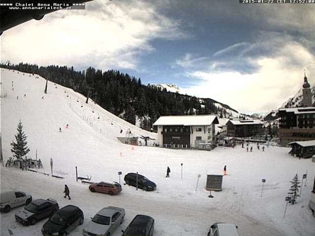
Pictured below is Lech, in the Arlberg, where the snow is currently 50-105cm deep.
Below is the view from Schmitten towards the Kitzsteinhorn glacier, near Zell am See, where I’ll be skiing next week. The pistes are 20-83cm deep here, and up to 260cm deep on the glacier.
There’s been some fresh snow in the Rockies, but a thaw will follow
Despite a rather ho-hum forecast at the start of the week, some Colorado resorts have picked up moderate amounts of fresh snow this week. Both Vail and Breckenridge had powder days on Tuesday. Vail has picked up 20cm, since Monday. Breck’s done even better: 15cm yesterday with a total of 51cm since the weekend.
Here’s Tuesday’s video from Vail.
And this was the scene on Tuesday in Breckenridge.
However, it’s worth noting that in the Rockies too there’s been a mild flavour to the winter so far, with cold and snowy weeks alternating with warmer spells. Next week, the sun’s due to come out, and temperatures are set to rise.
| France: conditions in the French Alps have improved considerably in the last eight days, following 10-15cm of snow on January 14, 20-45cm at the weekend, and light-to-moderate snowfall since then. Add in the lowish temperatures, and you’ll understand why even the low-altitude resorts are in decent shape. All eyes are now on next week’s forecast: it looks as though a short thaw could be followed by a significant winter storm. Let’s hope we get it.
Currently in high-altitude Tignes there’s 50-100cm of cover, on-piste: and the cover is almost universally soft. Meanwhile, in the Three Valleys, Val Thorens reports 90-130cm of snow, on-piste. |
|
| Switzerland: in western Switzerland, the situation is very similar to France. All resorts are in better shape now, though you’ll still find the best skiing at altitude. Further east, there’s good skiing too, though nowhere can quite match the quality of the snow in St Moritz in the south-eastern corner of the country, which was walloped by the weekend storm. Currently Verbier, in the west, has 20-105cm of cover on its pistes, Laax in the east reports snow depths of 50-250cm, and St Moritz, has 35-145cm. | |
| Austria: Austria didn’t get quite as much snow as was forecast over the weekend, although most resorts had at least 20cm, and some double that. Currently, in the Arlberg Lech reports cover 50-105cm deep, and in the northern Tirol the Skiwelt has 35-45cm on its pistes. Meanwhile, in the east, Schladming has 60-95cm of settled snow on its pistes. | |
| Italy: parts of the Italian Alps were walloped over the weekend: and there was more snow in the first half of this week, too, especially in the west. Currently above Cervinia the snow is 150cm deep, mid-mountain. Meanwhile, in the Dolomites, Canazei has up to 105cm of cover on its higher pistes. | |
| Andorra: in Andorra, the Grandvalira ski area reports a respectable 50-100cm of cover on its pistes. | |
| Western USA: see our main report. Some Colorado resorts – Breckenridge especially – have had a great week. But everyone’s lowering their expectations for next week as a spell of mild and sunny weather is forecast. Currently, Vail in Colorado has 107cm of snow packed down, mid-mountain, Jackson Hole in Wyoming has 177cm of cover, mid-mountain, and Snowbird in Utah 170cm. | |
| Western Canada: Whistler has just had a decent week of cold, snowy weather, and the snowpack is now 156cm deep, mid-mountain. However, it’s going to warm up now. Wet snow mixed with rain will fall over the ski area over the weekend. Inland, in Revelstoke has had 46cm of snow in the last seven days and reports cover 177cm deep, mid-mountain. |


Add Comment