


Greetings Snowfiends: today, we start in the western US.
Why? Because the resorts there – especially in California and Utah – are enjoying a spectacular spell of snowy weather.
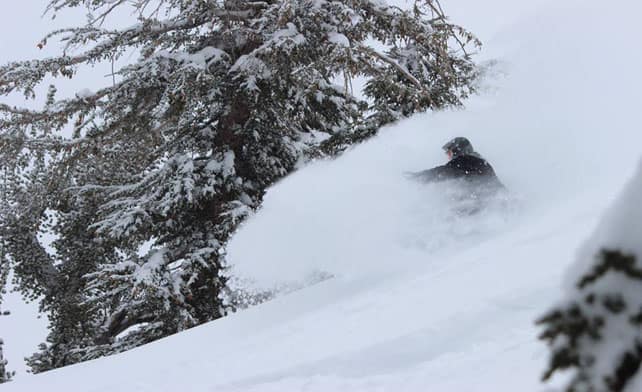
Pictured, below, is lovely little Kirkwood in California on April 1. Yesterday, it claimed nearly six feet of snow – 182cm – on its upper slopes in the last week.
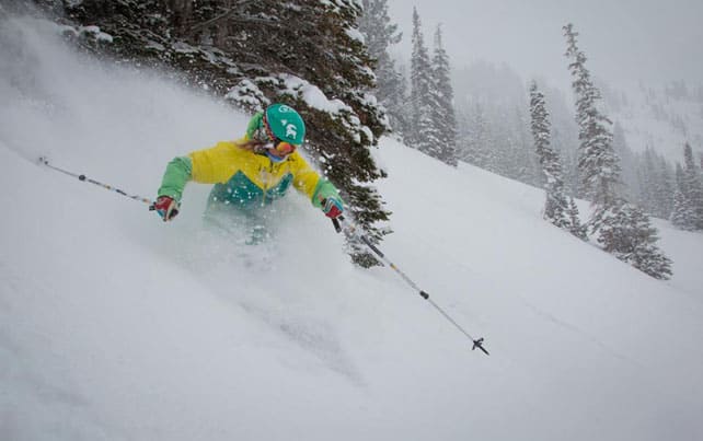
Meanwhile, pictured below, is The Canyons, near Park City in Utah, on the same day, when it reported 74cm of snow in seven days.
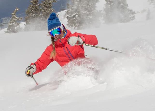
And this was Snowbird in Utah , which had 58cm of snow in three days to April 1.
In Utah, local snow guru Evan Thayer said April 1, “was perhaps the best skiing of the year in the Cottonwoods/Park City [the main area of ski resorts, east of Salt Lake City],” and forecast another dose of Utah powder on Saturday.
There’s been snow in Colorado and Wyoming too – although not in quite the same quantities. Yesterday in Colorado, Breckenridge reported 58cm in the last week, and posted this tasty video of conditions over the weekend.
According to Colorado forecaster Joel Gatz, Colorado should have seen more snow last night, with more to come at the weekend.
Not a bad start to April, huh?
In the Alps, staying warm
After the wonderfully wintry interlude of late March, spring has reasserted its grip on the the Alps, with a daily cycle of melting and overnight refreezing on all but the highest, shadiest slopes.
This pattern is going to be disrupted over the next couple of days, but not because the weather is getting cooler. It’s just that a warm southerly wind and overnight cloud cover will be keeping temperatures above freezing in many places. That was already the case last night – and today the Tirol’s avalanche service is warning the ski-touring and off-pisting fraternity to bear in mind that even where it has refrozen the overnight crust is thinner than normal. Also, that the daytime purge of snow from warm mountain sides would start earlier than normal.
In the short term, the forecast is for showery, spring-like weather over the western Alps, which should spread east on Saturday afternoon and Sunday. The freezing point – currently around the 2500-2800m mark, should briefly drop down the mountain as the showery weather passes through, before rising sharply on Monday to 3000m or higher when the skies clear.
Thereafter, there is the chance of cold weather midweek, and snow in Switzerland and Austria, but it’s not certain yet. Keep your eyes on our snow forecast for signs that it’s coming. Even if the change does materialise, however, the rule of thumb for April remains unchanged. Aim high!
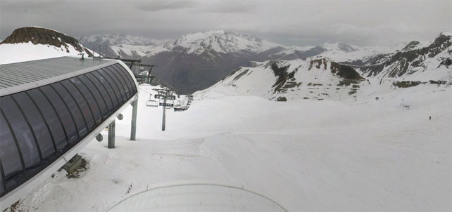
Here’s a brief sample of the webcams today, starting with in high-altitude Tignes, where I’ll be skiing next week. The snow here is 85-200cm deep and off-piste the snow on south-facing slopes is thinning fast, even here. Top temperature today will be +9C at village level, but -5C up on the glacier.
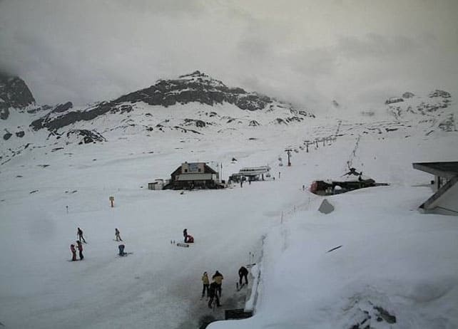
Meanwhile, pictured below is Les Deux Alpes, where conditions are pretty similar.
Pictured below is Cervinia, in Italy, where the snow, on-piste, is 70-310cm deep. Top temperature in the village is expected to reach +5C, which isn’t very high by recent standards, and is explained by the cloud cover.
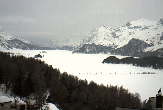
It’s cloudy, too, in the Egadin valley in south-eastern Switzerland, which is home to St Moritz. The snow here is 78-192cm, on-piste, and top temperature at village level should reach +10C.
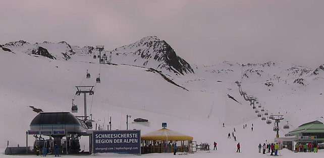
Finally, this is how it’s looking in Obergurgl in Austria, where the pistes have 34-118cm of cover, and the temperature at village level should reach +7C.
| France: There’s still plenty of good skiing to be had in the high-altitude resorts, provided you stick to north-facing slopes, or else adopt spring-skiing tactics: tackling slopes as soon as the snow starts to soften. The outlook is for the mild weather to continue until the middle of the week, when there could be a change. Currently, Val d’Isere reports 85-155cm of settled snow on its pistes. On the Grands Montets above Chamonix the snow report records 110-285cm of cover, on-piste. | |
| Switzerland: as in France, spring has returned to the Swiss Alps, and you need to aim high, and stay on north-facing slopes to find wintry snow. Failing that, spring-skiing tactics will deliver a good morning on the slopes, before all but the highest slopes turn slushy. Currently, in Saas-Fee the cover is 68-340cm deep, on piste. Meanwhile, little Andermatt reports cover 60-400cm deep on its slopes, and Verbier 15-167cm. | |
| Austria: Austria did well from the snow on March 22 and 23: but the current thaw has undone much of the good work at lower altitudes: in fact, the Skiwelt, north of Innsbruck, has already shut its lifts after a pretty threadbare season. Further south, however, there’s more snow. Currently Nassfeld in Carinthia reports 20-290cm of settled snow, on-piste, St Anton 30-125cm, and Obergurgl 34-118cm. | |
| Italy: the weather warmed up quickly in the Italian Alps this spring, and the lower pistes are thinning fast: some of the quieter ski areas have already shut their lifts for the season. However, at altitude, there’s still plenty of snow. Currently, in the Aosta Valley, Cervinia has 70-310cm of settled snow on its pistes, and Canazei in the Dolomites 50-220cm. | |
| Andorra: the Pyrenees had fresh snow last week, but the weather’s been mild since then. Today, it’s going to be wild and windy, with rain on the lower slopes and snow higher up. Many lifts are closed as a result. Currently, Soldeu in the Grandvalira ski area reports 70-200cm of settled snow on its pistes. | |
| Western USA: see our main report. This is where we all wish we were skiing at the moment! Currently, Jackson Hole in Wyoming, reports a settled mid-mountain snowpack of 290cm – and unbelievably it’s due to close for the season this weekend! In Colorado, Breckenridge in Colorado has reported its fifth snowiest season ever, and a mid-mountain snowpack of 234cm. In Utah, The Canyons reports a settled snowpack of 193cm. | |
| Western Canada: Canada hasn’t had quite the same powder party as the western US, but conditions are still good for the time of year in Whistler, which reports 54cm of snow in the last week, and a mid-mountain snowpack 274cm deep. Inland, there’s been more snow. Fernie, has had 79cm in the last week, and 396cm of cover mid-mountain. In Revelstoke the mid-mountain cover currently measures 267cm. |


Starting to get just a little jealous of condition in Utah and California at the moment… https://t.co/3MPGj00NyZ