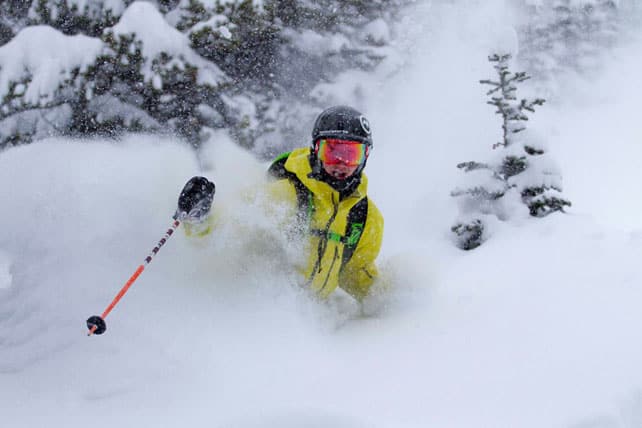
First, the good news. The Canadian Rockies have just had a fabulously wintry passage of weather, combining heavy snowy and frigid temperatures. In Banff National Park, Lake Louise has reported 78cm of the white stuff in the last week, and Sunshine Village 88cm – most of which fell on Thursday and Friday. After a slow start to winter, this has put the ski season right back on track, and in contrast with the American Rockies further south, it’s stayed cold too. Very cold. In Lake Louise, the top temperature is expected to hit -19C today, but it’ll feel like -26C when you factor in wind chill.
A little further west, Revelstoke also had a good week, notching up 82cm of fresh snow, when set things up nicely for its opening day on Saturday. Check out this video for an idea of how snowy things were looking as the lifts started spinning.
Revelstoke claims a total snowfall of 288cm so far this winter, which puts it way ahead of both Whistler and Lake Louise, which report 133cm and 117cm respectively. The outlook now is for generally dry and sunny weather in western Canada, accompanied by rising temperatures as the week progresses. However, they’re not expecting a thaw to match the one currently being felt further south.
But winter still hasn’t settled over the Alps
In the Alps, the resorts are chewing their fingernails waiting for winter to arrive – and there’s no immediate remedy in sight.
That doesn’t mean the scene is entirely snowless. Regular followers of our snow report will know that the white stuff has been a frequent visitor to the high Alps this autumn. In October, Austria had a big dump, which set up its glaciers nicely, and then in the middle of November several big storms walloped the area around Cervinia, Zermatt and Saas-Fee, and brought light-to-moderate falls to many peaks and ridges elsewhere.
There’s been some more snow over the last couple of days as well, and in places it’s fallen down to 2200m. Check out our snow forecast for the Alps, below, to see where it’s fallen.
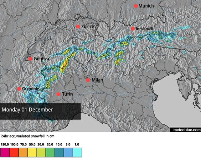
However, there’s no denying it’s been a mild autumn, and last week in particular was warm. Lower down, below 2000m it’s been all but impossible to run the snow cannons to prepare the pistes for the start of the ski season, and resorts are now significantly behind in their preparations. With several due to open for the winter over the coming weekend, we should probably brace ourselves for a series of postponements. If you’re planning a quick early-season escape to the Alps, before Christmas, make sure there’s a lot of altitude in your plans.
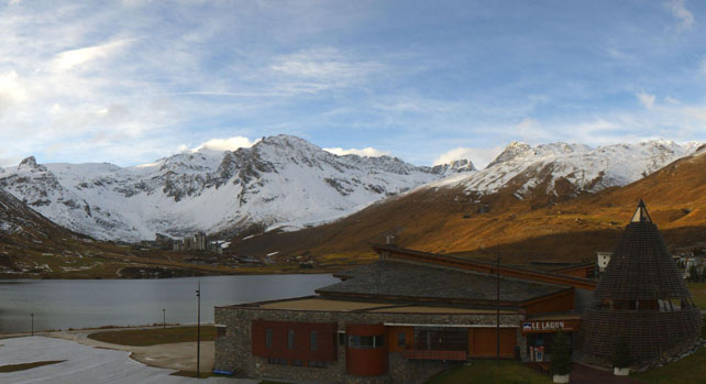
The webcam shot, below, was taken in Tignes this morning and gives you a good indication of conditions in many areas. There’s snow higher up, but at 2100? Not so much.
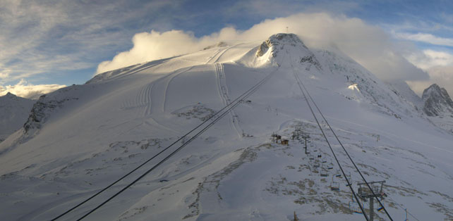
Of course, grassy slopes lower down don’t mean the season’s on hold up top. Pictured below is how it’s looking on the Grande Motte glacier, above Tignes, where I was skiing on soft, cold, wintry snow this time last week. Conditions are very similar now.
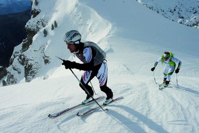
Meanwhile, this was the was the second annual Schneekoenig race on the Kitzsteinhorn glacier on Saturday – walking up, rather than skiing down…
Pictured, below, is how it’s looking at 2500m today in Cervinia, which has been one of the big winners so far this season. Here the snow is 160cm deep.
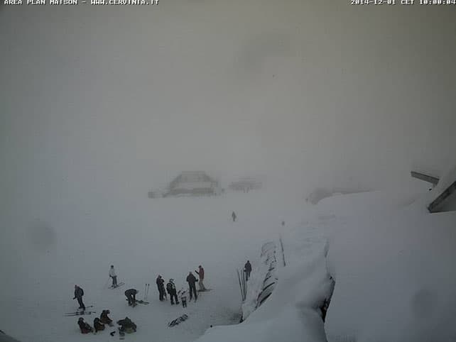
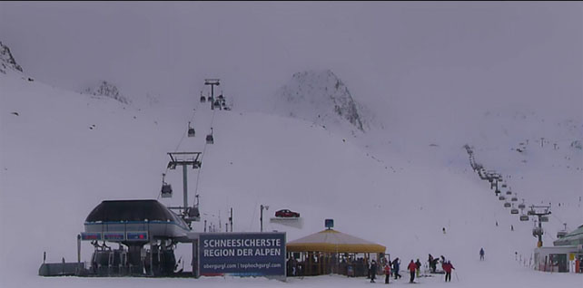
And this was high-altitude Obergurgl in Austria, where the snow is up to 75cm deep, on-piste.
Check our country-by-country guide, below, for details of which ski areas are currently open.
As for the outlook, everyone’s eyes are now on the weather charts next week. In the short term, cooler air has settled across the region, with the freezing point down to 2000-2200m. That’ll help the higher resorts get their snow-making systems going so they can build up reserves of man-made snow. Then an area of high pressure is going to build over the eastern Atlantic, and what happens to that is crucial to how mid-December will unfold. Either it will extend over Europe and keep the mountains dry and mild, or else it’s going to shrink back and let areas of low pressure roll down its eastern flank from Scandinavia, pouring cold, snowy air onto the Alps.
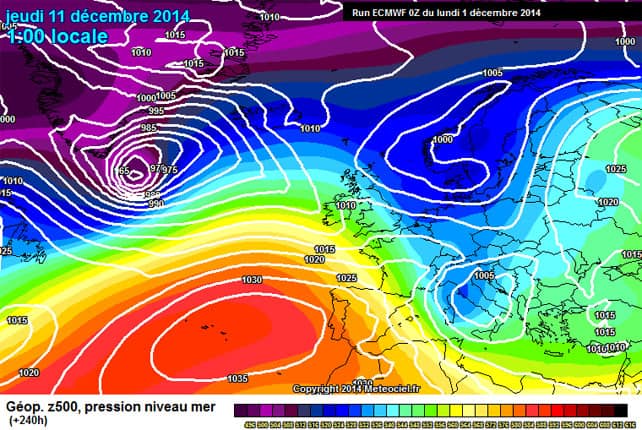
Obviously, the second outcome is the one we’re all praying for – and it’s the one currently predicted by the European Centre for Medium-Range Weather Forecasts (ECMWF) as shown above on Meteociel.fr. If it comes, then there’s going to be a sudden and dramatic transformation in conditions, as is so often the case in the transitional weeks between autumn and winter. If it doesn’t – well, that moment is almost certain to come at some point. It’s December, after all. But we’ll have to bite our fingernails a little longer.
In the American Rockies, there’s lots of snow, but it is mild
Anyone who saw last Thursday’s snow report will know that many Rocky-Mountain resorts in the US had a fabulous Thanksgiving, courtesy of another meaty snowstorm – one of several which have transformed conditions in recent weeks. As a result of the snow, Vail in Colorado was able to open China Bowl on Saturday, bringing the total acreage available to skiers to 3,600 – a big number, given it’s so early in the season.
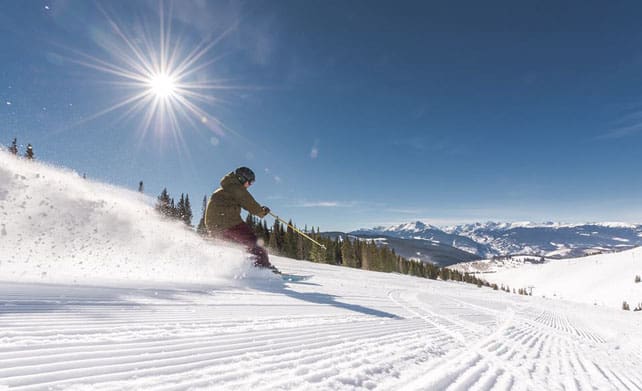
However, it is worth pointing out that in Colorado and Utah the latest dump was followed by a blast of warmer air, which has made the snow a little heavy lower down. Here, more snow is expected, but according to local snow guru Joel Gratz, it will stay fairly mild, with the snow/rain level hovering between 7,000 and 8,000ft. So in some resorts you’ll need to get to the top of lift system to find proper, wintry powder.
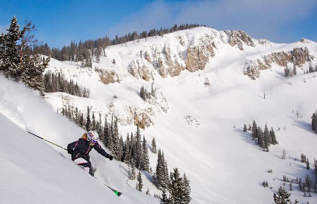
Further north, it’s stayed cooler, and Jackson Hole had a bonus 15cm of snow on Saturday. Total snowfall to date there is now 243cm, and the mid-mountain base is now just under a metre deep.
| France: see our main report. It’s not as mild as it was, but it’s still not cold enough for snow-making systems to really crank out man-made snow in the lower resorts. We’ll need to brace ourselves for postponed and limited resort openings over the coming couple of weeks unless there’s a significant change in the weather around December 8. For the time being, Tignes is the place to be, thanks to the big, snowsure pistes on the Grande Motte glacier. But Val d’Isere and Val Thorens are also open. | |
| Switzerland: weather permitting, four glaciers are currently open for skiing in Switzerland – above Zermatt, Saas-Fee, Engelberg and Les Diablerets. Snow cover at altitude above Zermatt and Saas-Fee is exceptional in the wake of the heavy snow in mid-November, although the current thaw has affected its quality on all but the highest slopes. Verbier is now also open for the season, although only four pistes are available for skiing and the settled cover is 35cm deep. | |
| Austria: it’s been mild in Austria too, but that hasn’t interrupted the skiing on offer at Obergurgl, as well as on the Hintertux, Stubai, Molltal, Pitztal, Kaunertal, Rettenbach and Kitzsteinhorn glaciers. However, with lots of lower resorts due to open on December 6, and many slopes below 2000m currently snowless, we need to brace ourselves for a wave of postponements. Aim high if you’re planning to ski here over the next week or so. | |
| Italy: early-season conditions have been superb above Cervinia, especially above 2500m. Above Champoluc and Gressoney in the Monterosa ski area a handful of lifts and pistes are also open. However, as is the case elsewhere in the Alps cover is very thin, or non-existant in many Italian resorts, and the start of the ski season is on hold. Above Val Senales in the South Tyrol, eight pistes are currently open for skiing on the glacier. Above Passo Tonale, on the Presena Glacier, three pistes are also open. | |
| Andorra: the situation is the Pyrenees is very similar to that in the Alps right now. There’s snow on the high peaks and ridges, but lower down the pistes are green, not white. The Grandvalira ski area, home to Soldeu and Pas de la Casa, had to postpone its November 29 opening day last week, but is hoping to get going this weekend. | |
| Western USA: see our main report. November turned into a memorable month in the American Rockies with the snowstorms coming in waves. As a result, many resorts are in great shape for the early season, although the milder weather in Colorado and Utah of recent days has made the snow heavy on the lower slopes. In Breckenridge, Colorado, the settled cover is 91cm deep on the upper slopes. In Snowbird, Utah, it’s around 84cm deep. | |
| Western Canada: Whistler opened on November 21 this year, and now offers skiing on both Whistler and Blackcomb mountains. The resort records over 70cm of snow on its upper slopes in the last week. Meanwhile, in Banff National Park, Lake Louise reports nearly 80cm of snow in the past week, and frigid temperatures. |




Suddenly that bargain holiday to La Rosiere on the 13th doesn’t look such great value…. Ah well, have to hope that things go our way as you mention next week and there’s always Les Arcs relatively close to get some proper altitude. Keeping everything crossed.
Hi Will – the mid-range charts are still looking hopeful for next week. In fact, there’s more unanimity today than there was yesterday. Keep sacrificing those chickens to the Snow Gods!