Over the next couple of days, it’ll be Italy’s turn to see the white stuff. But after that, the long snowy spell that settled over the Alps a week ago will be over. It will, however, stay cold until the middle of next week.
There might be snow again next Monday in the north-eastern Alps. But this is not yet a certainty, as high pressure is beginning to exert its influence once more. It could stay in control of the weather for quite some time.
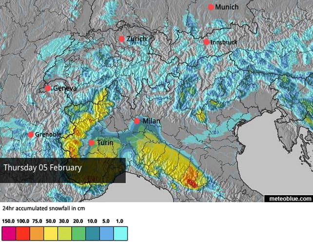
Below is latest snow forecast for the Alps for today, February 5. As you’ll see, heavy snow is on the cards for the western resorts of Italy, with over half a metre predicted. There’ll be snow in French, Swiss and Austrian resorts close to the Italian border, too. But it’s a disappointing map all the same, because it seems the Dolomites won’t get nearly as much of the white stuff as first thought. Some resorts may only get a dusting.
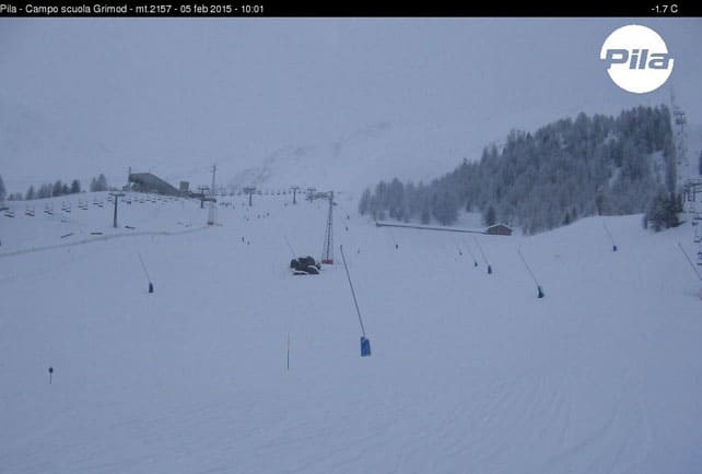
Oh well: at least it’s coming down hard in the Aosta Valley, and the resorts there will be in great shape once skies clear tomorrow. Pictured below is how it was looking this morning in Pila, which reports 30cm of fresh snow already, and settled depths of 30-140cm. At 1800m, the temperature is -4C.
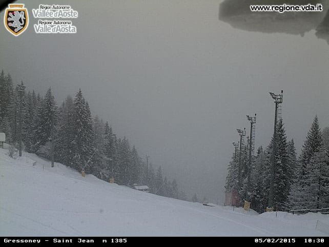
Meanwhile, here’s how it’s looking at Gressoney St Jean in the Monterosa ski area, also in the Aosta. St Jean is set apart from the main network of lifts and pistes, but the webcam here gives the best impression of how heavily the snow is falling. Across Monterosa, settled snow depths vary between between 25 and 240cm. Top temperature will be -5C in the valleys.
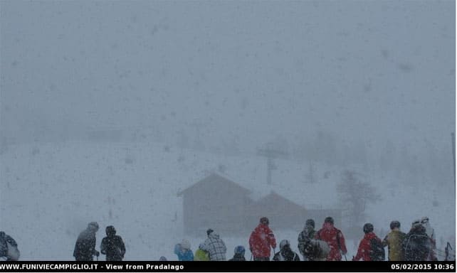
Further east, Madonna di Campiglio is doing its usual trick and picking up lots more snow than the rest of the Dolomites (it sits right on the western edge of the range). Currently, snow depths are 65-165cm, and top temperature in town will be -1C.
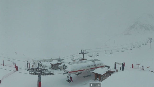
Meanwhile, pictured below is evidence of how the snow is leaking into resorts across the Italian border. This was the Pisaillas glacier above Val d’Isere in France, a little earlier on. I wonder what that lone skier is thinking? Top temperature at 2000m will be -4C.
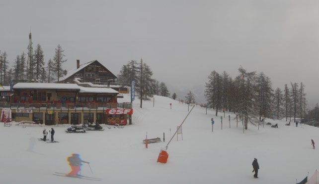
Pictured below is Serre Chevalier, further south, which reports 15cm of fresh snow this morning, and settled depths of 48-165cm, on-piste.
And here’s the snowy situation above Saas-Fee this morning. Here the snow is 57-260cm deep, and top temperature in town today will be -4C.
Great skiing this weekend
Today’s looking rather grey across the areas where it’s not actually snowing, but skies should clear tomorrow, and for much of the weekend it’s going to be sunny. Temperatures will drop, as a biting easterly wind picks up, but I don’t think too many people will be complaining. The northern Alps have just had a superb run of snowy weather, which dropped 50-70cm of fresh snow in many resorts in Austria and eastern Switzerland, and 70-160cm in France and parts of western Switzerland. Conditions on-piste have improved enormously since January 10, when some areas had their warmest January day on record.
Off-piste, the new snow has been buffeted by strong winds, and the presence of many poorly-bonded, wind-packed slabs has kept the avalanche risk pretty high. It’s at 3/5 in many places, and in the Austrian Tirol the local avalanche service warns that “The avalanche scenario in Tirol remains tense… More than anything else the peril lies in freshly formed snowdrift accumulations which are frequently deposited on top of loose new fallen snow or surface hoar, making them prone to triggering.” That said, there are still deep pockets of powder about on the mountains, but you’ll need a guide to show you where to find them, and help to keep you safe.
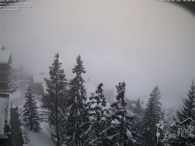
Here’s a quick scan of cams today, away from Italy’s snowstorm, starting with a foggy scene in Meribel this morning. Here the snow is 87-175cm deep.
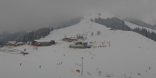
Pictured, below, is Soll in Austria’s Skiwelt, where the snow is currently 75-95cm deep.
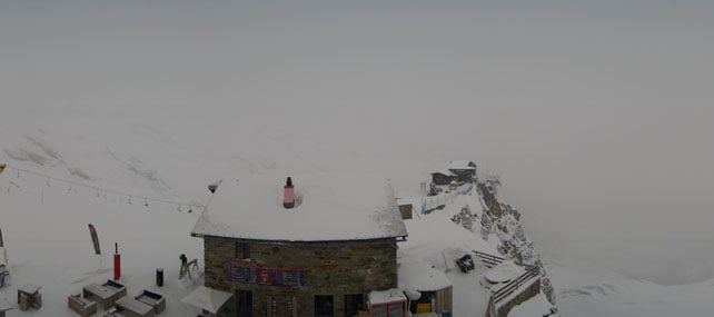
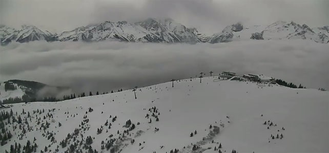
Meanwhile, pictured below is the long ridge the top of the Schmittenhohe, above Zell am See, with the Kitzsteinhorn in the distance. On the Schmitten, the snow is up to 114cm deep. On the Kitzsteinhorn, it’s 260cm deep in places.
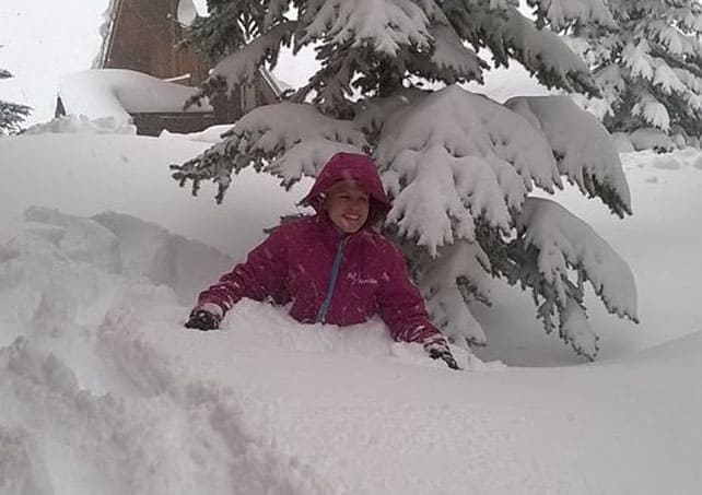
Finally, here’s a photo taken earlier today in Reberty, above Les Menuires, by British tour operator Ski Famille. Thanks guys! Looks like you’re not short of a flake or two…
Looking into next week…
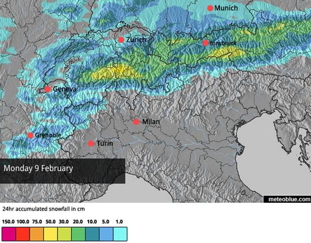
Above, is the current snow forecast for the Alps for Monday, February 9, showing moderate to heavy falls in Switzerland and Austria. But this is far from certain. Fact is, high pressure is going to re-exert its influence over the region from Saturday. It’ll be centred over Ireland, and it’ll stretch as far a eastern Europe, with low pressure along its eastern edge. Small movements and changes in its shape could easily block Monday’s weather front, or weaken it considerably. So don’t count on the snow just yet.
Looking further into next week, high pressure will continue to dominate until February 14th, at which point the weather models lose any sense of consensus. Some predict another snowy spell, some more sunshine. Expect temperatures to rise for a while, as well. It won’t be as warm as early January, but it will be mild enough to affect the quality of the snow on the lower slopes.
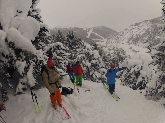
There’s been heavy snow in the Pyrenees too
Fresh snow in parts of the American Rockies
There’s been fresh snow across the northern half of the American Rockies, with Jackson Hole in Wyoming getting the best of it. Yesterday, it claimed half a metre from the storm, and has a mid-mountain snow depth of 215cm.
Here’s how it’s looking at the moment.
In northern Utah and northern Colorado there’s been fresh snow, too. In Beaver Creek, Colorado there was enough to force the postponement of the men’s Super G at the 2015 World Ski Championships, which was frustrating news for anyone hoping to marvel at Ted Ligety’s edge angles once more. The good news is that the race will run at 11am today, local time.
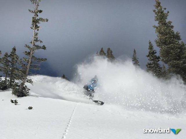
Meanwhile, in Utah, Snowbird reported about 15cm of fresh snow. Here’s how it was looking yesterday.
However, despite the welcome return of the white stuff, temperatures are weirdly spring-like at the moment, and with sunny weather now forecast for the next three days, it’s going to get even warmer. In Beaver Creek it could reach +6C at village level on Saturday.
| France: between January 29 and February 2 the French Alps were walloped by snow. Chamonix, Avoriaz, and Alpe d’Huez were among the resorts which saw the heaviest falls: each one notched up about 1.5m of fresh snow. Meanwhile, in the Haute Tarentaise, Tignes and Val d’Isere had 70-100cm. As a result of the storm, the snow depths are much healthier than they were, although some guides are saying another dump like the last one is needed to really open up the terrain, off-piste. Sadly, with high pressure in the offing, that’s not likely for a while – but that shouldn’t distract from the fact that there is currently very good skiing to be had almost everywhere. | |
| Switzerland: in western Switzerland, the situation is very similar to France. Heavy snow has fallen, and the situation in the region’s ski resorts is much improved. In the east, the new snow isn’t quite so deep, but conditions on piste are still excellent. The only area that’s missed out is the south-east, in resorts such as St Moritz: however, there was heavy snow there two weeks ago. Currently Verbier has 55-170cm of cover on its pistes, Laax in the east reports snow depths of 60-280cm, and St Moritz in the south has 46-134cm. | |
| Austria: Austria hasn’t had as much snow as France, but all the same many resorts have notched up 50cm or more in the last week. Currently, in the Arlberg, Lech reports cover 100-195cm deep, and in the northern Tirol the Skiwelt has 75-95cm on its pistes. Meanwhile, in the east, Schladming reports 70-125cm of cover, on-piste. | |
| Italy: it’s a shame the core of the Dolomites won’t see more snow today, but at least it’s falling heavily in the west. The resorts of Piedmont and the Aosta Valley in particularly will be considerably refreshed, although they’re still going to lag behind the best-performing French resorts of the last week. Currently, Cervinia has 155cm of snow packed down, mid-mountain, Madesimo has 170-430cm of cover, on-piste, and Canazei in the Dolomites 15-115cm. | |
| Andorra: Andorra has seen heavy snow as well, increasing the settled cover on the lower pistes in the Grandvalira ski area from 50 to 100cm. Higher up, the cover is now 160cm deep. | |
| Western USA: the mild weather has backed off the Rockies over recent days – but only a little. The snow that’s fallen in Wyoming, Utah and Colorado has been rather wet and heavy for early February. When the sun comes out later today, temperatures are likely to become positively springlike again. Currently Jackson Hole in Wyoming reports a mid-mountain snowpack that’s 215cm deep. Meanwhile, in Utah, Snowbird in Utah has 175cm of mid-mountain cover, and in Vail, the settled snowpack is 117cm deep, mid-mountain. | |
| Western Canada: Whistler’s expecting snow over the next four days – although it will be raining at resort level today and tomorrow, before temperatures drop. On the higher slopes, over half a metre of the white stuff is expected. Inland, in Banff National Park, Lake Louise reports a modest 22cm of snow in the last week, and mid-mountain cover of 122cm. Top temperature today will be -2C. |




Add Comment