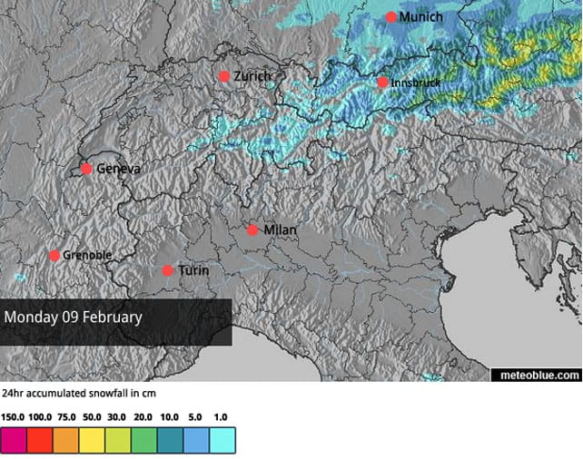
It was snowing in the eastern Alps yesterday, and it’s snowing in Austria again today. The further east you go, the heavier it gets: east of Innsbruck, 20-30cm are likely to fall by the time the clouds lift tonight.
In the west, the sun’s out, and temperatures are on the rise. Conditions will be positively spring-like by Wednesday, with the freezing point at 2500m in the French Alps.
It should stay sunny and mild until Thursday at least: but there is a chance of snow at the weekend.
The good news today is that Austria is getting its snowstorm after all. I wasn’t convinced it was coming: but the high pressure sitting over the western Alps hasn’t extended far enough to block it. 10-15cm fell across many resorts yesterday, and there should be more than that in central and eastern areas of the country today.
Parts of Switzerland had snow yesterday as well, but it looks as though they’ll miss out on most of the action today.
Here’s the latest snow forecast for the Alps.
Meanwhile, here’s how it’s looking on the Schmitten above Zell am See this morning, where there’s up to 106cm of settled cover on the pistes.
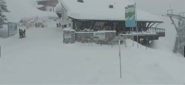
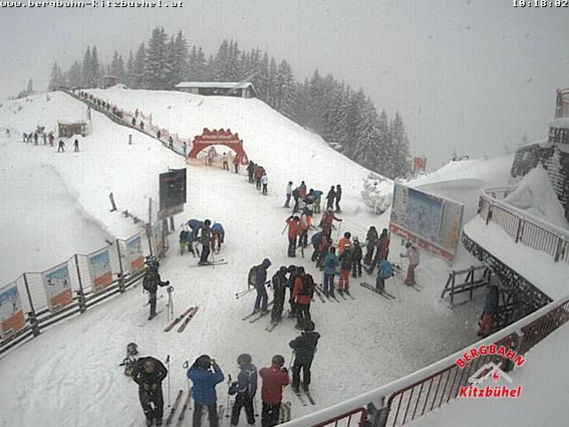
Pictured below is Kitzbuhel in the Tirol, where the cover is 70-86cm deep.
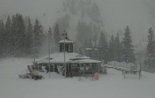
This final Austrian picture, from Schladming, gives you an idea how windy it is. It’s a good day to be amongst the trees. (On piste, the snow here is 80-145cm deep.)
Thanks to the low visibility and bumpy pistes, skiing will be difficult to today; but tomorrow – with the sun out and the slopes regroomed – should be a cracker.
Off-piste, however, extreme caution is needed. There’s been a lot of wind about and this new snow is being deposited in unstable wind-packed slabs, on top of already unstable cover. The Tirol’s avalanche service is blunt in its warning today: “The inexperienced are urgently advised not to leave secured ski runs!”
In the west, the sunshine has already taken hold
High pressure already holds sway over the western Alps, and it will extend over Austria tomorrow.
Thanks to all the snow that fell at the end of January in France and western Switzerland, and last Thursday and Friday in western Italy, there’s some gorgeous skiing to be had in the sunshine. However, the weather will warm up significantly in the next two days, and that’s going to have a significant impact on the quality of the cover. Expect sunny pistes below 2500m to soften during the day, and refreeze overnight, so that they’re hard first thing in the morning. Off-piste, a sun-baked crust is will be the result. Increasingly, you’ll have to migrate to the top of the lift system, and stick to shady slopes, to find sof, cold snow: or wait until the sun warms up the pistes each morning, and the snow begins to melt once more.
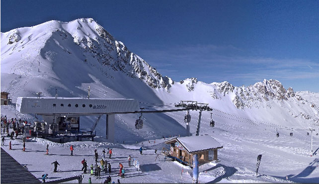
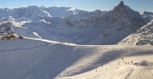
Still, with views like the one below, from the top of the Saulire in Courchevel, you might not hear too many people complaining. Here, the cover is 91-150cm deep.
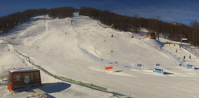
Meanwhile, pictured below is how it’s looking in Serre-Chevalier, where the snow is currently 53-170cm deep.
The high pressure may break down at the weekend
We’re not sure what’s happening next. The forecasts haven’t yet settled on a consensus, but there is the chance that colder, more humid air will reach the Alps at the weekend, bringing more snow. If it comes, it won’t be a storm to match that of January 29-February 2. But it would bring a welcome top-up to the pistes just before half-term.
Mild sunshine for the World Ski Championships in Beaver Creek
Did you see the men’s World Championships Downhill on Saturday in Beaver Creek, Colorado? What a seat-of-his-pants run by the winner, Patrick Keung! There’s eye-popping footage of his run at the end of this NBC news story.
The other thing you may notice in the video is how soft the snow was looking off the sides of the downhill course. The first week of the World Championships was an unusually mild one in the American Rockies, and soft snow had a part to play in the running of the Super-Combined yesterday, which was won by Marcel Hirsch of Austria. He got first dibs at the slalom course, which got heavily rutted as the race progressed.
Fortunately, the weather will cool a little bit over the next couple of days, but the racers will also lose the sunshine. There should be light snow tomorrow and Wednesday. Further north, in Wyoming, Jackson Hole is expecting heavier snowfalls from the same weather front – but it could rain for a time on the slower slopes as well.
50cm in at the top of Whistler in the last seven days
At the top of Whistler they were skiing deep snow over the weekend, as you’ll see from the footage below.
Lower down, however, it’s been warm: “wet and gross” was how one disgruntled skier put it on Facebook. Generally, it’s been a mild winter here – and that’s been the general trend in the weather across much of the western US, too, despite big snow in the Rockies over Thanksgiving and Christmas.
| France: clear skies and deep, cold snow should combine to create a magnificent day across the French Alps. However, temperatures are rising, and increasingly sunny slopes will be affected by the change. Let’s hope this spring-like spell doesn’t settle in for too long, and we get the snow at the weekend – as some forecasts are now predicting. All the same, I’d pick a resort with plenty of altitude in it if you’re planning a trip in March.
Currently, Avoriaz – which was hit hard by the big storm at the end of January – reports 230-280cm of snow on its pistes. Meanwhile, high-altitude Tignes has 92-165cm of cover on its pistes, and and Alpe d’Huez had 106cm packed down, mid-mountain. |
|
| Switzerland: in western Switzerland, the situation is very similar to France. In the wake of the big storm at the end of January, the skiing is much improved. There was a 10cm top across the eastern half of the country at the weekend, as well. Expect temperatures now to rise significantly in the sunshine. Currently Verbier has 40-160cm of cover on its pistes, Laax in the east reports snow depths of 60-280cm, and St Moritz in the south has 46-132cm. | |
| Austria: see our main report. Austria has its own private snowstorm today, and conditions are rather wild in strong, cold wind. Tomorrow, skies should clear and temperatures rise. Currently, in the Arlberg, Lech reports cover 110-190cm deep, and in the northern Tirol the Skiwelt has 80-100cm on its pistes. Meanwhile, in the east, Schladming reports 80-145cm of cover, on-piste. | |
| Italy: there was heavy snow across the Aosta Valley and Piedmont on Thursday and Friday last week. Check out these photos from Snoworks in Gressoney last week. Further east, there was some snow, but it wasn’t as heavy. Canazei in heart of the Dolomites, reported 5-35cm of new snow last Friday, and currently has cover 20-115cm deep. Meanwhile, Madesimo is still reporting 170-430cm of snow on its pistes. Further west,Cervinia has 55-250cm of cover, on piste. | |
| Andorra: Andorra saw heavy snow last week: the Grandvalira ski area reckons it got 150cm of fresh, in the end, and reports settled cover, on-piste, of 100-170cm. | |
| Western USA: it was a mild and sunny weekend in the Rockies. One snow forecaster in Colorado said the pistes were like “mashed potatoes” by lunchtime yesterday. Some snow is expected over the next couple of days, and it looks as though Jackson Hole in Wyoming will do well from it – although it’ll probably be raining at the bottom of the lifts for a while. Currently its mid-mountain snowpack is 205cm deep. Meanwhile, in Utah, Snowbird in Utah has 167cm of mid-mountain cover, and in Vail, the settled snowpack is up to 112cm deep, mid-mountain. | |
| Western Canada: it’s been mild in western Canada too, with rain on the lower slopes of many resorts, and heavy snow higher up. Revelstoke reports 80cm of fresh over the last week at the top of its ski area from a storm system dubbed The Pineapple Express. Even Lake Louise in Banff National Park has been feeling the heat. Top temperature at this usually cold resort should reach +4C today. Currently, its mid-mountain snowpack is 138cm deep. |




Add Comment