


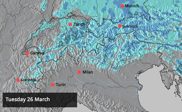
It’s spring. So we shouldn’t be surprised that, in the Alps, the sensational snow of last week has been followed by a thaw. The rise in temperatures at the weekend was pretty sharp, too: in high-altitude Val Thorens, the mercury hit +6C at village level on Saturday afternoon.
It’s cooling down now – and according to French forecasters Meteo Chamonix the freezing level will be down to 1300m on Tuesday. Our Alpine snow forecast is predicting a dusting of snow today and tomorrow as well, especially in the eastern half of the region.
But I’m afraid the sumptuous powder snow we were skiing last week has become either wet or crusty on many slopes. As MeteoFrance’s Avalanche Forecast says, spring conditions now predominate – with the snow affected up to 3000m on south-facing slopes and up to 2000-2400m on north-facing slopes. Because it’s cooler today, the daytime melting cycle will be less pronounced too. You’ll have to ski fairly low down to find snow that’s softening in mild air – or migrate to the highest north-facing slopes in search of the powdery stuff left over from last week. Otherwise, expect to find the skiing surface pretty firm on the pistes, and crusty off them.
Advertisement
Temperatures will rise again as the week progresses, and heavy snow is in the forecast for the western and central Alps on Friday and Saturday – although it will be raining lower down. This is no surprise at the end of March. If you are planning a last-minute escape to the mountains then make sure you’ve booked a high-altitude ski area to be sure of good-quality cover.
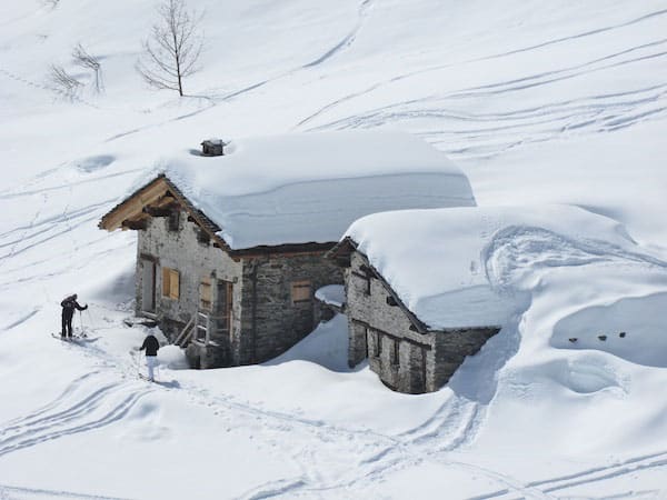
Despite the spring weather, the cover is – for the most part – deep for the time of year, and we’ve enjoyed a much better March than in many recent seasons. There’s not much consensus in the mid-range weather charts about what lies ahead in early April: but there is the chance of another wintry blast next week. We’ll keep you posted.
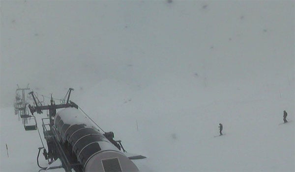
Below is a quick survey of today’s webcams – I emphasise quick because on a day of flat light and fog about there’s not much to look at!
But first, in case you haven’t seen it already: here’s Torin Yater-Wallace’s winning run at the X-Games SuperPipe in Tignes on Friday. The guy’s only 17, for Chrissake…
In Scandinavia, the long sunny spell is over – for now
Up in Scadinavia, the weather’s changing after a long, cold sunny spell. In Are, Sweden, it’s a little milder today – up to +1C at the bottom of the lifts. There’s snow in the forecast too: nothing heavy, but certainly enough to refresh the pistes.
Powder days in parts of America and Canada
Last week was pretty wintry in the American and Canadian Rockies. On Friday, Snowbird in Utah notched 43cm of new snow in 48hrs, and this morning in Colorado, Breckenridge’s snow report records 22cm in 48hrs, and 76cm in the last week. Up in Canada, Fernie has had 91cm of fresh snow in the last seven days.
Jackson Hole has had plenty of snow too. Here’s a rather tasty video of the powder day on March 21.
Across the region temperatures are now forecast to rise steadily, and warmer, wetter snowfall is expected over the Easter Weekend.
| France: see our main report. Sadly, the thaw at the end of last week has affected the snow cover – and you’ll need to ski as high as possible on north-facing slopes to find really wintry snow. However, the cover is still deep, and the high-altitude resorts are expecting a dump this coming weekend. In Val Thorens, in the Three Valleys, the snowpack is currently 155-360cm deep, and a high of 0C at resort level is expected. In Flaine in the Grand Massif, the snow’s 68-365cm deep. In the village, the mercury should reach +1C this afternoon. | |
| Switzerland: Switzerland should do best from the light snowfall expected today and tomorrow. As is the case everywhere across the Alps now, aim high for if you want to ski soft, wintry snow. Currently, St Moritz reports a settled snowpack of 20-160cm, Engelberg has 42-450cm, and Davos 60-163cm. In Davos the top temperatures in town today will be +3C. | |
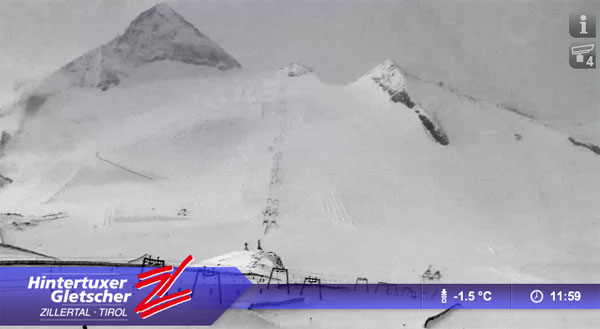
| Austria: the weather’s cooled down in Austria today, in the wake of the weekend thaw. But you’d still be well-advised to ski at altitude if you can. The snow cover in the lower resorts is still pretty deep, but has been affected by the recent mild temperatures. Currently, high-altitude Obergurgl has 75-196cm of settled snow, and a high of +1C. There was 3cm of fresh snow overnight. St Anton reports 70-235cm of settled cover on its pistes. | |
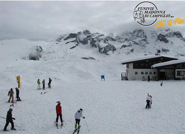
| Italy: many Italian resorts have a dusting (or more) of fresh snow this morning. In the Dolomites, Canazei reports 5cm of fresh snow, and 45-190cm of settled cover. A top temperature of +4C is expected today. Above the Aosta Valley, Cervinia reports 95-295cm of settled snow. | |
| Andorra: it’s going to be a mild, moist week in Andorra, for the most part – although it’s gloriously sunny today. The Grand Valira – Andorra’s biggest ski area – reports 140-250cm of settled snow on its slopes, and a temperature of +6C at resort level. | |
| Western USA: It was a lovely end to the week in many resorts of the American west – as you’ll have seen from our main report. Now, milder weather is expected. It’s due to snow again at the weekend, but the white stuff over Easter is expected to be wetter and heavier this time round. In Utah, Snowbird the snow report talks of 241cm of settled cover, mid-mountain; in Jackson Hole in Wyoming that figure is 172cm, and in Breckenridge, Colorado 182cm. Meanwhile, above Lake Tahoe in California, Heavenly reports 15cm of new snow in the last 48hrs and 122cm of settled cover. | |
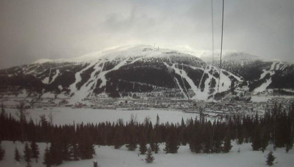
| Western Canada: it’s going to be a mild and sunny week in Whistler, where the mid-mountain snowpack is 263cm deep. Meanwhile, in Lake Louise, in Banff National Park, top temperature at the base of the trails is likely to be -3C. There, the snow is 180cm deep, mid-mountain. |


Here’s the Monday #Snow Report for skiers. https://t.co/lRZhvpntox
RT @welove2ski: Here’s the Monday #Snow Report for skiers. https://t.co/lRZhvpntox