


Today, we’re kicking off our Snow Report in the American Rockies.
Why?
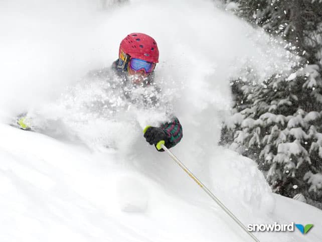
Because of this…
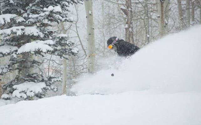
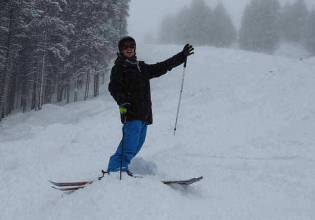
And this…
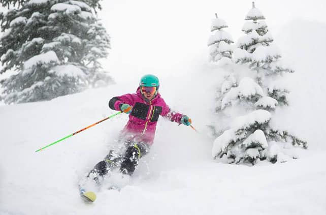
And this…
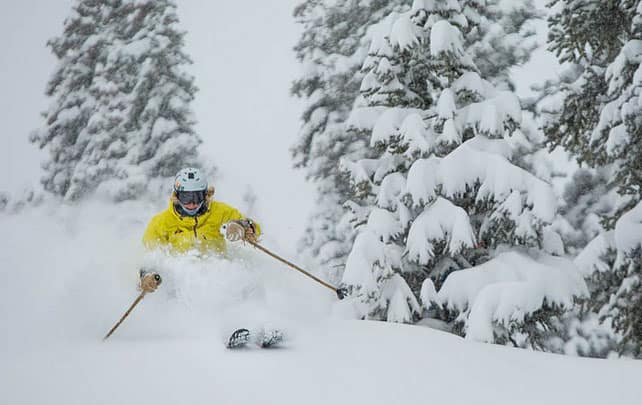
And this…
And this…
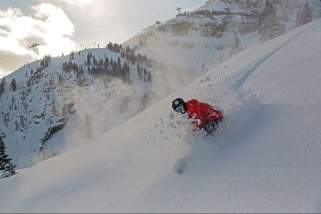
Many resorts have been walloped by frigid winter storm – which hit Montana and Wyoming on Sunday, and muscled into Utah and Colorado on Tuesday and Wednesday. Most places had around a foot of fresh snow, followed by plunging temperatures. Many ski areas are posting highs today of -10C, and wind chill of -20C or lower.
Thanks to British tour operator Crystal I was lucky enough to catch the start of the storm – in Breckenridge, Colorado, on Wednesday. And as I’m sure you can imagine, it was bliss. Thanks to all the trees, visibility was good and the mountain was littered with local skiers and boarders going nuts – gobbling up the powder like it was their last ever day on snow.
There were some junior shredders amongst them…
Oh yes, and look who I met? British Slopestyle sensation James “Woodsy” Woods: in training for the one of the biggest freestyle events of the season – the Breckenridge leg of the Dew Tour. And, of course, the Winter Olympics…
GO WOODSY!
There’s fresh snow in the Eastern Alps, too!
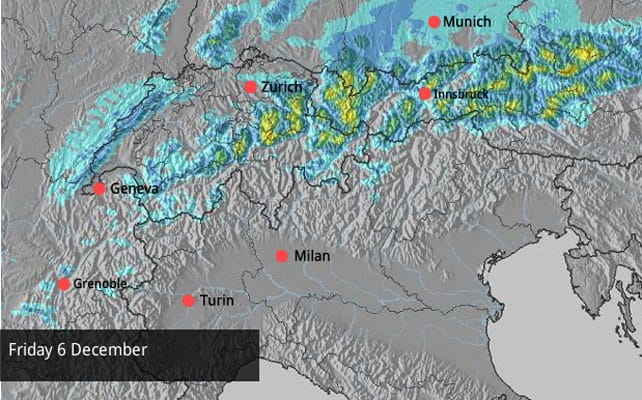
This morning, the white stuff has made a welcome return to the eastern Alps, too – along with much colder temperatures. The snow blew in last night, and according to our snow forecast up to 50cm of new snow is a possibility on the slopes above resorts such as St Anton, Mayrhofen and Schladming. In Switzerland, resorts south of Zurich, such as Laax, should do well too.
Here’s today’s forecast.
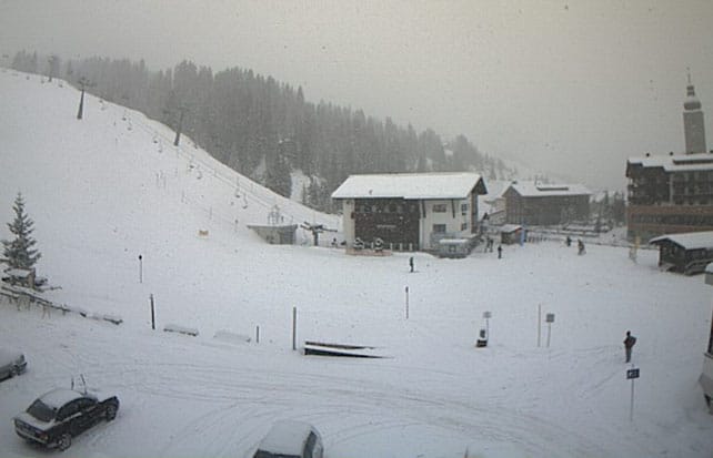
And here’s a short video of how it looking this morning in St Anton: a nice piece of early-season publicity for the resort, but a bit of a drag for the lift company and ski patrollers, as today is actually the opening day for the resort.
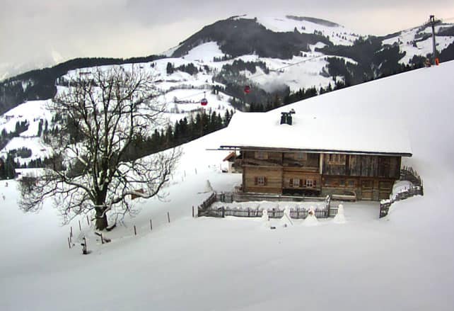
Pictured, below, was the scene in neighbouring Lech: it too is firing up the lifts today for the first time this winter.
Here’s how it was looking above Soll this morning. The Skiwelt, in which it’s set, opens tomorrow.
But the sunshine will make a swift return
Sadly, it looks as though the French and Italian Alps will miss out on most of this new snow – although it will get colder for a while. In France today the freezing point will be back down to around 700m today, after the spring-like highs of midweek. The sun will continue to shine in many places.
In fact, by the beginning of next it’ll be sunny right across the region, and temperatures will be climbing again. French forecaster Meteo Chamonix expects the freezing point to be up to 2700m by next Wednesday. It’s likely to stay that way until December 14 at least. Obviously, sun-worshippers will be delighted. But Snowfiends like us? Not so much. We want the stormy weather of Snovember to come back!
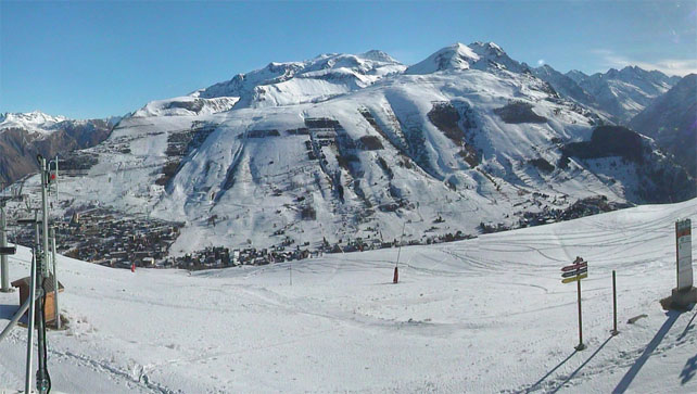
Pictured, below, is the view from La Croisette in Courchevel this morning – to give you an idea of how sunny it is. In the Three Valleys, Val Thorens is already open, and Courchevel, Meribel and Les Menuires will be joining it for the season tomorrow.
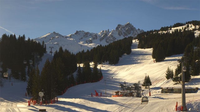
This is the view today down to Les Deux Alpes, which opened last week.
And this was the scene a couple of days ago in Serre Chevalier, which is readying itself for opening day on December 14.

| France:Temperatures have dropped significantly in the French Alps today – but there’s no sign of snowfall in the immediate forecast. Snow cover is good for the time of year – but after a week of mild sunshine you won’t find much powder left in those resorts that are already open. In Val d’Isere the settled cover is 41-83cm deep. In Val Thorens it’s 65-105cm and in Les Deux Alpes it’s 20-160cm. are already open. Lots more resorts are opening weekend, including most of rest of the Alpe d’Huez. | |
| Switzerland: The eastern end of Switzerland is getting a welcome top-up of snow, and resorts south of Zurich, such as Laax, are doing well. Engelberg is getting snow too. South and west of Engelberg, in Zermatt and Verbier the sun’s out. In Verbier, the cover is 20-90cm deep. In Engelberg, the mid-mountain snow depth is 48cm. In St Moritz the settled snow is around 20-25cm deep, on-piste. | |
| Austria: Today’s another significant day in the Austrian ski calendar, with the opening of St Anton and Lech. Heavy snow is expected there today, which will set things up nicely for the weekend. Currently, in Lech, the snow is 45-60cm deep. The Skiwelt also opens tomorrow with 20-50cm of snow, on-piste. Meanwhile, the season is already well underway in both Obergurgl and Ischgl. Obergurgl has done particularly well out of the early-season storms and has 70-175cm of cover, on piste. There’s also great skiing on offer on the glaciers – including the Hintertux, and the Kitzsteinhorn. | |
| Italy: The weather has been sunny across much of the Italian Alps this week. In Cervinia, the last snow fell on November 21, but the mid-mountain cover is still well over a metre deep. In Madonna di Campiglio in the Brenta Dolomites, the cover is 35-60cm deep, and above Canazei in the main Dolomiti Superski area it’s 10-70cm. | |
| Andorra: Thanks to heavy snow in November, the Pyrenees got off to a cracking start to the season, and in Andorra both the Grandvalira and Vallnord ski areas are open. Grandvalira reports 100-170cm of settled snow, on-piste. | |
| Western USA: See our main report: the forecast was bang on target, bringing a dramatic drop in temperatures and around a foot of powder to many Rocky-Mountain resorts. There’s more snow coming at the weekend. According to local snow guru, Joel Gratz, southern Colorado will see the best of it with up to 30cm in the forecast. The Salt Lake City resorts, such as the Canyons, should see 12-25cm too. Thanks to the storm, snow depths are good for the time year – although you’re still going to hit the odd rock away from the groomers. Breckenridge has 86cm packed down, mid-mountain, Snowbird 89cm, and Jackson Hole 94cm. | |
| Western Canada: the resorts of the Canadian Rockies haven’t done so well as their rivals south of the border from the latest storm. In Banff National Park, for example, Lake Louise reports on 11cm of snow in the last week. But the temperature has fallen through the floor: today’s high is MINUS 24C! Further west in Whistler has had 35cm of snow in the last week (mainly at the weekend) and is expecting a high today on the upper slopes of -19C. |


Winter hit hard in the American Rockies this week. And now there’s fresh snow in the eastern Alps too! https://t.co/N8cld6zFan