


First of all, the good news…
1. Parts of Austria have just had 10cm of snow
Add that to the sterling work done by the snow-making crews over the last two weeks and – hey presto – suddenly the world looks wintry in resorts such as Saalbach and Zell am See.
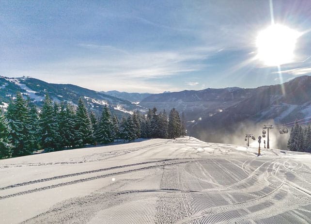
This was Saalbach this morning.
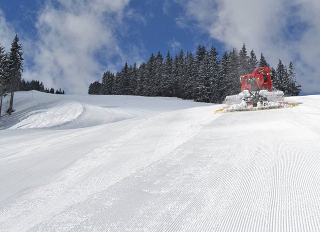
And this was the Schmitten, above Zell am See.
This morning, the natural snow has been groomed onto the existing, man-made surface of the pistes, to produce a lovely, soft skiing surface. Lucky are those who got to ski it.
2. Up high – especially in the west – there’s still plenty of cover
Regular followers of our Snow Report will know that high-altitude resorts in the west, such as Cervinia, Val d’Isere, Tignes and Val Thorens had two bouts of heavy snow in November. Despite some mild spells since then, they still have good early-season cover, even if it the pistes are now firm.
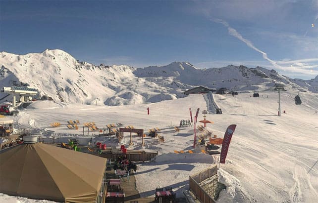
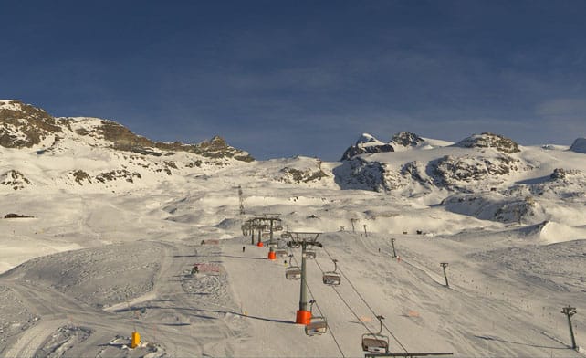
Pictured below was the Solaise, above Val d’Isere this lunchtime. The cover here is 30-135cm deep, depending on altitude.
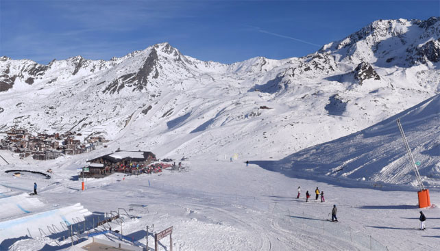
This was Val Thorens, where I’m heading on Saturday (yippeeeeee!). The resort reports 60-135cm of snow on its pistes.
And this was Cervinia in Italy a little earlier, which has 30-160cm of snow.
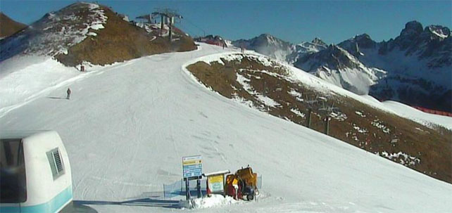
Further east, in the high-altitude resorts, the cover is thinner, but thanks to the snow cannons, there’s plenty of skiing on offer. In Austria, the cover in Obergurg is currently 10-45cm deep, depending on altitude, and 90% of its pistes are open.
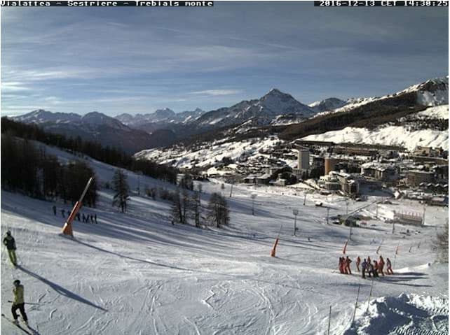
3. In the southwest, there’s plenty of snow, too
The resorts of Piemonte, the Aosta Valley and the southern French Alps did well from the late-November storms. Here’s how Sestriere is looking, with 40-120cm of snow on its slopes.
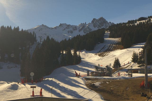
4. In many resorts the snow cannons have been working hard
Elsewhere in the Alps, the natural snow cover is confined to the peaks and even here it’s thin. To make up for the shortfall, resort snow-making teams have been working flat out to get lay down man-made cover, and in many places they’ve done a cracking job. In north-eastern Italy, for example, the Dolomiti Superkski area already has 667km of piste open, and 317 lifts operating, despite the complete lack of natural cover on the lower slopes.
Here’s how it’s looking above Canazei today. Check out the depth of the piste and its smooth surface…
Meanwhile, this is La Croisette in the middle of Courchevel today. There’s natural cover higher up, but down here all the snow has come from the cannons.
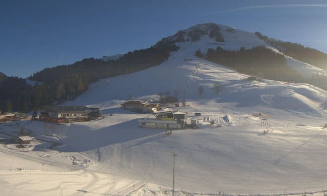
And this is the Skiwelt, above Soll.
So, as you can see, we’re in a better place than we were last winter – despite the horrible bout of wet, warm weather in late November, and the two-week dry spell since then. The fact that most nights have been clear and cold has been a huge help, because they’ve been ideal for snow-making.
But all the same, Mother Nature needs to pull her weight now and give us a proper snowstorm.
Truth is, some resorts have struggled to make up for the lack of natural snow. In the Portes du Soleil, for example, only 14 pistes are open, mainly in Avoriaz. Plenty of other low-lying resorts need a helping hand too – before the Christmas and New Year crowds arrive.
Is any snow coming? Possibly – but not in the right places. It’s a little too soon to be certain, but Sunday could see an area of low pressure forming in the western Mediterranean, which then pushes into the southern Alps. This is one to watch: because it could produce heavy snow in the south-western resorts, which spreads east into the Dolomites, and west into the Pyrenees.
Bear in mind that, if it comes, it won’t be a very cold system, so there could be rain on the lower slopes. It may not bring much snow to the northern Alps, either. AND it’s likely to be followed by another dose of sunshine. But all the same, it’ll be worth keeping a close eye on the snow forecast over the next couple of days. The resorts of Piemonte (such as Sauze d’Oulx) and the Aosta Valley (including Pila and Champoluc) could be in for a dump.
Beyond that local excitement however, the mid-range charts are not encouraging. That’s the bad news: high pressure remains the dominant theme over western Europe. You’ll need to aim high, or look for resorts with great snow-making systems, to be sure of decent skiing over the coming fortnight.
Meanwhile, in North America…
After a slow start to winter in the American Rockies, December has been much more productive than in the Alps. Jackson Hole, Wyoming, is a resort that’s done particularly well – with 25cm in the last 24hrs and a settled snow depth of 120cm mid-mountain (and 178cm at the top).
Here’s how it was looking at the weekend, after 75cm of fresh snow at the end of last week.
If that doesn’t leave you feeling sick with envy, you’ve come to the wrong website…
Further north, Whistler has had 14cm of snow in the last 48hrs and reports a settled snow depth of 166cm, mid-mountain. It’s also COLD. Top temperature today, despite the sunshine, will be -14C at the top of the ski area. Inland, at Lake Louise it’ll be -17C.
Meanwhile, in Colorado and Utah they’re expecting more snow. To start with it’ll be quite wet and heavy: but by Saturday temperatures will have dropped and the snow will be lighter and drier. Colorado snow guru Joel Gratz is already talking about more snow at Christmas.


Add Comment