


All this sunshine and spring-like temperatures across the Alps is not what we want at all in January. We’ve had the most volatile snowpack in 15 years and now it’s melting on the lower slopes like a block of ice cream that you forgot to put back in the freezer.
But fear not! Today is the warmest in this indecent spell of Foehn with temperatures up to double figures Celsius in some places and the freezing level soaring to 3000m. But tomorrow and over the weekend you can zip up your jacket – and next week we’ll hopefully be back in thermals. See our Alpine snow forecast for more details.
There’s not much new snow around…a dusting perhaps tomorrow across the northern Alps. Switzerland and Austria should catch a few centimetres on Sunday in some resorts – but it will be nothing to email home about. Monday should produce modest falls across the French Alps as temperatures drop further. In the classic destinations such as Val d’Isere, Verbier, and even St Anton there’s some great piste skiing to be found at altitude. Keep an eye on our snow report for any changes.
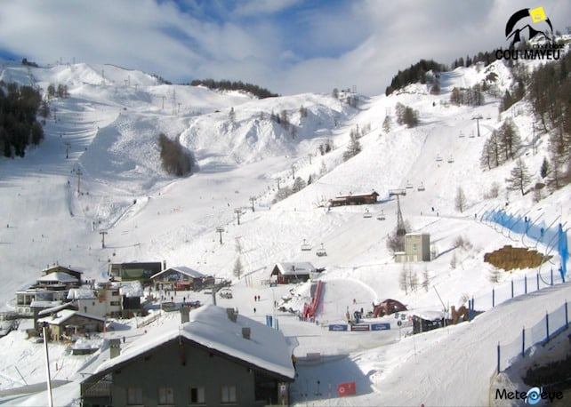
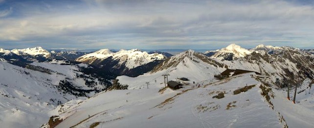
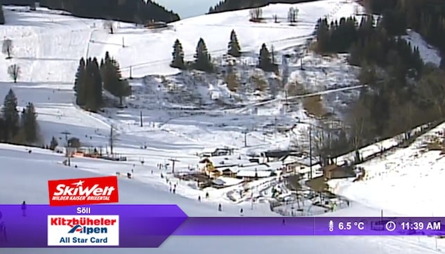
There’s an increasingly marked contrast between conditions above and below 1600m all across the Alps. Up top the snow lies proverbially deep and crisp and – thanks to good grooming – even. However, lower runs are suffering badly from the thaw in resorts such as Soll in Austria and Morzine in France.
Across the Atlantic conditions are sweeter. Sean Newsom was lucky enough to be in the The Canyons, in Utah, earlier this week, and on Tuesday had a high old time blasting around its pistes in the company of local goddess Kaylin Richardson: but he’s banging his head on the desk today because he left just before a big storm blew in. This morning, the Canyons reported 10cm of fresh snow, and local snow guru Evan Thayer reckons it’ll keep snowing until Friday afternoon – with 25-50cm of snow falling by the time the skies clear. The resorts of Little Cottonwood Canyon will probably see the biggest totals: Snowbird has claimed 22cm already. However, it’s worth noting that the cover off-piste is still fairly thin after a dry December. The locals will hoping another storm will follow shortly.
Take great care off-piste
Sorry to be depressing, but I’m going to bang on about the unusually dangerous off-piste again – it’s not going to go away. Days after the last substantial falls at altitude you might be lulled into thinking that the avalanche risk in the Alps is dropping. It is not. Generally, the risk remains 3/5 with the occasional 4 because of this incredibly unstable weak snow way down in the pack. It’s like having a layer of ball-bearings spread across the mountainside – particularly on north-facing slopes. The slightest pressure from a ski or board can cause an avalanche – or it can even trigger naturally. Warm sunshine is exacerbating the danger.
So far since Christmas Day 12 people have been killed in Switzerland alone and 21 overall. We’ve lost count of the number who have survived – some with serious injuries. Swiss pro-skier Dominique Perret, greatest free rider of the 20th century, has said: “This massacre has got to stop.” His concern is that too many people buy all the safety kit at great expense, but know zero about snowcraft and don’t invest in an avalanche awareness course before venturing away from the corduroy.
If you do go off-piste, take a guide and make sure you have full survival equipment. This winter we’re seeing a major increase in ABS. An airbag is a sensible piece of kit, but even if you manage to trigger it in a crisis, it by no means guarantees survival – especially in the vicious slab avalanches we are seeing at present.
The snowpack in the Rockies also appears to be unstable. On Tuesday the 24-year-old grandson of Vail’s founder was tragically killed in an avalanche in the notoriously dangerous East Vail Chutes.
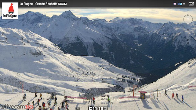
| France: Piste conditions are close to perfection in the higher resorts, but the heavy thaw has taken its toll on the lower slopes. Les Gets has 30cm in the village and 120cm up top. Morzine has a nasty 9C in town today and the nursery slopes show unwelcome patches of green. However depths are 110cm at 1800m and 180cm up on the Swiss frontier. Tignes has 67cm at Le Lac and 140cm on the Grande Motte. Alpe d’Huez has 60cm in town and 190cm at the top of Pic Blanc. Val Thorens has 100/160cm. La Plagne has 70cm at 2000m and 145cm on the glacier. | |
| Switzerland: Conditions have improved dramatically since Christmas with some decent falls over New Year. However, this has served to increase the already substantial avalanche risk. Snow cover varies quite dramatically. While Davos has 25-88cm, Verbier has 40cm in town and 120cm at the top of the Funispace gondola. Zermatt has 50cm in the resort and 150cm at 2900m with a substantial 315cm at the top of the Klein Matterhorn. St Moritz reports 76-120cm, while in Laax it’s 20-130cm. | |
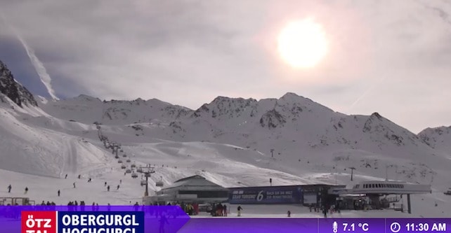
| Austria: Snow depths are pretty varied across the country). At altitude, near the Italian border, the snow is deep. In Obergurgl for example, the settled cover is 84-189cm. The snowpack on the Stubai Glacier is 40-210cm. However, Further north, and in the lower resorts, it’s much thinner. For example, in the Skiwelt it’s only 20-40cm deep, but we can expect a few more flakes tomorrow. St Anton has only 20-80cm compared to 73-170cm in the same week last year, but it’s skiing well. Ski Juwel (Alpbach and ” target=”_blank”>the Wildschonau) from where we will be reporting next week has 20cm in the valleys and 60cm at the top of the lift system. | |
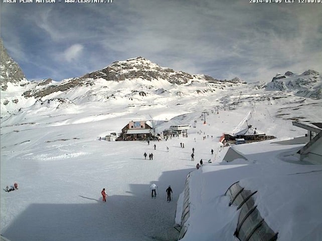
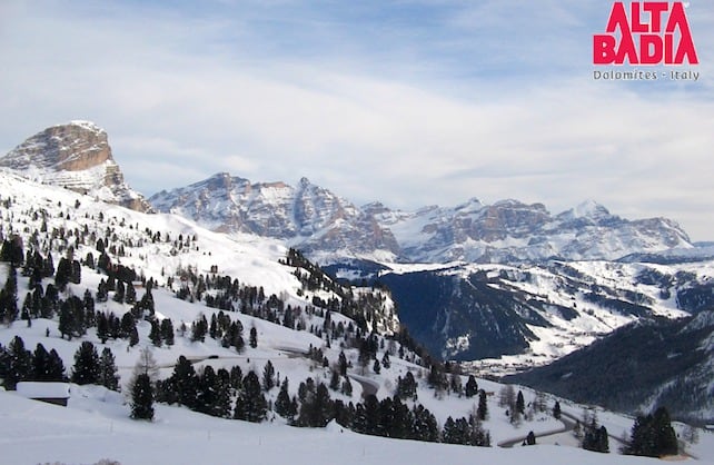
| Italy: Overall what is more often than not – in snow terms – the poor relation of the Alpine Big Four is experiencing its best start to the season in a decade. The snow is deep in many resorts in the central and western Italian Alps. Currently, above the Aosta Valley, Cervinia reports 60-160cm and Courmayeur 50-110cm. Meanwhile little Madesimo above the shores of Lake Como has caught another 60cm and now has an incredible 250cm in the village and 350cm at the top lift system. Further east, in the Dolomites, there’s 60-155cm in Val Gardena and 90-16cm in Cortina d’Ampezzo. | |
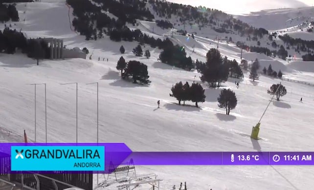
| Andorra: Snow cover across the Pyrenees is excellent at present and Andorra is no exception. In fact, piste conditions are nothing short of superb , with a full metre on the lower slopes in Vallnord (Arcalis, Arinsal-Pal) and nearly twice that at the top. What’s more, the sun is shining and the snowpack is more stable than in the Alps although the avalanche risk is 3/5 today. | |
| Western USA: Colorado has had several top-ups of snow, which have been significant in the north and east of the state. Breckenridge is getting steady top ups and it’s going to be a chilly weekend there with the possibility of more snow on a mid-mountain base that is currently 142cm. ” target=”_blank”>Jackson Hole has 137cm and more forecast all weekend. Over in Utah at The Canyons there’s 74cm mid-mountain and 104cm at the summit, with more snow forecast over the weekend.
California and the Pacific Northwest remain short of snow and are looking forward to a fundamental change in the weather. Heavenly has 79cm mid-mountain with the promise of a few more flakes on Saturday before the sunshine returns on Sunday. |
|
| Western Canada: a big and welcome storm is expected to hit Whistler this weekend, but it will be accompanied by strong winds. North America’s top resort is not currently experiencing a vintage winter, but all that could change. At the moment the base is 111cm – rather modest by Whistler’s exalted standards.
Elsewhere, Lake Louise in Banff National Park has had 36cm of fresh snow over the past week and the base is now123cm in the Back Bowls. Conditions here, as well as in Sunshine Village and Mount Norquay, are faultless. |


Tomorrow you can zip up your jacket: https://t.co/fbyWKBiNVB